Adding one or more of the following conditions will narrow your search to match all the fields you've given value to.
Belongs to category:
--- All categories ---
Warning
Art
Special site
Gardens and parks
Bridge
Religion
Monuments and History
Beaches and promenades
Squares and fountains
Preservation
Walking path
House number
Maps
Coord.
Direction sign
Original or funny sign
Street sign
Town name
Street name and house number
Neighborhood name
Traffic
Country:
--- All countries ---
Argentina
Australia
Austria
Belarus
Belgium
Bulgaria
Canada
Chile
China
Colombia
Croatia
Cuba
Cyprus
Czech Republic
Denmark
Ecuador
Egypt
Estonia
Ethiopia
France
Galápagos (Ecuador)
Georgia
Germany
Greece
Hong Kong
Hungary
India
Ireland
Israel
Italy
Japan
Jordan
Kenya
Luxembourg
Mexico
Netherlands
Norway
Palestine
Peru
Poland
Portugal
Qatar
Russia
Singapore
Slovakia
Slovenia
South Korea
Spain
Sweden
Taiwan
Thailand
Turkey
United Arab Emirates
United Kingdom
USA
Vatican City State
Vietnam
City:
--- All cities ---
’s-Hertogenbosch (Den Bosch) (Netherlands)
Abu Ghosh (Israel)
Achziv (Israel)
Acre (Israel)
Adams, MA (USA)
Adanim (Israel)
Agios Nikolaos (Crete) (Greece)
Aguas Calientes (Peru)
Ahi’ezer (Israel)
Ahmedabad (India)
Akrotiri (Crete) (Greece)
Alicante (Spain)
Alonei Abba (Israel)
Amboise (France)
Amsterdam (Netherlands)
Anacapri (Capri) (Italy)
Ancenis (France)
Anjou (Val de Loire) (France)
Antwerp (Belgium)
Ao Nang (Thailand)
Apúlia (Portugal)
Aqaba (Jordan)
Arachova (Greece)
Arbúcies (Spain)
Arcozelo (Barcelos) (Portugal)
Arenys de Munt (Spain)
Ashdod (Israel)
Ashkelon (Israel)
Athens (Greece)
Atlanta, GA (USA)
Atlit (Israel)
Austin, TX (USA)
Aviezer (Israel)
Avoine (France)
Ayanot (Israel)
Azor (Israel)
Bahan (Israel)
Baltimore, MD (USA)
Banff, AB (Canada)
Bangkok (Thailand)
Bar Giora (Israel)
Barcelona (Spain)
Bareket (Israel)
Bat Hen (Israel)
Bat Yam (Israel)
Batalha (Portugal)
Bath (United Kingdom)
Batumi (Georgia)
Batzra (Israel)
Be’er Ora (Israel)
Be’er Tuvia (Israel)
Be’er Tuvya Regional Council (Israel)
Be’er Ya’akov (Israel)
Be’eri (Israel)
Be’erot Yitzhak (Israel)
Beersheba (Israel)
Beit Aryeh (Palestine)
Beit Dagan (Israel)
Beit Elazari (Israel)
Beit Guvrin (Israel)
Beit HaLevi (Israel)
Beit Hanan (Israel)
Beit Hanania (Israel)
Beit Herut (Israel)
Beit Oved (Israel)
Beit She’arim (Israel)
Beit Shemesh (Israel)
Beit Uziel (Israel)
Beit Yanai (Israel)
Beit Yehoshua (Israel)
Beit Yitzhak-Sha’ar Hefer (Israel)
Beppu (Japan)
Berkeley, CA (USA)
Berlin (Germany)
Białowąs (Poland)
Bik’at HaYarden Regional Council (Palestine)
Binyamina-Giv’at Ada (Israel)
Biot (France)
Bishopsbourne (Kent) (United Kingdom)
Bitan Aharon (Israel)
Bitzaron (Israel)
Blois (France)
Bnei Atarot (Israel)
Bnei Brak (Israel)
Bnei Shimon Regional Council (Israel)
Bnei Zion (Israel)
Bodrum (Turkey)
Bogotá (Colombia)
Borisoglebsk (Russia)
Boston, MA (USA)
Boxtel (Netherlands)
Boynton Beach, FL (USA)
Bratislava (Slovakia)
Breda (Netherlands)
Breda (Girona) (Spain)
Brisbane (Australia)
Brno (Czech Republic)
Broadway (Worcestershire) (United Kingdom)
Buckingham (United Kingdom)
Budapest (Hungary)
Buenos Aires (Argentina)
Caesarea (Israel)
Cairo (Egypt)
Calgary, AB (Canada)
Cambridge (United Kingdom)
Cambridge, MA (USA)
Canandaigua, NY (USA)
Capri (Capri) (Italy)
Carapinheira (Portugal)
Cardiff (United Kingdom)
Cascais (Portugal)
Cayambe (Ecuador)
Chania (Crete) (Greece)
Charlotte NC (USA)
Cheltenham (United Kingdom)
Chessington (London) (United Kingdom)
Cheverny (France)
Chiang Mai (Thailand)
Chipping Norton (United Kingdom)
Chitenay (France)
Civitavecchia (Italy)
Cléry-Saint-André (France)
Clayton, CA (USA)
Clisson (France)
Colares (Sintra) (Portugal)
Comporta (Portugal)
Coningsby (United Kingdom)
Copenhagen (Denmark)
Coral Gables, FL (USA)
Cordoba (Spain)
Corinth (Greece)
Cork (Ireland)
Corpus Christi, TX (USA)
Coyhaique (Chile)
Cusco (Peru)
Custóias (Matosinhos) (Portugal)
Dan (Israel)
Daratsos (Crete) (Greece)
Dehradun (India)
Delfi (Greece)
Delft (Netherlands)
Delray Beach, FL (USA)
Doha (Qatar)
Dorval, QC (Canada)
Dubai (United Arab Emirates)
Dublin (Ireland)
Dubrovnik (Croatia)
Durham (United Kingdom)
Egham (United Kingdom)
Ein Gedi (Israel)
Ein Sarid (Israel)
Ein Shemer (Israel)
Ein Vered (Israel)
El’ad (Israel)
Elishama (Israel)
Elyakhin (Israel)
Elyashiv (Israel)
Emunim (Israel)
Encarnação (Mafra) (Portugal)
Entrevaux (France)
Ericeira (Portugal)
Española Island (Galápagos (Ecuador))
Esposende (Portugal)
Even Yehuda (Israel)
Figueres (Spain)
Fiumicino (Italy)
Florence (Italy)
Frankfurt (Germany)
Fureidis (Israel)
Gallipoli (Italy)
Gan Haim (Israel)
Gan HaShomron (Israel)
Gan Shmuel (Israel)
Gan Sorek (Israel)
Gan Yavne (Israel)
Ganei Am (Israel)
Ganei Hadar (Israel)
Ganei Tikva (Israel)
Ganei Yohanan (Israel)
Ganot (Israel)
Ganot Hadar (Israel)
Gdańsk (Poland)
Gdynia (Poland)
Ge’alya (Israel)
Gedera (Israel)
Genoa (Italy)
Gerês (Portugal)
Gesher (Israel)
Ghent (Belgium)
Giethoorn (Netherlands)
Ginosar (Israel)
Giv’at Ada (Israel)
Giv’at Ko’ah (Israel)
Giv’at Shmuel (Israel)
Givat Brenner (Israel)
Givat Haim (Ihud) (Israel)
Givat Haim (Meuhad) (Israel)
Givat HaShlosha (Israel)
Givat Hen (Israel)
Givat Yeshayahu (Israel)
Givatayim (Israel)
Glasgow (United Kingdom)
Gouda (Netherlands)
Guatapé (Colombia)
Gvat (Israel)
Hadar Am (Israel)
Hadera (Israel)
Hagor (Israel)
Haifa (Israel)
Hakodate (Japan)
Hamilton, ON (Canada)
HaOgen (Israel)
Harel (Israel)
Harutzim (Israel)
Havana (Cuba)
Havatzelet HaSharon (Israel)
Hayes, Hillingdon (United Kingdom)
Hebron (Palestine)
Hefer Valley Regional Council (Israel)
Heidelberg (Germany)
Hemed (Israel)
Heraklion (Crete) (Greece)
Herut (Israel)
Herzliya (Israel)
Hibat Tzion (Israel)
Ho Chi Minh City (Vietnam)
Hod HaSharon (Israel)
Hofit (Israel)
Hogla (Israel)
Holon (Israel)
Hong Kong (Hong Kong)
Hook of Holland (Netherlands)
Horshim (Israel)
Hounslow (United Kingdom)
Hulda (Israel)
Hydra (Hydra) (Greece)
Ierapetra (Crete) (Greece)
Infias (Vizela) (Portugal)
Ingapirca (Ecuador)
Irus (Israel)
Istanbul (Turkey)
Ithaca, NY (USA)
Jab’a (Palestine)
Jackson, NH (USA)
Jaljulia (Israel)
Jerusalem (Israel)
Jisr az-Zarqa (Israel)
Kadima-Zoran (Israel)
Kafr Bara (Israel)
Kafr Qara (Israel)
Kafr Qasim (Israel)
Karmei Yosef (Israel)
Key West, FL (USA)
Kfar Ahim (Israel)
Kfar Baruch (Israel)
Kfar Bilu (Israel)
Kfar Blum (Israel)
Kfar Haim (Israel)
Kfar HaNagid (Israel)
Kfar HaRif (Israel)
Kfar Haroeh (Israel)
Kfar Hasidim (Israel)
Kfar Hess (Israel)
Kfar Kama (Israel)
Kfar Malal (Israel)
Kfar Menahem (Israel)
Kfar Monash (Israel)
Kfar Netter (Israel)
Kfar Ruth (Israel)
Kfar Saba (Israel)
Kfar Shmaryahu (Israel)
Kfar Sirkin (Israel)
Kfar Tavor (Israel)
Kfar Vitkin (Israel)
Kfar Warburg (Israel)
Kfar Yedidia (Israel)
Kfar Yehoshua (Israel)
Kfar Yona (Israel)
Kingston (Kent) (United Kingdom)
Kingston upon Thames (London) (United Kingdom)
Kinneret (Israel)
Kiryat Anavim (Israel)
Kiryat Ekron (Israel)
Kiryat Malakhi (Israel)
Kiryat Ono (Israel)
Kiryat Tiv’on (Israel)
Koper (Slovenia)
Kosmas (Greece)
Kranjska Gora (Slovenia)
Kutaisi (Georgia)
Kutchan (Japan)
Kvutzat Yavne (Israel)
Kyoto (Japan)
La Chevrolière (France)
Lachish Training Base (Israel)
Lalibela (Ethiopia)
Latrun (Israel)
Lecce (Italy)
Leipzig (Germany)
Les Montils (France)
Lexington, MA (USA)
Lisbon (Portugal)
Liverpool (United Kingdom)
Ljubljana (Slovenia)
Locorotondo (Italy)
Lod (Israel)
Loire-Atlantique (France)
London (United Kingdom)
Lucca (Italy)
Luxembourg City (Luxembourg)
Lyndhurst (New Forest) (United Kingdom)
Lyon (France)
Ma’alot-Tarshiha (Israel)
Ma’ayan Tzvi (Israel)
Ma’ale HaHamisha (Israel)
Madrid (Spain)
Mafra (Portugal)
Malia (Crete) (Greece)
Manchester (United Kingdom)
Manshiya Zabda (Israel)
Maor (Israel)
Marathon (Greece)
Mariz (Portugal)
Marsala (Italy)
Matan (Israel)
Mateh Yehuda Regional Council (Israel)
Matosinhos (Portugal)
Matzliah (Israel)
Mazkeret Batya (Israel)
Mazor (Israel)
Medellín (Colombia)
Megiddo (Israel)
Meir Shfeya (Israel)
Meishar (Israel)
Memphis, TN (USA)
Mesilat Zion (Israel)
Messina (Italy)
Metsovo (Greece)
Metula (Israel)
Meung-sur-Loire (France)
Mevo’ot HaHermon Regional Council (Israel)
Mexico City (Mexico)
Miami Beach, FL (USA)
Middelburg (Netherlands)
Midsland (Terschelling) (Netherlands)
Migdal HaEmek (Israel)
Mikveh Israel (Israel)
Milan (Italy)
Milan, NH (USA)
Minsk (Belarus)
Mishmar HaSharon (Israel)
Mishmar HaShiv’a (Israel)
Mishmarot (Israel)
Mishmeret (Israel)
Mitzpe Ramon (Israel)
Modi’in-Maccabim-Re’ut (Israel)
Monopoli (Italy)
Montpellier (France)
Montreal, QC (Canada)
Motza Illit (Israel)
Mountainville, NY (USA)
Mumbai (India)
Mykonos (Greece)
Myrtos (Crete) (Greece)
Na’an (Israel)
Nafplio (Greece)
Nahalal (Israel)
Naham (Israel)
Nahshonim (Israel)
Nairobi (Kenya)
Nantes (France)
Nanyuki (Kenya)
Naples (Italy)
Nara (Japan)
Nazareth (Israel)
Nazareth Iliit (Israel)
Negba (Israel)
Nesher (Israel)
Ness Ziona (Israel)
Neta’im (Israel)
Netanya (Israel)
Netiv HaGdud (Palestine)
Netzer Sereni (Israel)
Neve Ilan (Israel)
Neve Yamin (Israel)
Neve Yarak (Israel)
New Delhi (India)
New Haven, CT (USA)
New Orleans, LA (USA)
New Shoreham, RI (USA)
New York, NY (USA)
Newark, NJ (USA)
Nicosia (Cyprus)
Nikko (Japan)
Nir Eliyahu (Israel)
Nir Galim (Israel)
Nir Tzvi (Israel)
Nirit (Israel)
Nofekh (Israel)
Nordia (Israel)
Northampton (United Kingdom)
Oliveira (Barcelos) (Portugal)
Or Akiva (Israel)
Or Yehuda (Israel)
Oravský Podzámok (Slovakia)
Osaka (Japan)
Oslo (Norway)
Otranto (Italy)
Ottawa, ON (Canada)
Oxford (United Kingdom)
Pai (Thailand)
Palm Beach, FL (USA)
Paradisi (Rhodes) (Greece)
Pardes Hanna-Karkur (Israel)
Pardesiya (Israel)
Paris (France)
Pensacola Beach, FL (USA)
Petah Tikva (Israel)
Philadelphia, PA (USA)
Phuket (Thailand)
Piran (Slovenia)
Pisa (Italy)
Port Aransas, TX (USA)
Porto (Portugal)
Portsmouth (United Kingdom)
Portsmouth, NH (USA)
Prague (Czech Republic)
Princeton, NJ (USA)
Putignano (Italy)
Qalansawe (Israel)
Quito (Ecuador)
Ra’anana (Israel)
Ramat David (Israel)
Ramat Gan (Israel)
Ramat HaKovesh (Israel)
Ramat HaNegev Regional Council (Israel)
Ramat HaSharon (Israel)
Ramat Rachel (Israel)
Ramat Yishai (Israel)
Ramla (Israel)
Ramot HaShavim (Israel)
Ramot Meir (Israel)
Rantis (Palestine)
Rehovot (Israel)
Revadim (Israel)
Rhodes (Rhodes) (Greece)
Richmond (London) (United Kingdom)
Rinatya (Israel)
Rionegro (Colombia)
Rishon LeZion (Israel)
Rishpon (Israel)
Rochester, NY (USA)
Rome (Italy)
Rosh HaAyin (Israel)
Rosh HaNikra (Israel)
Rotterdam (Netherlands)
Rupit (Spain)
Safed (Israel)
Sakhnin (Israel)
Salzburg (Austria)
San Francisco, CA (USA)
Sant’Agata di Militello (Italy)
Sapporo (Japan)
Sarid (Israel)
Savyon (Israel)
Schiedam (Netherlands)
Schwechat (Austria)
Sde Warburg (Israel)
Sde Ya’akov (Israel)
Sdei Hemed (Israel)
Sderot (Israel)
Seattle, WA (USA)
Seogwipo (Jeju) (South Korea)
Seoul (South Korea)
Seur (Loir-et-Cher) (France)
Seville (Spain)
Shanghai (China)
She’ar Yashuv (Israel)
Shefayim (Israel)
Sho’eva (Israel)
Shoham (Israel)
Shokeda (Israel)
Siena (Italy)
Singapore (Singapore)
Sitria (Israel)
Sofia (Bulgaria)
Sopot (Poland)
Southall (United Kingdom)
Southampton (United Kingdom)
Sparta (Greece)
Spata-Artemida (Greece)
Spetses (Spetses) (Greece)
St Agnes (Cornwall) (United Kingdom)
St. Louis, MO (USA)
Stirling (United Kingdom)
Stockholm (Sweden)
Studio City (LA), CA (USA)
Susya (Palestine)
Szczecin (Poland)
Szentendre (Hungary)
Ta’oz (Israel)
Tabgha (Israel)
Tainan (Taiwan)
Taipei (Taiwan)
Takayama (Japan)
Talcy (France)
Tallinn (Estonia)
Talmei Elazar (Israel)
Tayibe (Israel)
Teddington (London) (United Kingdom)
Tel Aviv (Israel)
Tel Mond (Israel)
Tel Yitzhak (Israel)
Thessaloniki (Greece)
Timrat (Israel)
Tira (Israel)
Tirat Yehuda (Israel)
Tlalim (Israel)
Tokyo (Japan)
Topolia (Crete) (Greece)
Tourlos, Mykonos (Greece)
Tours (France)
Tremblay-en-France (France)
Trenčín (Slovakia)
Trier (Germany)
Tsuruoka (Japan)
Tucson, AZ (USA)
Tzafria (Israel)
Tze’elim (Israel)
Tzofit (Israel)
Tzova (Israel)
Tzukei Yam (Israel)
Tzur Moshe (Israel)
Urim (Israel)
Utrecht (Netherlands)
Vamvakou (Greece)
Vatican City (Vatican City State)
Viana do Castelo (Portugal)
Vic (Spain)
Victoria, TX (USA)
Vienna (Austria)
Vila de Cucujães (Portugal)
Vila Nova da Telha (Portugal)
Vila Nova de Gaia (Portugal)
Viladrau (Spain)
Vilanova de Sau (Spain)
Voulgaro (Crete) (Greece)
Wadi Musa (Jordan)
Warsaw (Poland)
Washington, D.C. (USA)
Watford (United Kingdom)
Weimar (Germany)
Willemstad (Netherlands)
Wimbledon (London) (United Kingdom)
Woodstock, NY (USA)
Wrocław (Poland)
Yad Mordechai (Israel)
Yagel (Israel)
Yagur (Israel)
Yakum (Israel)
Yarhiv (Israel)
Yarkona (Israel)
Yashresh (Israel)
Yatzitz (Israel)
Yavne (Israel)
Yehud (Israel)
Yifat (Israel)
Yokneam Illit (Israel)
Yokohama (Japan)
York (United Kingdom)
Zanoah (Israel)
Zierikzee (Netherlands)
Zikhron Ya’akov (Israel)
Click for advance search
Shape:
--- All shapes ---
Other
Elliptical
Rectangle
Circle
Arrowhead
Square
Material:
--- All materials ---
Stone, marble …
Cloth
Metal
Metal and concrete or stone
Wood
Wood and metal
Plastic, glass ...
Flora
Placement:
--- All placements ---
Pole
Wall or fence
Ground
Taken by:
--- All photographers ---
Adarsh Gujaran
Taufik Dawahri
David Berry
Slawek from Gdyni
Adam Powell
Harry
Tim Allman
David Ingram
J P
McCartney
Acacia Kam
Targon
DunDooey
Alex Ringer
Amit Gairola
Anonymous 1
Anonymous 3
Anonymous 4
Anonymous 5
Ariel Rubinstein
Arielle Loewinger
Chen Reuven
Doron Loewinger
Efrat Assaf
Eli Zvuluny
Gideon Yefet
Gil Ovadia
Iris Elhanani
Israel Preker
Jason Lempieri
Josette Attal
Karen Tordjman
Liron Mor
Manno Saks
Medad Gottlieb
Nachman Koniak
Nir Averbuch
Niv Preker
Oleg Pastushkov
Ronit Averbuch
Sharona Liman
Shelly Shapira
Shelly Vardi
Shimon Cohen
Shlomit & Alex Gan
Tani Shavit
Tsachi Mitsenmacher
Yael Gairola
Yael Rubinstein
Yeudith Shapira Haviv
Yosef
Zvika Mond
Tags:
--- All tags (including no tags) ---
המרקיז דה לה פאייט
Alexander Friedman
Élias Robert
Émile Brunet
Étienne Dantoine
Étienne Martin
Étienne-Hippolyte Godde
Étienne-Jules Ramey
Aarale Ben Arieh
Aba Elhanani
Abraham Berger
Abraham Yakin
Adam Berg
Adolph Alexander Weinman
Agrelo
Agricultural machinery
Aharon Adani
Ahmad Canaan
Aimé Millet
Alan Beattie Herriot
Alan Turing
Albert Einstein
Alexander Baerwald
Alexander Doyle
Alexander Levy
Alexander Phimister Proctor
Alexander Stirling Calder
Alexander Stoddart
Alexander Ulitzky
Alexandre Falguière
Alexandre-Théodore Brongniart
Alfred Drury
Alfred Gilbert
Alfred Hrdlicka
Alfredo Ruiz de Luna González
Aliyah Bet (Ha’apala)
Allen David
Amadeo Ruiz Olmos
Ambrogio Parisi
American Revolutionary War
Amos Kenan
Andrei Révész
Andrew O’Connor
Angela Conner
Animals
Anne Grimdalen
António Duarte
Anthony Caro
Antoine Coysevox
Anton Ospel
Antoni Gaudí
Antonio Barluzzi
Archaeology
Ari Maurice Hayoun
Arie Azene
Arie Cohen
Arie Lamdan
Arie Lilienfel
Arie Strimmer
Arieh El-Hanani
Arieh Sharon
Arik Einstein
Arman
Arnaldo Zocchi
Arpad Gut
Arthur George Walker
Arthur Rice
Asaf Lifshitz
Asher Gliberman
Auguste Bluysen
Auguste Dumont
Auguste Paris
Augustus Lukeman
Augustus Saint-Gaudens
Austen Harrison
Avi Sperber
Aviation
Avraham Goldman
Avraham Melnikov
Avraham Ofek
Avraham Stern - Yair
Avraham Wallach
Barbara Hepworth
Barry Flanagan
Baruch Elron
Baruch Friedman
Baruch Wind
Batia Lichansky
Belu Simion Fainaru
Ben Twiston-Davies
Ben Zion Ginsburg
Benjamin Anekstein
Benjamin Chaikin
Benjamin Tammuz
Benni Efrat
Beny Levy
Bernard Reder
Bernard Schottlander
Bernard Seurre
Bernie Fink
Bertram Mackennal
Bilu
Bini Sarid Ci
Binyamin Chlenov
Binyamin Orell
Blue Flag Beach
Blue plaques in Cambridge
Boaz Vaadia
Brigitte Nahon
Bruce Moore
Buky Schwartz
Cédric Loth
Caius Gabriel Cibber
Carl Kundmann
Carl Nesjar
Carl Rubin
Carlo Marochetti
Carlos Andrade
Carlos Basanta
Carlos Ramos
Caspar von Zumbusch
Celestino Alves André
Cemeteries and graves
Chaim Kashdan
Chaim Gross
Chana Orloff
Charles Daudelin
Charles Dickens
Charles Garnier
Charles Wheeler
Charles-François Lebœuf
Chen Winkler
Christianity and churches
Christopher Wren
Cinema and movies
City Heritage Award (London)
Civic Trust Awards
Claire Woods
Clemens Holzmeister
Clifford Holliday
Clocks
Conrad Schick
Costa Motta (uncle)
Cottinelli Telmo
Cultural Property (Hague protected)
Dalia Meiri
Dalia Ronen
Dan and Raphael Ben-Dor
Dan Richter-Levin
Dani Karavan
Daniel Gittard
Daniel Kafri
David Ben-Gurion
David Breuer-Weil
David Edelstein
David Fine
David Gabrieli
David Gerstein
David Mezach
David Peer
David Pinnaker
David Polus
David Resnick
David Tartakover
David Tuvia
Dennis Oppenheim
Denys Puech
Dina Babay
Dina Bleich-Zagreb
Dina Kahana-Gueler
Dina Merhav
Dina Recanati
Dina Shenhav
Dina Wind
Dorit Feldman
Dorit Levinstein
Doron Bar-Adon
Dorothy Robbins
Dorothy Wolf
Dov Chudnovsky
Dov Feigin
Dov Heler
Dov Hershkowitz
Dov Karmi
Dov Koczynski
Dov Or-Ner
Drora Dominey
Edmund von Hellmer
Edna Benes
Edoardo Villa
Eduardo Souto de Moura
Edward Delaney
Edward H. Kendall
Edwin Russell
Eitan Bartal
Eitan Ben Moshe
Elaine Lorenz
Eli Aharon
Eli Ilan
Eli Shuki
Eliezer Weishoff
Eliezer Yellin
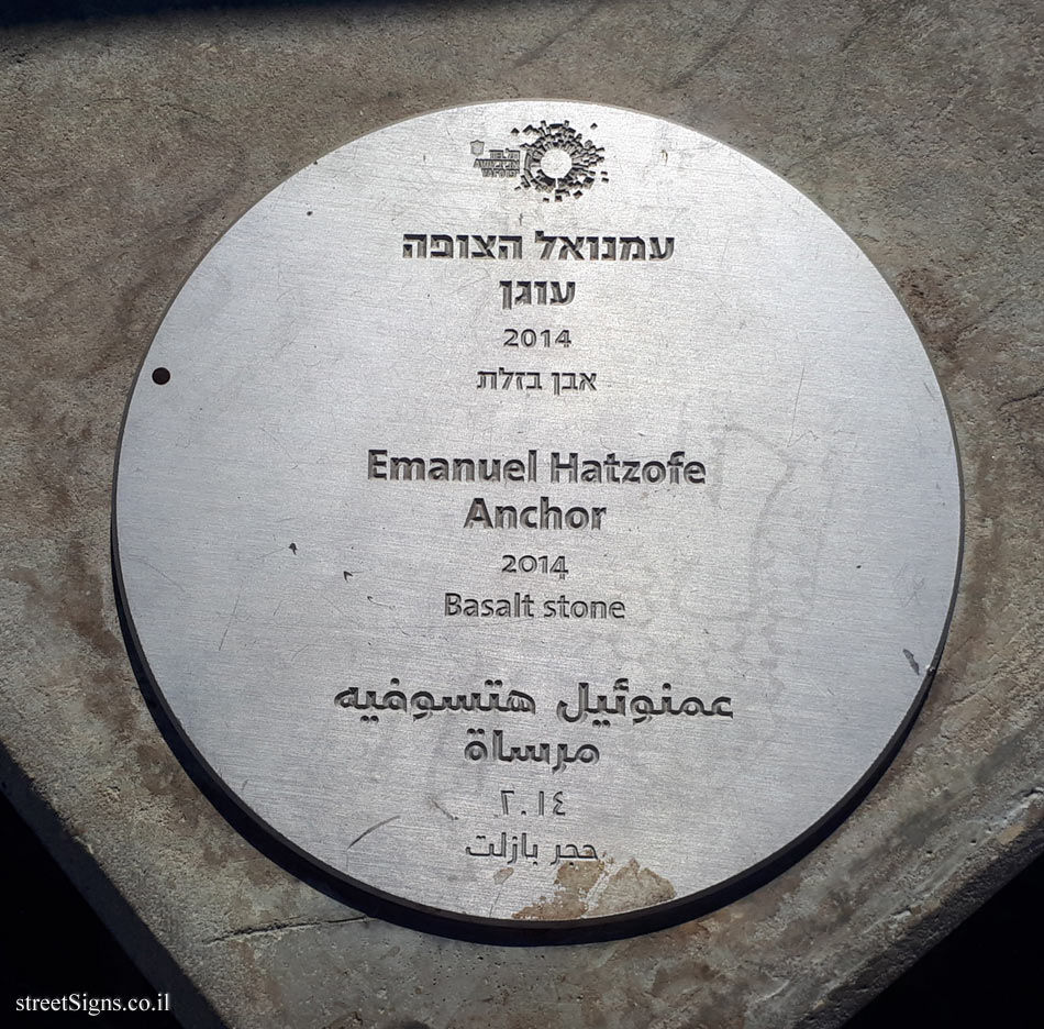
Emanuel Hatzofe
Emanuel Max
Emil Teiner
Emil von Förster
Emmanuel Frémiet
English Heritage Plaque
Enzo Cucchi
Eran Shakine
Erich Mendelsohn
Ernest Flagg
Ernest-Eugène Hiolle
Ernst Degasperi
Ernst Julius Hähnel
Esther Perkel
Eugène Delaplanche
Evie Pollig
Ferdinand Boberg
Fernando Botero
Fiona Banner
Flora
Football (soccer)
Foyatier Denis
François de Hérain
François Mansart
François Sicard
France - Historical heritage site
Francesco Sabatini
Francis Leggatt Chantrey
Francisco Dos Santos
Francisque Duret
Frank Meisler
Franta Belsky
Franz Anton von Zauner
Franz Pönninger
Franz Seifert
Freddy Kahana
Frederick Clarke Withers
French Revolution
Frigyes Schulek
Fritz Kornberg
Gabi Klasmer
Gabriel Davioud
Gaston Lachaise
Gedalia Suchowolsky
Gedalyahu Wilbuszewicz
Genia Averbuch
Genia Gendelman
George Frampton
George Gammon Adams
Georgy Frangulyan
Germaine Richier
Geza Yosifovitz
Gian Lorenzo Bernini
Gianni Aricò
Gideon Gechtman
Gidon Graetz
Gila Stein
Gilbert Ledward
Gillian Wearing
Gio Pomodoro
Giovanni Angelo Montorsoli
Giovanni Comino
Giovanni Fontana
Giovanni Turini
Glynn Williams
Gottfried Semper
Gottlieb Nigelli
Great Fire of London
Gregg LeFevre
Guillaume Coustou
Guy Zagursky
H.N. Bornstein
HA Schult
Haganah
Haim Arlosoroff
Haim Dotan
Haim Meshulam
Haim Sokolinski
Hamo Thornycroft
Hanna Stiebel
Hanoch Caspi
Hans Hillger
Hans Sobelsohn
Harry Baron
Hayim Nahman Bialik
Hector Guimard
Heinz Rau
Henri Alfred Jacquemart
Henri Laurens
Henri Vidal
Henrietta Szold
Henry Liberson
Henry Moore
Henry Weekes
Herbert Hampton
Herman Imberger
Hervé Mathieu-Bachelot
Hila Amram
Hilit Sheffer
Historical routes
Hopare
Ian Walters
Ido Michaeli
Igael Tumarkin
Ignác František Platzer
Igor Brown
Ilan Averbuch
Ilan Gelber
Ilan Goldstein
Ilana Goor
Ion Vlad
Irgun (Etzel)
Irit Segal Israeli
Isaac Blaks
Isaac Mandelbaum
Isaac Newton
Israel Hadany
Israel National Trail
Israel Primo
Israel Rabinovitz
Issac Golombeck
Itzhak Danziger
Ivor Roberts-Jones
János Kalmár
János Marschalkó
János Pásztor
József Hild
J. Borman
J. H. Foley
J. Mittelmann
Jack Jano
Jacob Epstein
Jacques Gondouin
Jacques Lemercier
Jacques Lipchitz
Jacques Louis Robert Villeneuve
Jacques Offenbach
Jamal Hasan
James Butler
James Wilson Alexander MacDonald
Jawad Abul-Huda El-Faruki
Jean Beausire
Jean Bernard Duseigneur
Jean Cardot
Jean David
Jean Dubuffet
Jean Gautherin
Jean Raon
Jean Theodore Stracké
Jean-Baptiste Hugues
Jean-Pierre Cortot
Jeronimo Suñol
João de Sousa Araújo
João Frederico Ludovice
Joaquim Machado de Castro
Jobs Wertheim
Johan Tobias Sergel
Johann Bernhard Fischer von Erlach
Johann Lucas von Hildebrandt
John Bell
John Coll
John Doubleday
John Edward Carew
John Galen Howard
John Michael Rysbrack
John Seward Johnson II
John Tweed
John Woolley
Jorge Marín
Jorge Vieira
José de Creeft
José Otávio Correia Lima
Josef Engelhart
Josef Hermelin
Josef Hlávka
Josef Müllner
Josef Wennagel
Joseph Berlin
Joseph Edgar Boehm
Joseph Emanuel Fischer von Erlach
Joseph Kornhäusel
Joseph Neufeld
Joseph Perlman
Joseph Wackerle
Joshua Zvi Tabachnik
Juan O’Gorman
Jubilee Walkway
Jules Dalou
Julia Bugram
Julien Roux
Käthe Ephraim Marcus
Karl Bitter
Karl von Hasenauer
Karl-Martin Hartmann
Karol Badyna
Kathleen Scott
Kenneth Martin
Korean War
László Dunaiszky
Lagoa Henriques
Laurent Marqueste
Le Vacher
Lehi
Leon Adler
Leon Feinstein
Leon Leibman
Leonard van Munster
Leonid Zilber
Leopold Krakauer
Leopoldo de Almeida
Les Johnson
Leslie Green
Lev Segal
Lev Stern
Libéral Bruant
Liora Alexander
Liora Kaplan
Literature and poetry
London Underground (Tube)
Louis Clausade
Louis Hasselriis
Louis Rochet
Louis-Ernest Barrias
Luís Valadares
Ludwig von Forster
Lynn Chadwick
M. Mühlbauer
Maayan Elyakim
Maggi Hambling
Manuel Tolsa
Marcel Favier
Marcello Piacentini
Mari Andriessen
Maria João Bahia
Mario Raggi
Mark Lewis
Mathurin Moreau
Matthew Noble
Maty Grunberg
Maya Cohen Levi
Meir Dizengoff
Meir Trussman
Meisgad
Menachem Shemi
Menashe Kadishman
Meredith Bergmann
Micha Ullman
Michael Black
Michael Drobil
Michael Gross
Michael Kara
Michael Katz
Michael Lazar
Michael Messinger
Michael Shacam
Michel Vollman
Mihály Pollack
Miriam Chalfi
Moises Cabrera Orozco
Monty Python group
Mordechai Ben Horin
Mordechai Goldenberg
Mordechai Rosengarten
Mordechai Zabrodsky
Morice Lipsi
Moshe Cherner
Moshe Gerstel
Moshe Lubranitzky
Moshe Perlman
Moshe Shek
Moshe Sternschuss
Moshe Ziffer
Mosque
Motti Meller
Motti Mizrachi
Music
Nachum Gutman
Naftali Bezem
Nahum Zelkind
Nancy Schön
Napoleon Bonaparte
Nathan Borsky
Nathan Rapoport
National Historic Landmark (USA)
National Register of Historic Places
Nechama Ofek
Neil Estern
Nella Buscot
New York - Designated Landmark
New York City Subway
Nicolas Coustou
Nihad Debit
Nili
Niv Gafni
Noam Rabinovich
Noga Spector,
Obelisk
Oded Feingersh
Ofer Lallouche
Ofer Zick
Ofra Zimbalsta
Olaf Nicolai
Olivier Brice
Olivier Carre
Omer Uvdin
Orna Ben Ami
Oscar Nemon
Oskar Kogoj
Ossip Zadkine
Otto Hoffmann
Ove Arup
Pablo Picasso
Paintings exhibition
Paris Métro
Paul Day
Paul Gasq
Paul Landowski
Paul Richer
Paul Sisko
Penelope Jencks
Pepe Gregoire
Philip Jackson
Philip Martiny
Photo exhibition
Pierre Alexandre Schoenewerk
Pierre Le Gros II
Pierre Le Muet
Pierre Louis Rouillard
Pierre-Alexis Delamair
Pietro Cascella
Pietro Nobile
Pietro Tacca
Pinchas (Philip) Huett
Pinhas Bijonsky
Plaques in Hampstead
Political murder and assassination
Prosper
Rachel Whiteread
Rafaelle Monti
Rafi Peled
Rafi Peretz
Ran Morin
Randolph Rogers
Rannia Akel
Raphael Chamizer
Restaurants and foods
Reuven Gafni
Reuven Givati
RIBA - Architecture Award
Richard Kauffmann
Richard Kauffungen
Richard Shiloh
Richard Westmacott
Robert Adam
Robert Bennett
Robert Hoff
Robert Hooke
Robert Tait McKenzie
Robert Ullmann
Robert W. Gibson
Robyn Denny
Rodrigo Arenas Betancourt
Rolf (Roda) Reilinger
Ron Arad
Roy Lichtenstein
Roy Place
Rudolf Weyr
Ruth Bloch
Ruth Mandel
Ruth Zarfati
Sébastien Slodtz
S.Rubenstein
Salvador Dalí
Samson Merhav
Samuel Barkai
Sculpture Garden
Secret arms cache (Slick)
Sergio Stichini
Shaul Tchernichovsky
Shira Zelwer
Shlomit Averbuch
Shlomo Emanuel
Shlomo Gepstein
Shlomo Ginsburg
Shlomo Liaskovsky
Shlomo Ponrov
Shlomo Selinger
Shmuel Belder
Shmuel Rosov
Shmuel Yosef Agnon
Siegfried Charoux
Sigal Primor
Sigalit Landau
Silo
Simón Bolívar
Siona Shimshi
Sister cities
Six-Day War
Sorel Etrog
Sport walking and riding
Spyro Houris
Standards (length, etc.)
Stanisław Lutostański
Stanislaw Ostrowski
Steell
Steindl
Sune Malmquist
Synagogue
Tamir Sheffer
Tanya Preminger
Tauno Kangaroo
Templar colonies in Israel
Terror attacks
Théodore Ballu
The Beatles
The Corporation Of London Signs
The Equator Point
The Holocaust
Theobald Stein
Theodor Herzl
Theodor Lundberg
Theodor Menkes
Theodore de Lemos
Theodore Zandel
Theophil Hansen
Thomas Brock
Thomas Harrison
Thomas Thornycroft
Thomas Woolner
Tim (Louis Mitelberg)
Toilet
Tom Eckersley
Tom Goldsmit
Tom Otterness
Tomáš Seidan
Toni Schneider-Manzell
Trains and railroads
Uri Dushy
Uri Katzenstein
Uri Lifshitz
Uriel Schiller
Víctor Bastos
Varda Givoli
Varda Rotem
Varda Yoran
Vessels and their parts
Vhils
Victor Jachun
Viktor Tilgner
Vincenz Pilz
Vineyards and wineries
Vivien Mallock
Walter Schott
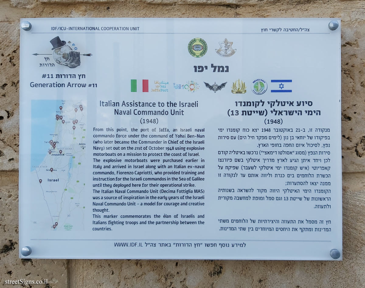
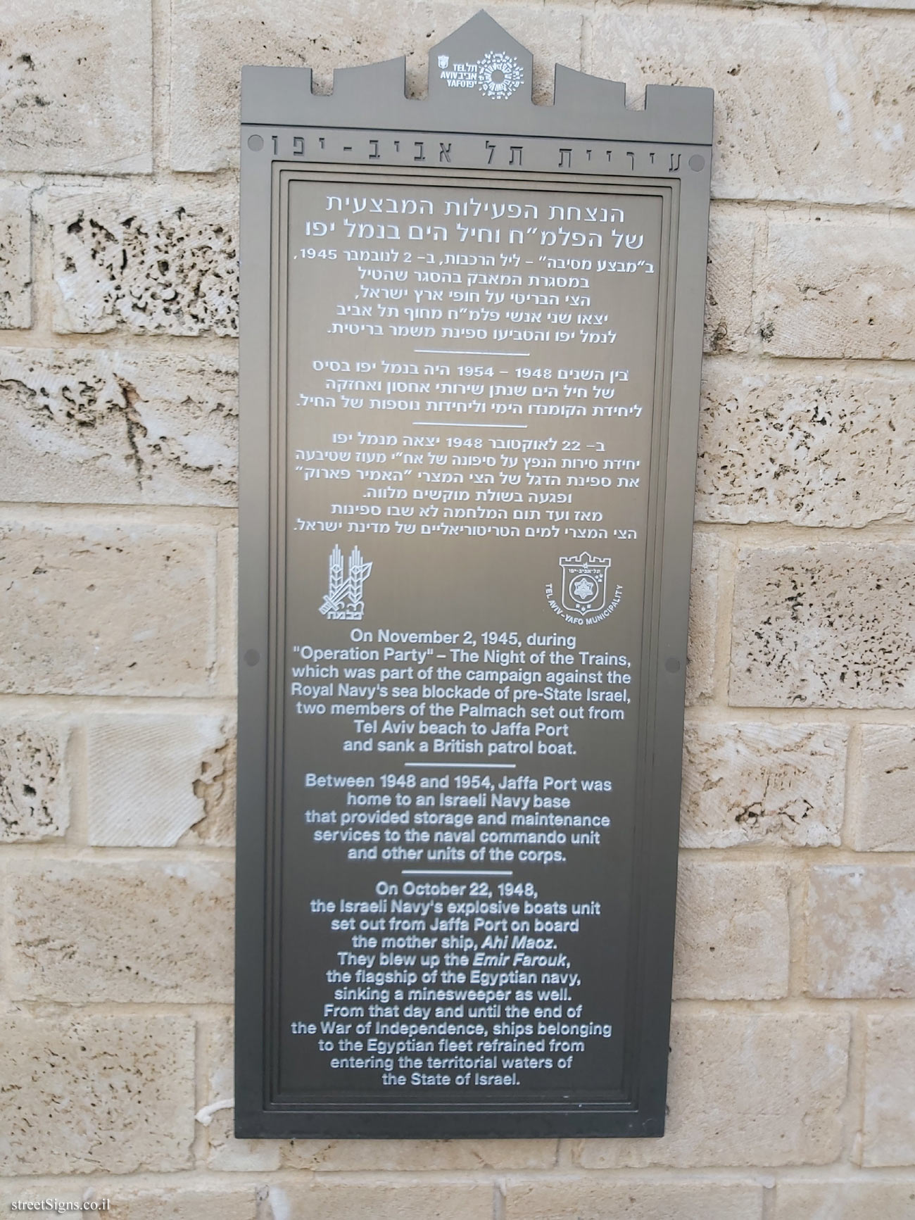
War of Independence (Israel)
Water tower
Weapons
Wells and pools
Wendy Taylor
Wiktoria Czechowska-Antoniewska
Wilhelm Hecker
Wilhelm II’s visit to Israel
Willem Verbon
William Behnes
William Bouwens van der Boijen
William McMillan
William Robert Colton
William Shakespeare
William Tite
William Wetmore Story
Wills Brothers
Windmill
Winston Churchill
Wolf Dieter Prix
Wolfgang Amadeus Mozart
World Heritage Site
WWI
WWII
Y D Gordon
Y. G. Hagar
Yaacov Agam
Yaacov Dorchin
Yaacov Hefetz
Yaakov Benor Kalter
Yaakov Ben-Sira
Yaakov Borenstein
Yaakov Matrikin
Yaakov Orenstein
Yaakov Rechter
Yadid Rubin
Yael Artsi
Yael Bareket
Yael Bartana
Yael Frank
Yasha Shapira
Yechiel Abrahamy
Yedidya Mor
Yehiel Shemi
Yehoshua Steinbok
Yehuda Magidovitch
Yehuda Stempler
Yehuda Tzimmerman
Yehuda Zuckerman
Yehushua and Or Kafri
Yigal Meron
Yisrael Dicker
Yitzhak Rapoport
Yitzhak Schwartz (Shen Tzur)
Yitzhak Toledano
Yoel Shmokler
Yohanan Ratner
Yoram Afek
Yosef Bersky
Yosef Kashdan
Yosef Minor
Yosef Tischler
Yury Chernov
Yuval Rimon
Yves Dana
Z. Orlov
Zadok Ben-David
Zaki Chelouche
Ze’ev Haller
Zeev Chudnovsky
Zeev Rechter
Zelig Axelrod
Zigi Ben-Haim
Zipora Gendler
Ziv Ben Dov
Zoe Sever
Zoltan Harmat
Zvi Frankel
Zvi Geyra
Zvi Lachman
Zvi Spokojny
Zvi Spoznikov
Zvika Kantor
Sets: Note that selecting a value from this field will delete the entry in the first search field (Word or words)
--- Ignore a set (all signs) ---
Commemoration of Underground Movements in Tel Aviv
Plaques of artists who lived in Tel Aviv
Tel Aviv - White city - buildings for conservation
The houses of the founders of Tel Aviv
Tel Aviv - Sarona complex - buildings for preservation
Heritage Sites in Israel
Interior of subway and railway stations
Independence Trail (TLV)
Givatayim - Rishonim route
Historic sites in Old Jaffa and Jaffa port
Tel Aviv Port - Levant Fair
Street signs in old Jaffa
Tel Aviv streets and sites
The Founders’ Path - Kfar Saba
Buildings in Gan Shmuel’s history
Boarding Gates
The historic wall of Gedera
Oxford Castle Route
The Founders’ Route & more - Rishon LeZion
The history of Ra’anana
History of the Port of Tel Aviv
Pictures of Agrobank (Holon) history
Historical Sites in Petah Tikva
Wroclaw Historical Trail
Union Square Timeline
History in pictures of Givat Haim
Outdoor sculpture in Tel Aviv
Ramat Gan's History
England Blue Plaques
Jerusalem - the built heritage
"Land marks" program
Kiddush levana
The music walk of fame
Coronavirus pandemic
Handling dog poo
World Heritage Sites
The Flag trail, Ness Ziona
Sites in the History of Herzliya
The open exhibition at Ramat Gan
Memorial to the Undergrounds - Petah Tikva
I Love ...
Budapest - the Roman frontier - Pannonian Limes
Street signs in Ramot Hashavim
Ramat Hasharon - Sculpture Garden
Decorated ceramic signs
Fauna & Flora in Hayarkon Park
Buildings in the history of Kfar Vitkin
Tel Aviv - London Garden - Ha’apala story
Buildings in the history of Sde Warburg
Topor sculpture garden - Sheba Hospital
Histadrut Garden - Youth Movement Trail
Hadera - The eucalyptus track
Buildings in the history of Ramot HaShavim
Calvin Square plaque
Stumbling stone (Stolpersteine) - memorial for the victims of the Nazis
Sites in the history of Rehovot
New York - Park Avenue plaques
A memorial site the Palmach-Harel Brigade
The Village Park - Rishon LeTsiyon
Discovery Tree Walk - The Hebrew University
Ecological Botanical Garden in Abu Kabir, Tel Aviv
Tel Aviv Orchard
Story gardens in Holon
Rishon Lezion - Nobel Laureates Boulevard
Photograph in stone - Jerusalem
Outdoor sculptures on the Tel Aviv University campus
Trees in the national park, Ramat Gan
Jerusalem - HaMesila Park - History of the railway line
Outdoor sculptures on the Reichman University campus
Jonathan Trail - Ramat Gan
Tel Aviv - 70 to Israel - Blue and White Art
Jerusalem - Amulet Authority
Ashdod -The blue route
New York - Library Way
Tel Aviv - in our streets
Jerusalem - Haviva Netiva and Aviva route
Zichron Yaacov - Wine Road
Tel Aviv - Flora in the Independence Garden
JNF - Gardens and Parks
Vienna - A city introduces itself
Vienna - Walk of Fame
London Underground History
Berkeley Poetry Walk
Ceramic street signs in Madrid
Entin Square tiles - Tel Aviv University
The History of Paris (Starck's Lollipops)
Seine bridges in Paris
Gardens in Paris
Tokyo - Circle of Flowers
Paris - 100 Years of Metro History
Kfar Saba - The Tree Path
Tuileries Gardens sculptures
Cities in the Loire Valley


 Click for sign's details
  Click for a larger image
 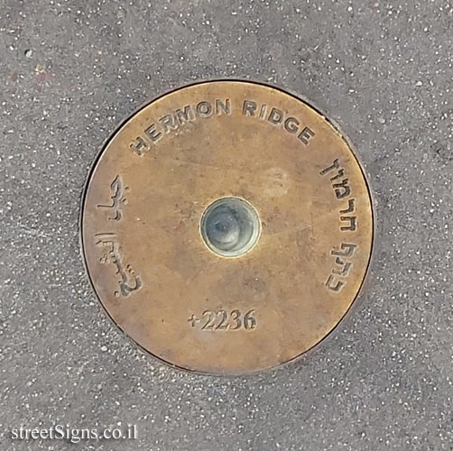 Click for a larger image
 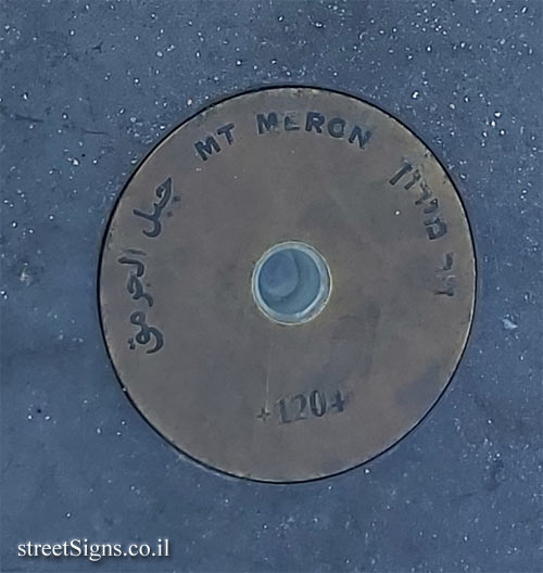 Click for a larger image
 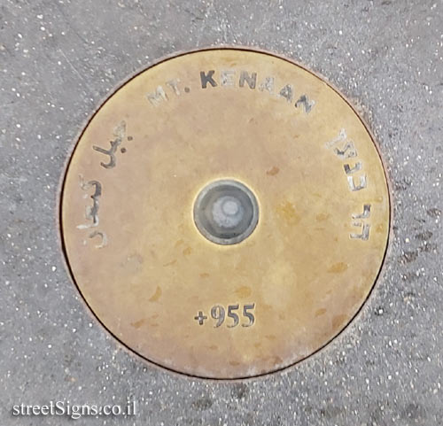 Click for a larger image
 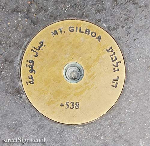 Click for a larger image
  Click for a larger image
  Click for a larger image
  Click for a larger image
  Click for a larger image
 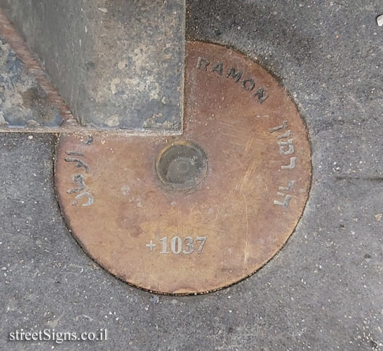 Click for a larger image
 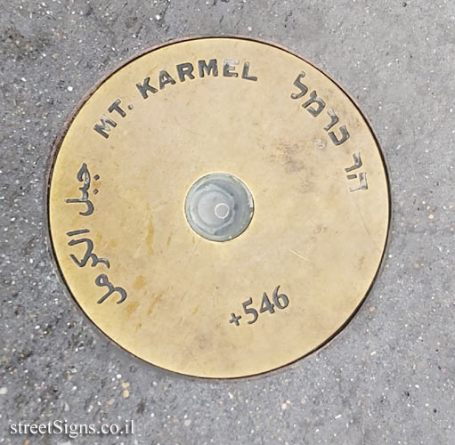 Click for a larger image


 Click for all signs belonging to Historic sites in Old Jaffa and Jaffa port
 Click for the map of all signs belonging to Historic sites in Old Jaffa and Jaffa port
 Click for more details on Historic sites in Old Jaffa and Jaffa port
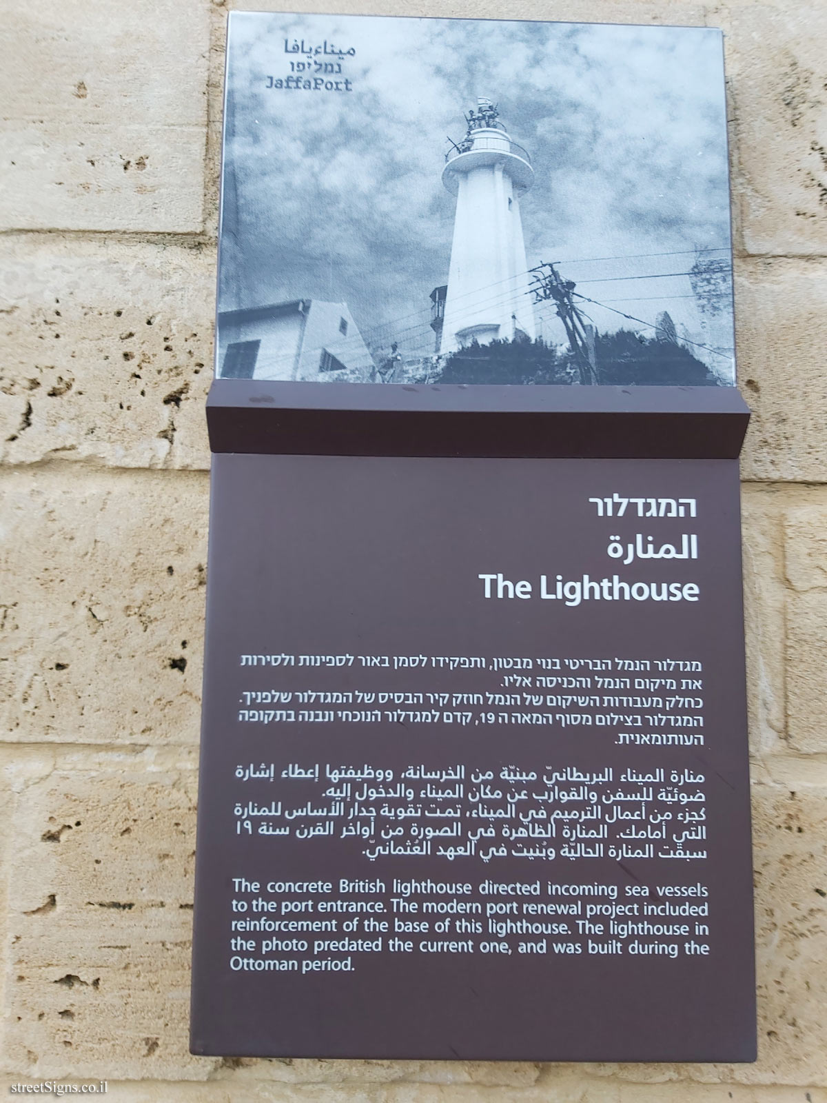
 The closest sign from this series (23 Meter): Tel Aviv - Jaffa Port - The Lighthouse
 52 Meter
 60 Meter
 64 Meter
 66 Meter
 69 Meter