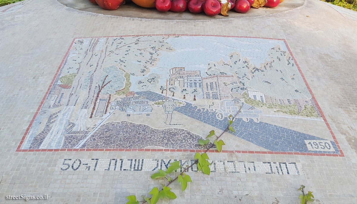
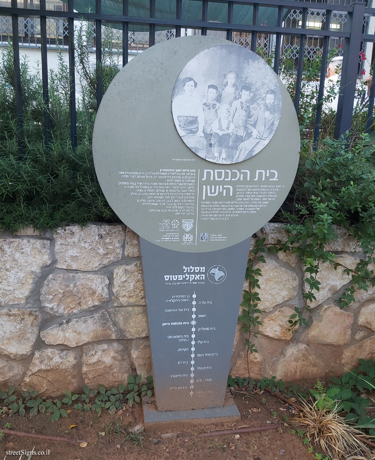
The Eucalyptus Trail is a trail of 16 historic sites in the heart of the city of Hadera. In addition to the signs placed at the points of the route, an illustration marking the route is stamped on the ground, as can be seen in the following sign
 Click for sign's details
 The place where the sign stands, and the Bank Hapoalim branch located on the site of the committee building were photographed that day
 Click for a larger image
 In the following image, a part of the sign is enlarged
 Click for a larger image
 Note: The QR code leading to the website listed on the sign - www.maslule.co.il - is not active
Translation of the text on the sign:
[Image]
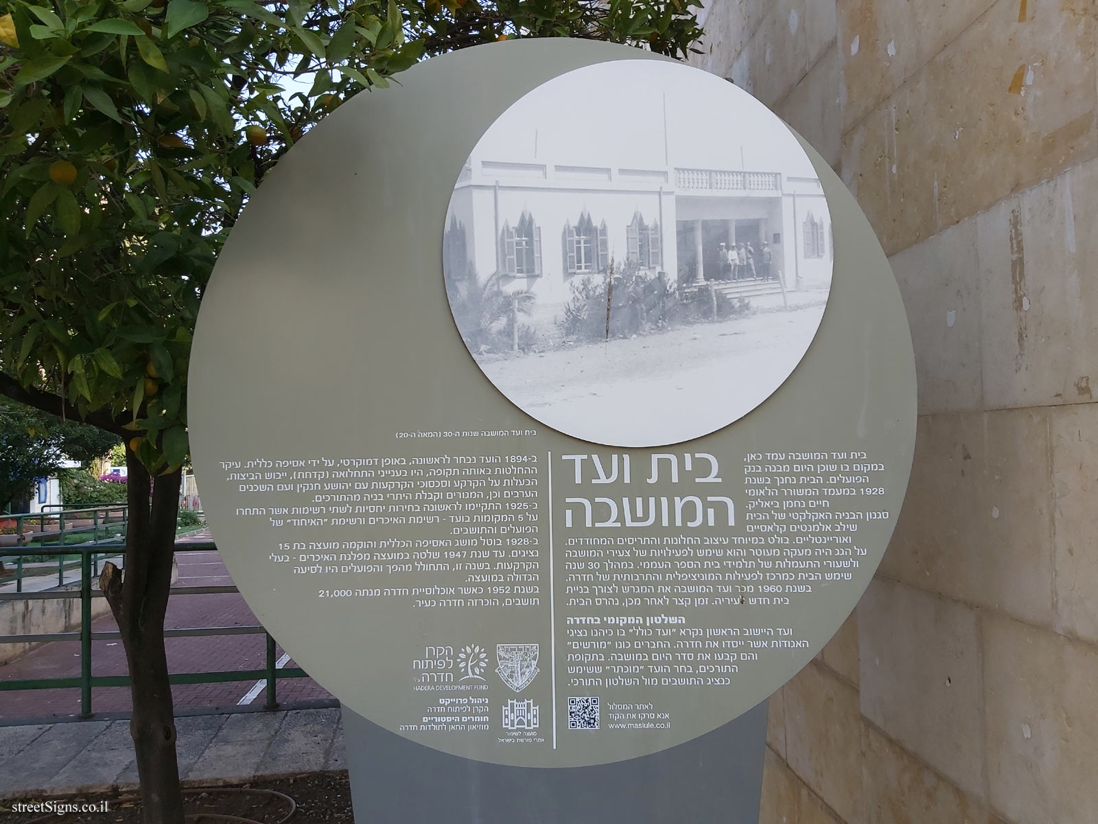
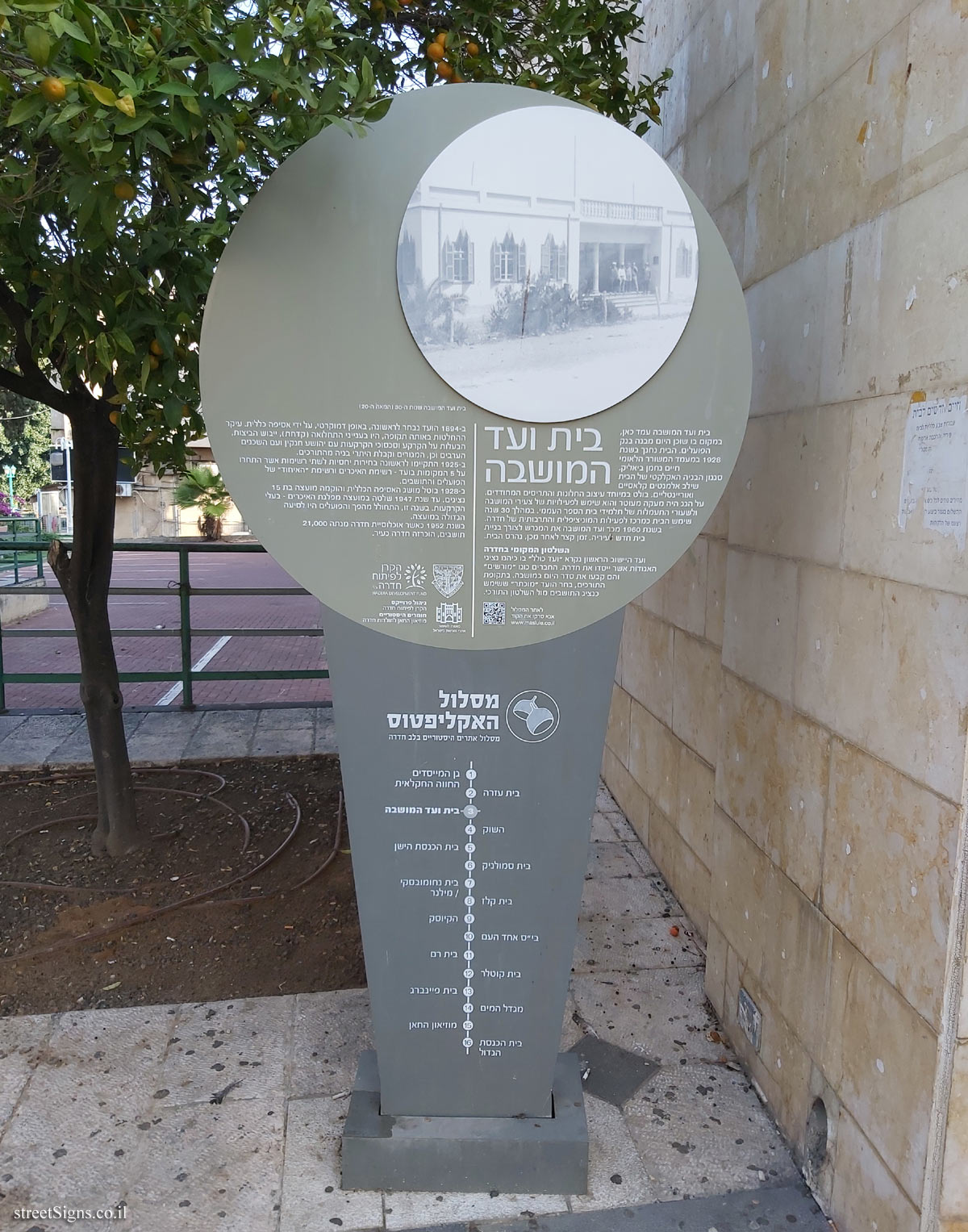
House of the Colony Committee 1930s (20th Century)
בית ועד המושבה The House of the Colony Committee stood here, where the Bank Hapoalim building is today. The house was inaugurated in 1928 in the presence of the national poet Haim Nachman Bialik.
The eclectic building style of the house combined classic and oriental elements. The design of the pointed windows and shutters is particularly noticeable. On the roof was a decorated railing and it was used for the activities of the young people of the colony and for the gymnastics lessons of the pupils of the elementary school. For 30 years, the house served as a center for Hadera’s municipal and cultural activities.
In 1960, the Moshava committee sold the plot for the purpose of building a new house for the municipality. Shortly afterwards, the house was destroyed.
To the route website
QR code
Please scan the code
www.maslule.co.il
Local Government in Hadera The first settlement committee was called the "Kollel Committee" in which the representatives of the associations that founded Hadera served. The members were called "licensed" and they set the agenda for the colony. During the Turkish period, the "Mukhtar" committee that served as the residents’ representative vis-à-vis the Turkish government was elected.
In 1984 the committee was first elected, democratically, by a general assembly. The main decisions at that time were in the matters of morbidity (fever), the drying up of the swamps, the ownership of the land and the land disputes with Joshua Hankin and the Arab neighbors as well as, the residence and the receipt of building permits from the Turks.
In 1925, for the first time, relative elections were held for two lists that competed for the 5 seats on the committee - the list of peasants and the list of "union" of the workers and residents.
In 1927 the concept of the General Assembly was abolished and a council of 15 representatives was established. Until 1947, the council was ruled by the Peasants’ Party - the landowners. This year, a revolution took place and the workers became the largest faction in the council.
In 1952, when the population of Hadera numbered 12,000, Hadera was declared a city.
Designers: Dani Karavan - Statue | Zvi Dekel - Landscape Architect
The late Micha Perry - Engineer | Aharon Kemminger - project developer and manager
The emblem of the city of Hadera
Symbol of the Dre Development Fund
Symbol of the Council for the Preservation of Heritage Sites in Israel
Project management - Hadera Development Fund
Historical Materials - The Khan Museum of Hadera History
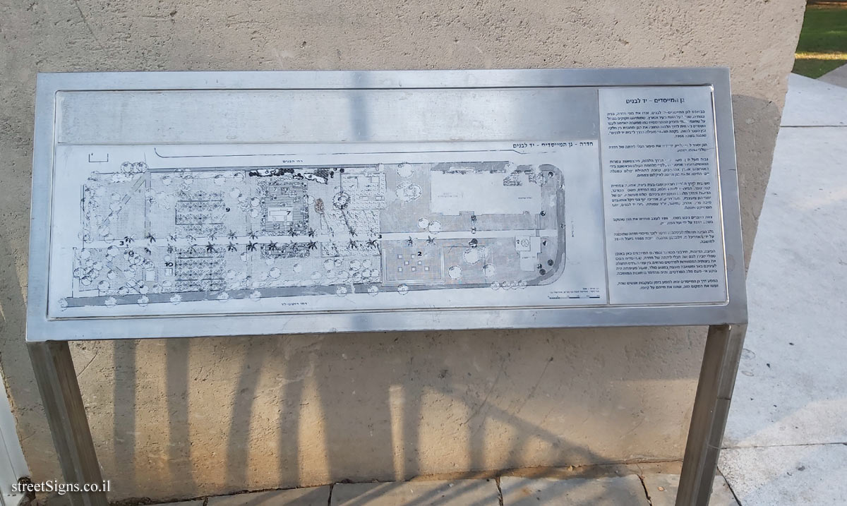
Eucalyptus route Historic sites route in the heart of Hadera
1. The Founders’ Garden, the agricultural farm / 2. Beit Ezra / 3. Beit HaMoshava / 4. The Market / 5. The Old Synagogue / 6. Beit Smolnik / 7. Beit Nakhumovsky / Milner / 8. Beit Kelz / 9. The Kiosk / 10. Ehad Ha’am School / 11. Beit Ram / 12. Kotler House / 13. Feinberg House / 14. Water Tower / 15. The Khan Museum / 16. The Great Synagogue


 Click for all signs belonging to Hadera - The eucalyptus track
 Click for the map of all signs belonging to Hadera - The eucalyptus track
  Click for the route that starts with this sign and goes through the signs belonging to Hadera - The eucalyptus track
 Click for more details on Hadera - The eucalyptus track
 The closest sign from this series (136 Meter): Hadera - The eucalyptus track - The old synagogue
 209 Meter
 214 Meter
 218 Meter
 229 Meter
 230 Meter