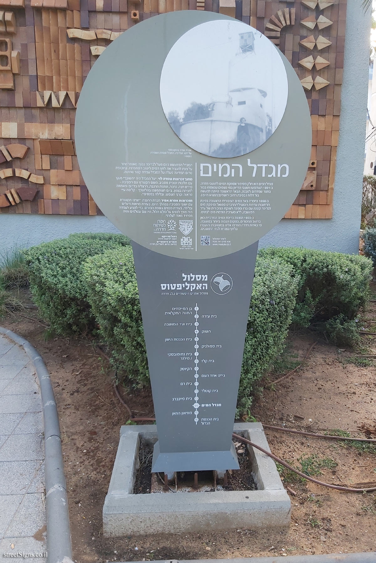
The Eucalyptus Trail is a trail of 16 historic sites in the heart of the city of Hadera. In addition to the signs placed at the points of the route, an illustration marking the route is stamped on the ground, as can be seen in the following sign
 Click for sign's details
 The Water tower was photographed that day
 Click for a larger image
 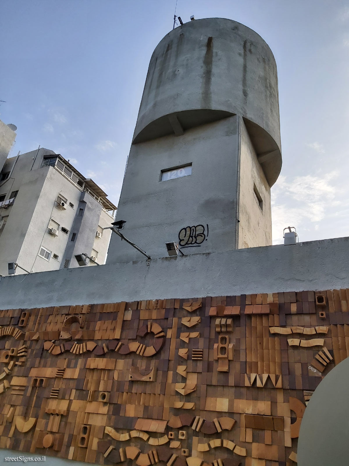 Click for a larger image
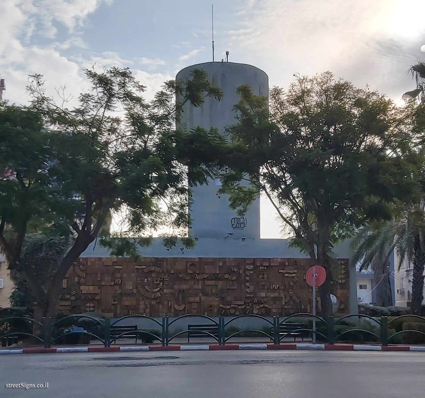
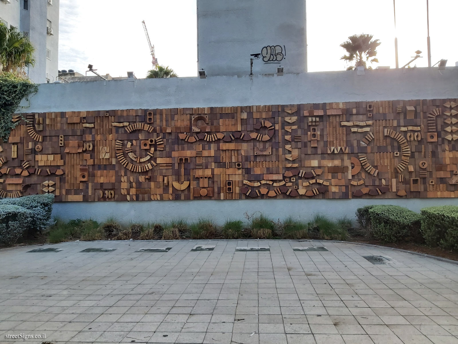
 In 1973, the work of sculptor Doron Bar-Adon was placed on the pool wall
 Click for a larger image
 In the following image, a part of the sign is enlarged
 Click for a larger image
 Note: The QR code leading to the website listed on the sign - www.maslule.co.il - is not active
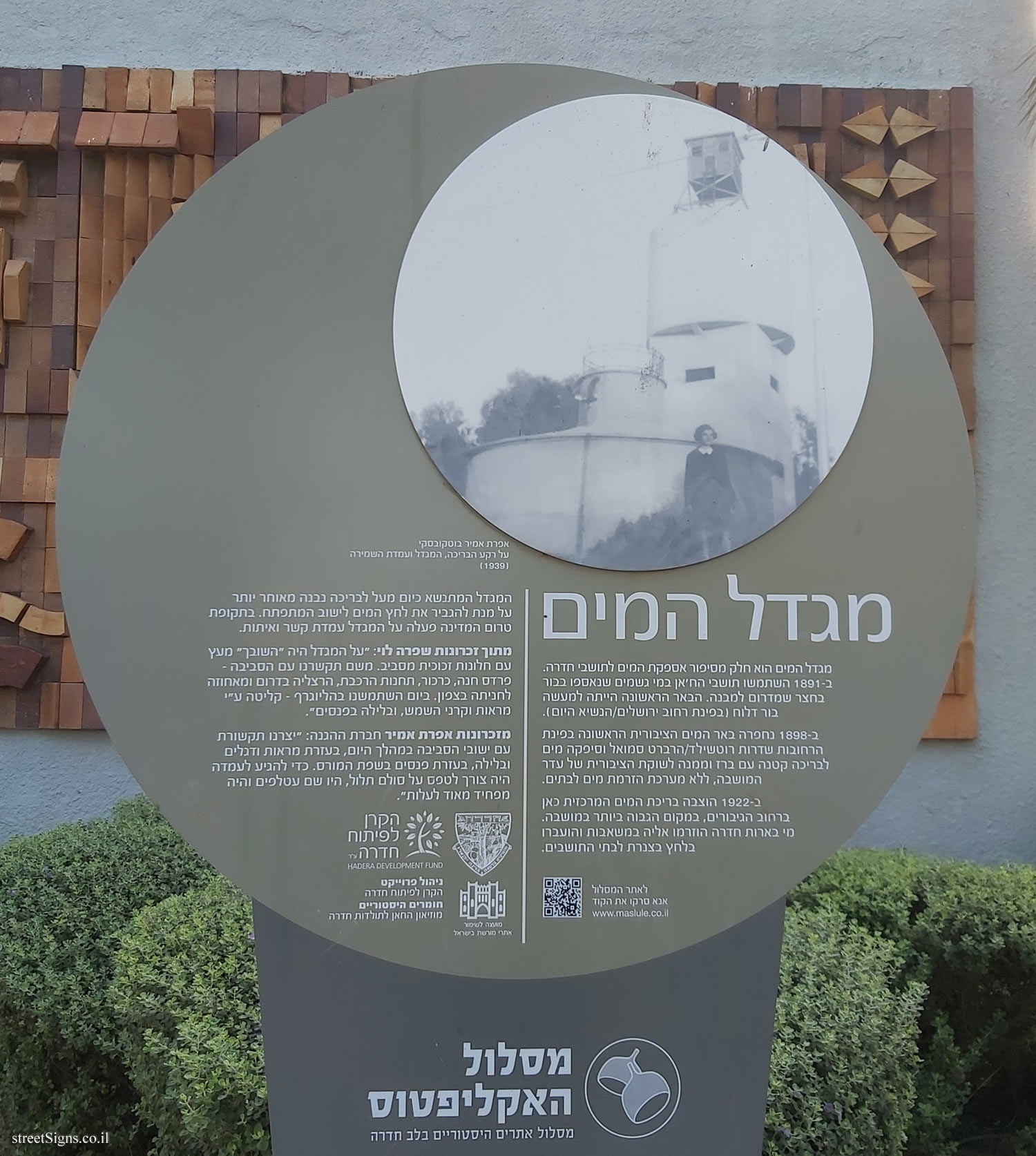
Translation of the text on the sign:
[Image]
אפרת אמיר בוטקובסקי על רקע הבריכה, המגדל ועמדת השמירה (1939)
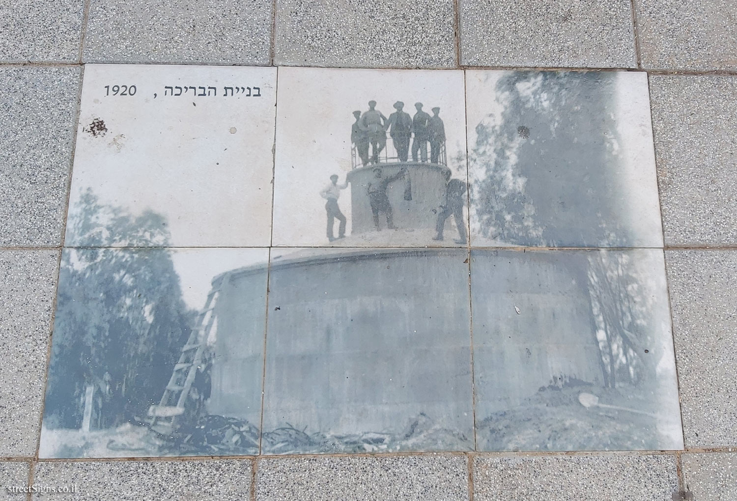
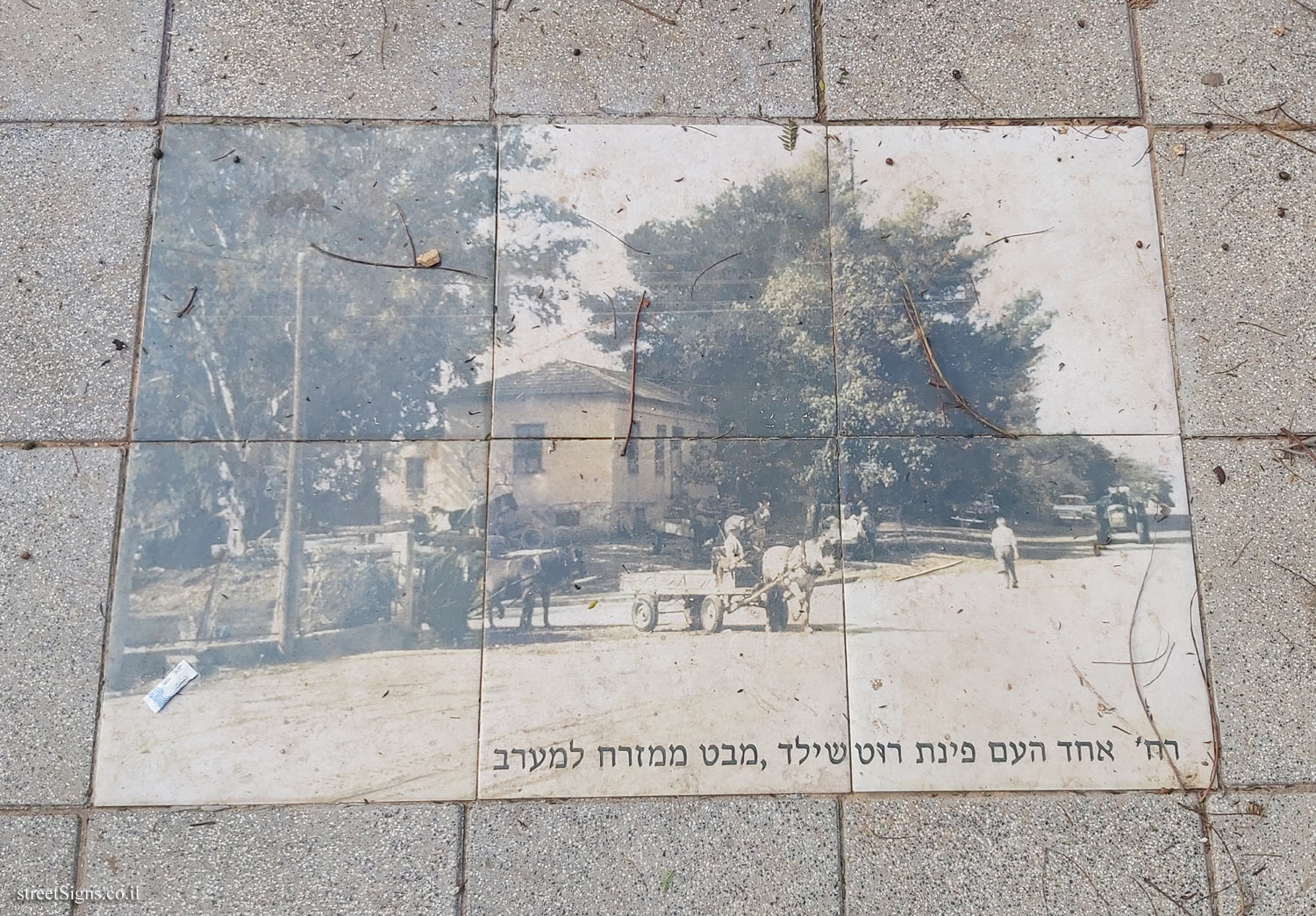
The Water tower The water tower is part of the story of the water supply to the residents of Hadera. In 1891, Khan residents used rainwater collected in a pit in the courtyard south of the building. The first well was actually a leaky pit (on the corner of Jerusalem/HaNasie streets today).
In 1898 the first public water well was excavated at the corner of Rothschild / Herbert Samuel streets and supplied water to a small pool with a tap and from there to the public trough of the colony herd, without a water flow system to the houses.
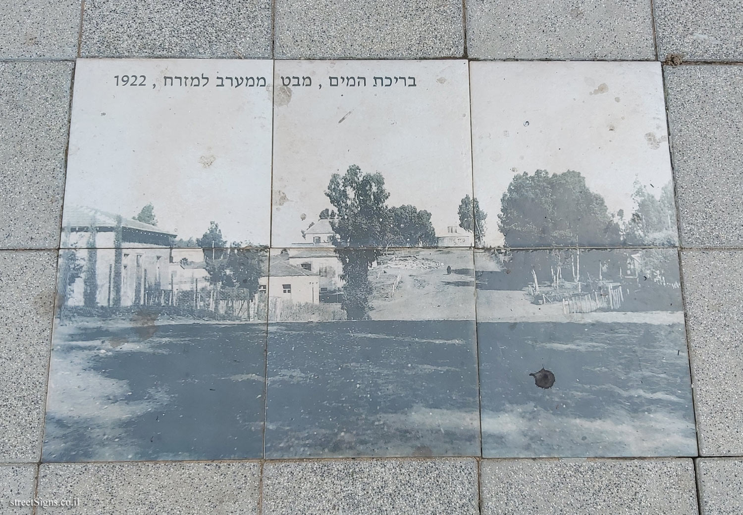
In 1922 the main water pool was placed here on HaGiborim Street, in the highest place in the colony. The water from the Hadera wells was pumped to it and pumped by piping to the residents’ homes.
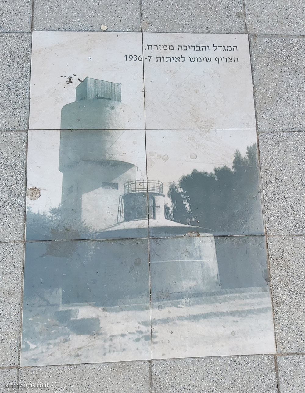
The tower that now stands above the pool was later built to increase the water pressure for the developing settlement. In the pre-state period, a liaison and signaling station operated on the tower.
From Shifra Levy’s memoirs: "On the tower was the "Dovecote" made of wood with glass windows all around.
From there we communicated with the area - Pardes Hanna, Karkur, the train stations, Herzliya in the south and from Ahuza to Hanita in the north. During the day we used a heliograph - absorption by mirrors and the sun’s rays, and at night with flashlights. "
Memoirs of Efrat Amir Member of HaHagana: We created communication with the surrounding communities during the day, with the help of mirrors and flags and at night, with the help of lanterns in the Morse language. To get to the position it was necessary to climb a steep ladder, there were bats and it was very scary to climb. "
To the route website
QR code
Please scan the code
www.maslule.co.il
The emblem of the city of Hadera
Symbol of the Dre Development Fund
Symbol of the Council for the Preservation of Heritage Sites in Israel
Project management - Hadera Development Fund
Historical Materials - The Khan Museum of Hadera History
Eucalyptus route Historic sites route in the heart of Hadera
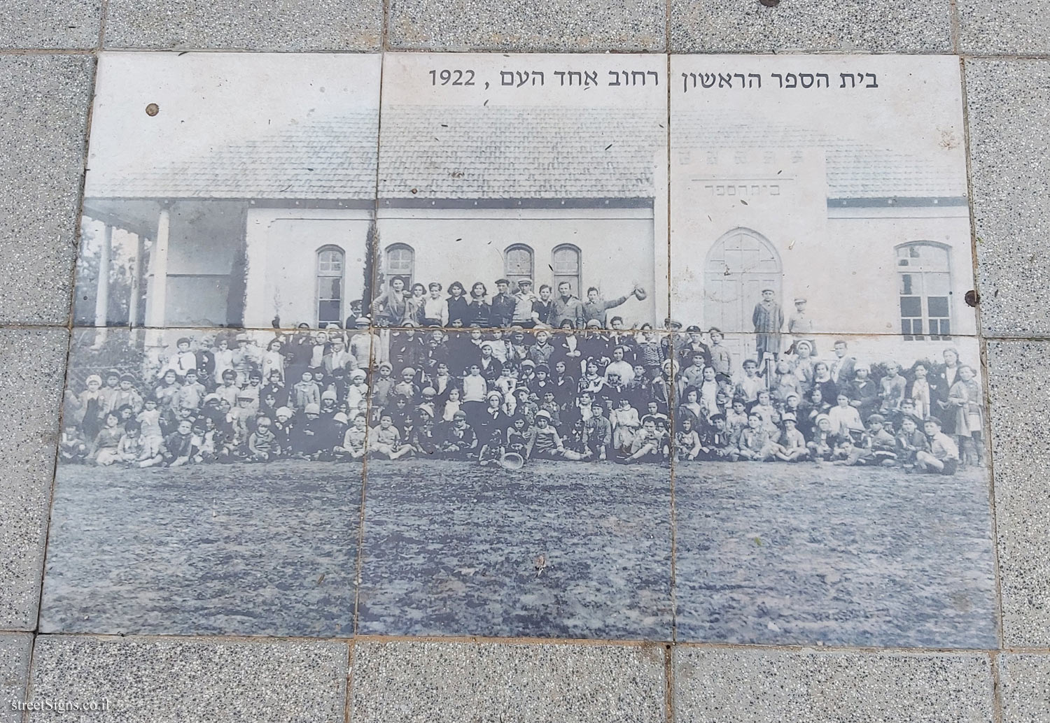
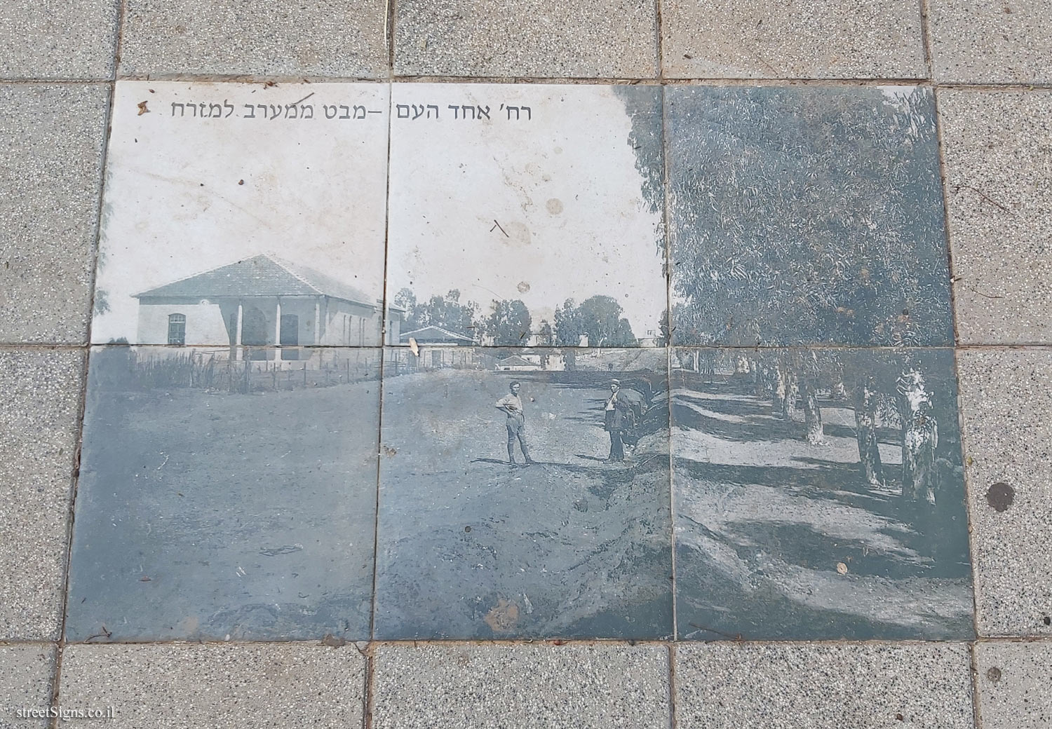
1. The Founders’ Garden, the agricultural farm / 2. Beit Ezra / 3. Beit HaMoshava / 4. The Market / 5. The Old Synagogue / 6. Beit Smolnik / 7. Beit Nakhumovsky / Milner / 8. Beit Kelz / 9. The Kiosk / 10. Ehad Ha’am School / 11. Beit Ram / 12. Kotler House / 13. Feinberg House / 14. Water Tower / 15. The Khan Museum / 16. The Great Synagogue


 Click for all signs belonging to Hadera - The eucalyptus track
 Click for the map of all signs belonging to Hadera - The eucalyptus track
  Click for the route that starts with this sign and goes through the signs belonging to Hadera - The eucalyptus track
 Click for more details on Hadera - The eucalyptus track
 The closest sign from this series (64 Meter): Hadera - The eucalyptus track - Beit Ram
 208 Meter
 225 Meter
 281 Meter
 281 Meter
 288 Meter