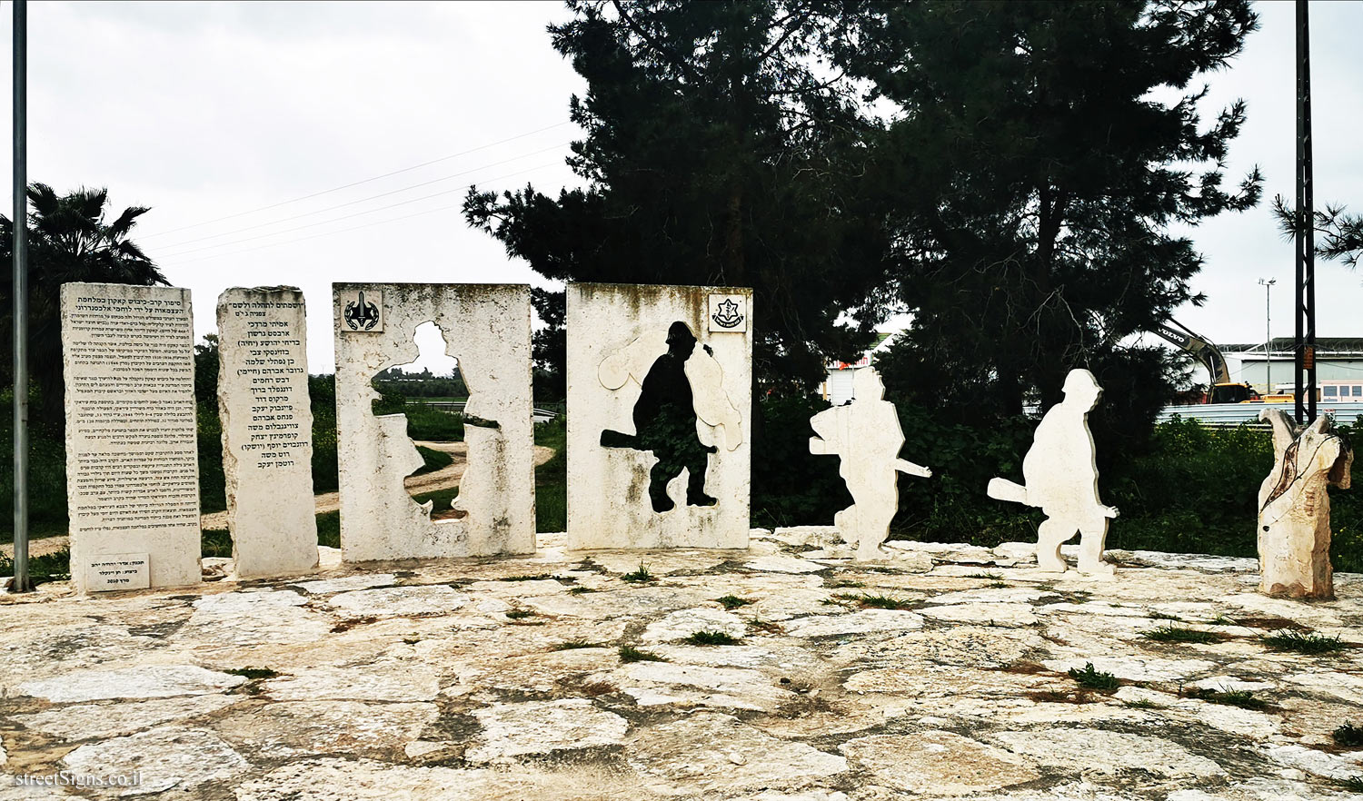
The monument consists of 4 stone boards, and two warrior figures who "came out of the boards". The other two plaques feature IDF and Alexandroni Brigade symbols
The monument was photographed that day by the same photographer
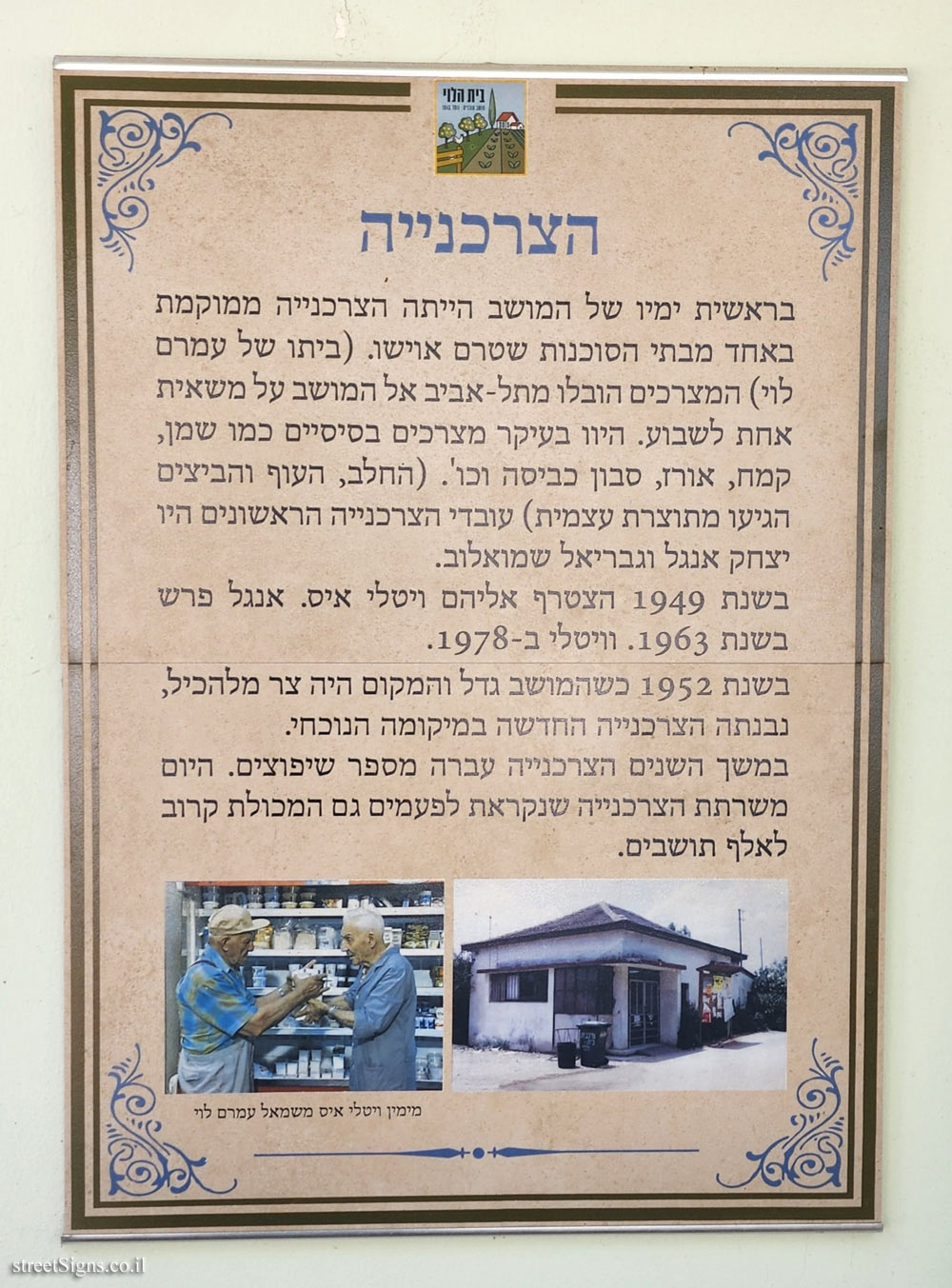
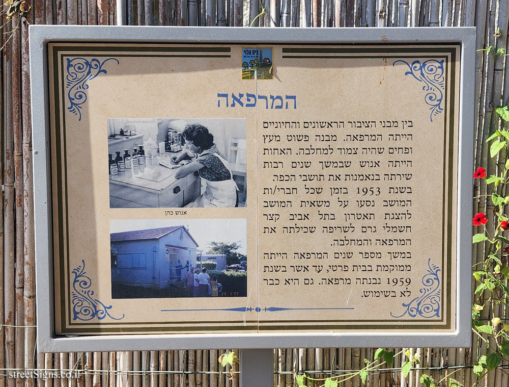
 Click for a larger image
 More details about the battle and details of those who fall on the signs that are also on the hill
 Click for sign's details Translation of the text on the sign
:
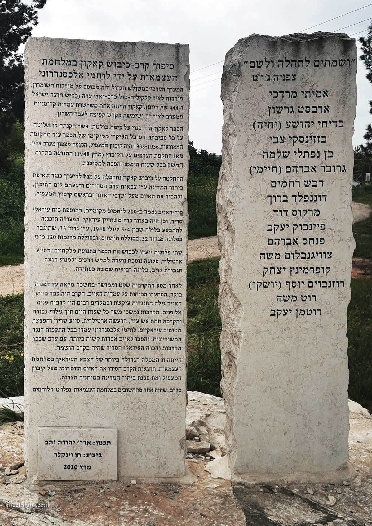
Story of the Battle of Qaqun in the War of Independence by the Warriors of Alexandroni The Arab line in the Great Triangle was based on the slopes of Samaria, slopes to the Qalqilya-Tulkarm-Wadi Ara axis (today’s Trans-Israel Highway and 444). Kakon was one of a chain of ancient positions west of this axis and served as a springboard towards the Sharon.
The village of Qaqun was built on a prominent dome, which gave it control over its entire surroundings. The main sufferer of the village’s location from the period of the events of 1938-1936 was Kibbutz HaMa’apil, which was observed northwest of it. Since the Arab attack on the kibbutz (March 1948), movement within the kibbutz around the clock has become dangerous.
The decision to occupy Qaqun was made in order to prepare against the aspiration of the dissolution of the state by the regular Arab armies and their arrival in the Mediterranean, and to remove the threat from the settlements of the area, headed by Kibbutz HaMa’apil.
The enemy force is estimated at 200 local fighters, plus a regular Iraqi force, as well as an Iraqi armored force. The operation was planned to take place on the night of July 5-4, 1948, by the 33rd Battalion, which would be reinforced with a company from the 32nd Battalion, a cannon battery, and a 120 mm mortar battery.
Two companies were intended to occupy the village with the movement of forceps, with the help of artillery, another company was intended to lay mines on the roads and prevent the arrival of enemy reinforcements, a fourth company was used as a reserve.
After a quiet and prolonged approaching campaign — in complete darkness until dawn, the forces stormed the enemy positions. The battle was already fierce, the enemy showed stubborn resistance and in many cases there were face-to-face battles. The fighting continued throughout the day while showing heroism and sacrifice under heavy fire, artillery barrage, armored aid and bombing of Iraqi planes. Alexandroni’s fighters withstood all the armored counterattacks, inflicting extremely heavy losses on the enemy, with an evening when the fighting subsided and the regular Iraqi force that was in the battle was destroyed.
It was the biggest defeat of the Iraqi army in the War of Independence. The results of the battle removed the daily threat over Kibbutz HaMa’apil and the danger of the state being dismembered in its narrow waist.
In the battle, which was one of the most important in the War of Independence, 16 fighters fell.
Design: Architect Yehuda Yahav
Performed by: Chen Winkler
March 2010
[The second stone of the monument]
"for I will make you a name and a praise"
Tzefaniah 3,19
Amitai Mordechai / Arvest Gershon / Badihi Yehoshua (Yehia) / Bazinsky Zvi / Ben Naftali Shlomo / Gruber Avraham (Chaimi) / Dbesh Rahamim / Donenfeld Baruch / Marcus David / Feinbok Yaakov / Pinchas Avraham / Zweigenblum Moshe / Kupermintz Yitzchak / Rosenkoim Yosef (Yosh ) / Roth Moshe / Rothman Yaakov
Learn about: