Various signs
The ultimate street signs, historical sites and house numbers
× Want to add signs? There is an app! Get it on Google Play Download on the App Store

Sign: Pardes Hanna - 90 years of innovation - A planned colony

Address:
Yad LaBanim/HaBanim Road, Pardes Hanna-Karkur, Israel
Country:
Shape:
Material:
Placement:
Click here for a map that contains other items in the area

On the sign:
[מפת התכנון של פרדס חנה]
מפת התכנון של פרדס-חנה, כפי ששורטטה על ידי המהנדס מיכאל קסלמן בשנת 1928
מקור: ארכיון בית ראשונים בפרדס חנה-כרכור

אתם כאן
האם אתם יכולים לזהות את ההבדלים בין פני המושבה כיום ובין התכנון:?

מושבה מתוכננת
איך הכול התחיל? חברת פיק"א, Palestine Jewish Colonization Association, בבעלות משפחת רוטשילד, החליטה להקים מושבת פרדסנים: היא רכשה אדמות, מינתה מומחים לתכנון ערים, צירפה להם פקידי ברון מנוסים והחלה בבניה לפי תכנית אב.
איפה? האזור הנבחר להתיישבות כונה "ראביה" (Ghabie) משמעתו בערבית: יער עבות, רמז ליער האלונים שהיה כאן. כיום ניתן לראות שרידים של האלונים העתיקים האלה, למשל לא רחוק מכאן, ב"ככר אגד".
מה הייתה התכנית? מושבה ברוח "עיר גנים": הרבה מרחב פיזי, פרטי וציבורי, בניה נמוכה וצנועה, צמחיה מרובה ושדרות עצים נותני צל. בשנת 1928 הוכנה מפה מפורטת למושבה על ידי המהנדס מיכאל קסלמן. במפה צירים עיקריים בכיוון צפון דרום (רחוב הנדיב ורחוב הדקלים), מערך הרחובות לינארי, ריכוז של מבני ציבור סביב הכיכר הראשית וחלוקה אחידה של חלקות חקלאיות. ראשוני תושביה של המושבה התגוררו בין רחוב הראשונים (שכונת הפועלים) ודרך הנדיב (רחוב 800), ובין רחוב החרובים לדרך הים.

קוד QR המפנה ל The First Founders - The Pardes Hanna-Karkur History Center, סמל 50 שנה לאיחוד המושבות פרדס חנה וכרכור, סמל 90 שנה לפרדס חנה, סמל בית הראשונים - המרכז לתולדות פרדס חנה-כרכור
Photography:
Add comments, corrections, or missing information. After clicking the "Submit" button you will be taken to a page where you will be required to specify your name and email address.
Please note, you do not need to specify details about the item, these details will be automatically added


Comments:
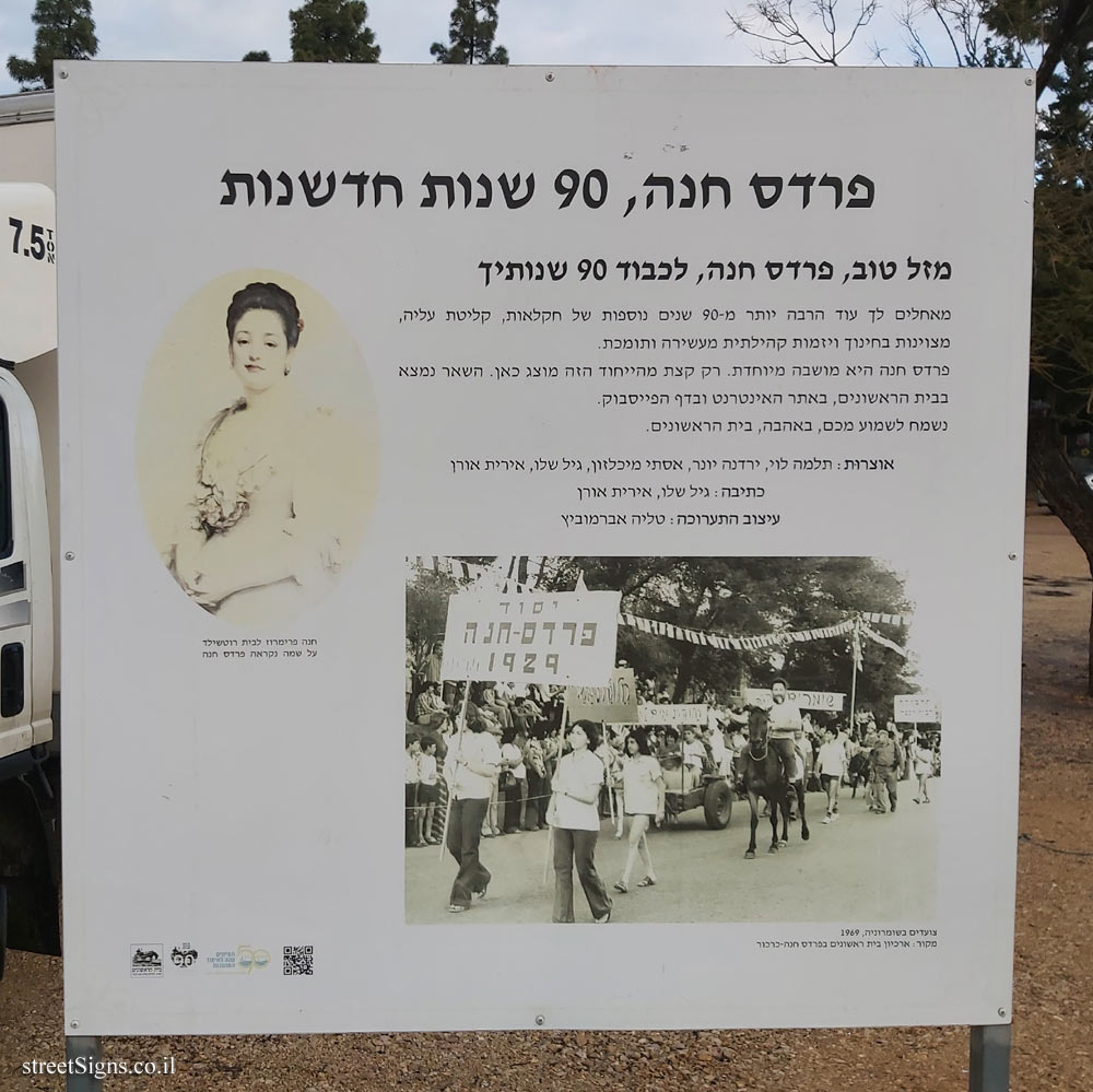
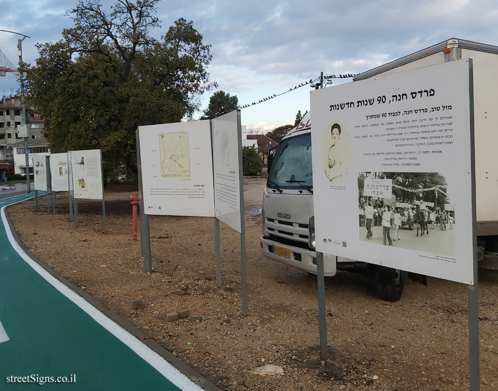
Part of the row of signs that were placed on the occasion of the 90th anniversary of Pardes Hanna
The row of signs was photographed that day 
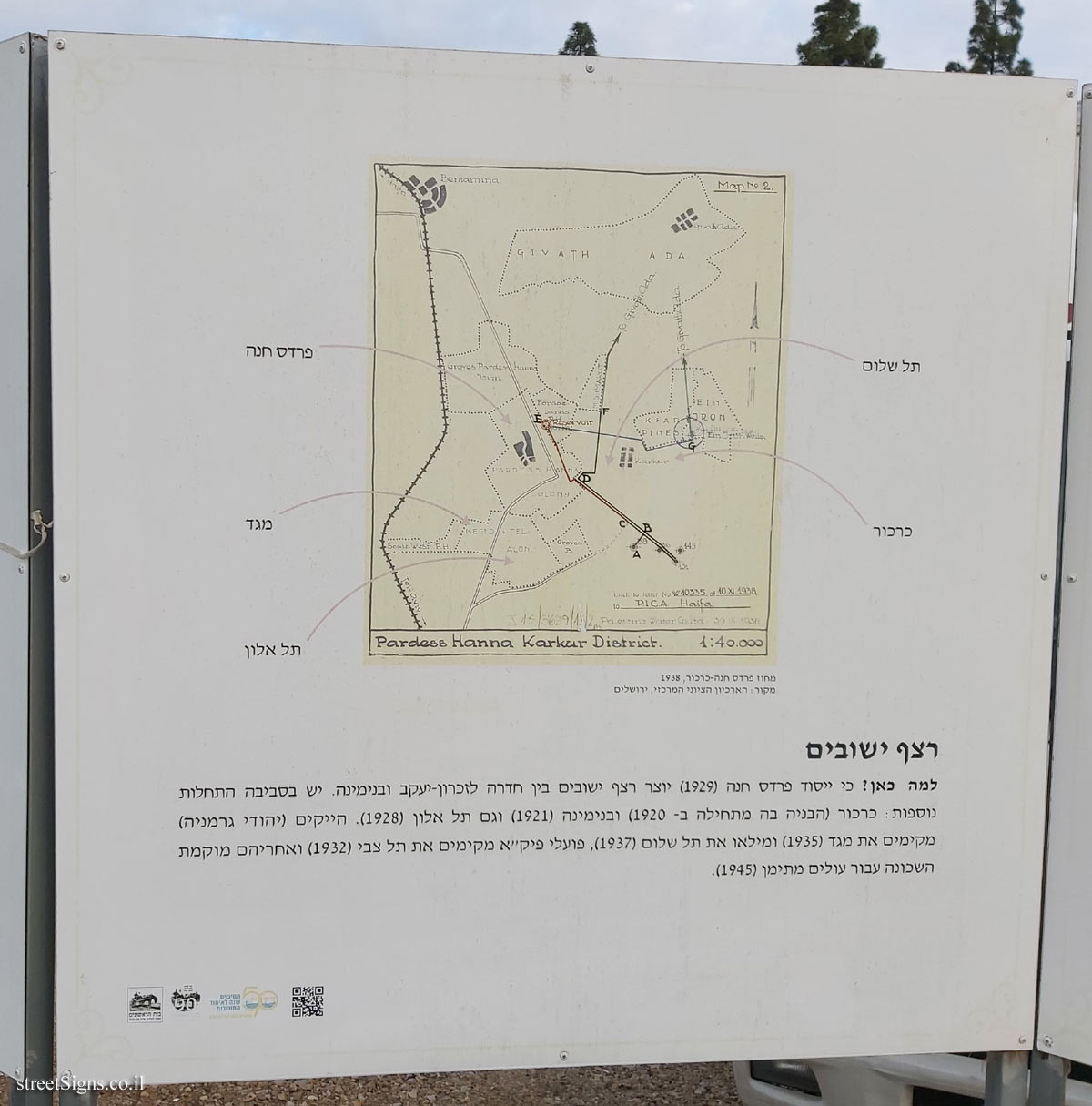
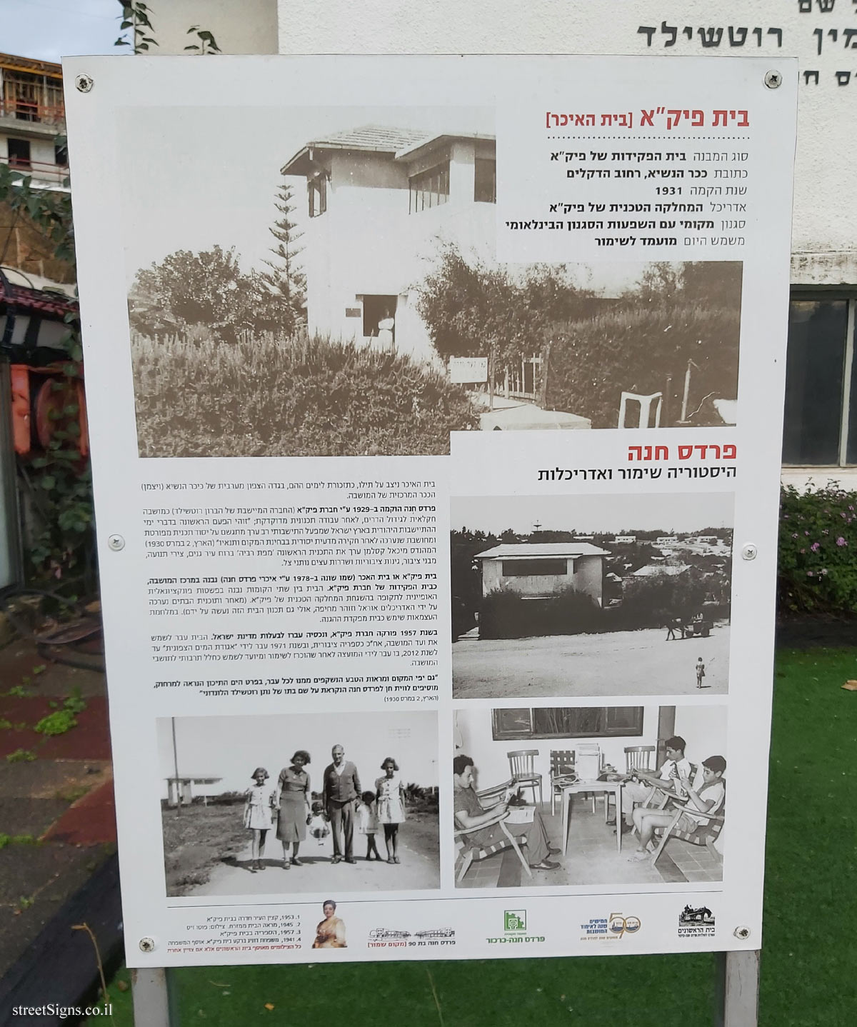
Click for a larger image

Translation of the text on the sign:
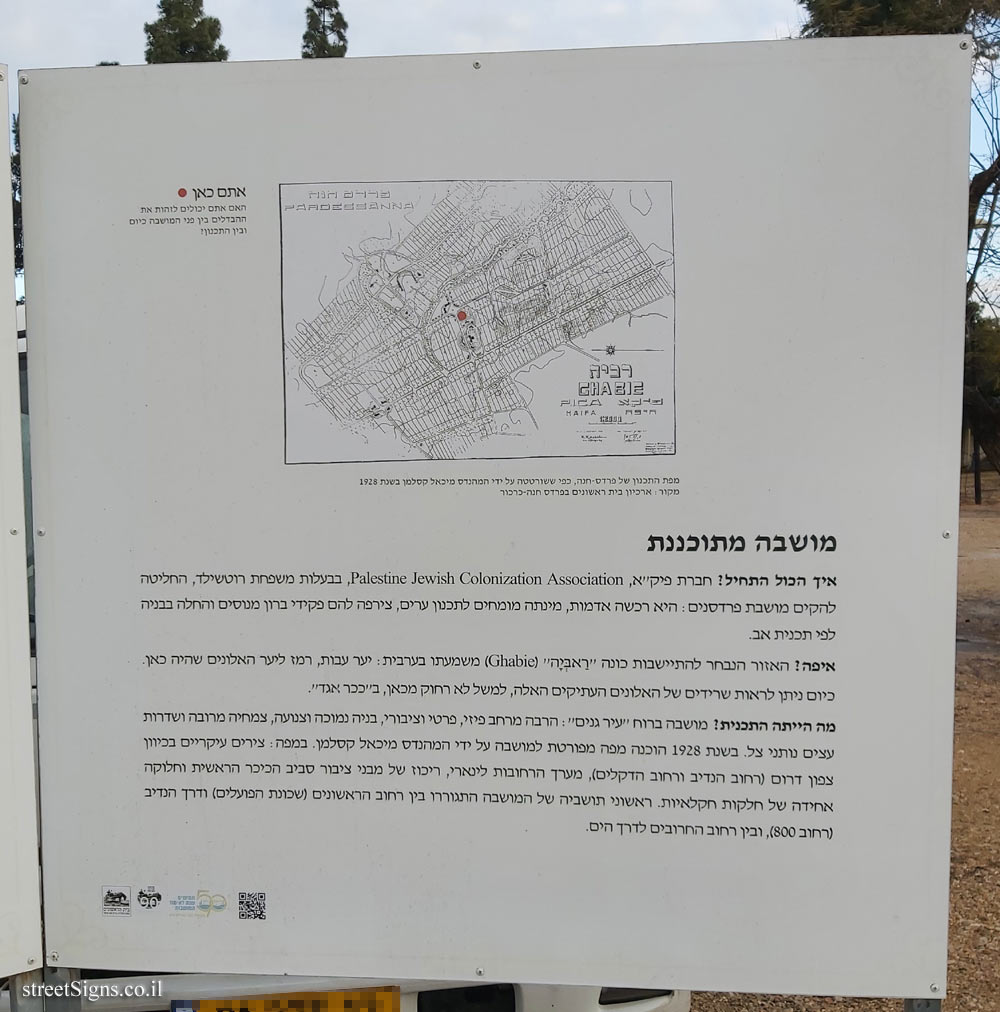
[Pardes Hanna planning map]
The planning map of Pardes Hanna, as drawn by the engineer Michael Kesselman in 1928
Source: Beit Rishonim Archive in Pardes Hanna-Karkur

You are here
Can you identify the differences between the face of the colony today and the planning :?

A planned colony
How did it all start? Pika, the Palestine Jewish Colonization Association, owned by the Rothschild family, decided to establish an orchard colony: it purchased land, appointed urban planning experts, added experienced Baron officials, and began construction according to a master plan.
Where? The area chosen for settlement was called "Ghabie" meaning in Arabic: thick forest, a hint of the oak forest that was here. Remains of these ancient oaks can now be seen, for example not far from here, in Egged Square.
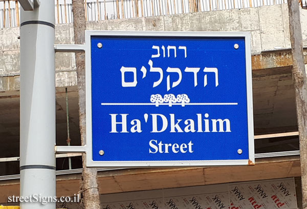
What was the plan? Colony in the spirit of "Garden City": lots of physical, private and public space, low and modest construction, lots of vegetation and shady trees. In 1928 a detailed map of the colony was prepared by the engineer Michael Kesselman. The map shows the main axes in a north-south direction (Hanadiv Street and Dekelim Street), a linear street layout, a concentration of public buildings around the main square and a uniform division of agricultural plots. The first residents of the colony lived between Harishonim Street (Hapoalim neighborhood) and Derech Hanadiv (800th Street), and between Haruvim Street and Derech Hayam.

QR code referring to The First Founders - The Pardes Hanna-Karkur History Center, Logo of the 50th Anniversary of the Pardes Hanna and Karkur Colonial Union, Logo of the 90th Anniversary of Pardes Hannah, symbol of the Founders House - The Pardes Hanna-Karkur History Center


The ultimate street signs, historical sites and house numbers

Initiating the site - Eli Zvuluny - Programming and building the site Possible Worlds Ltd. Possible Worlds Ltd. © 2019-2024

© ALL RIGHTS RESERVED - The site and its content are copyright protected. The full copyrights of the site's content belong to Eli Zvuluny. All images in the site (unless another photographer is mentioned) were taken by Eli Zvuluny that has the full copyrights on them. The use of any images or other materials included herein, in whole or part, for any purpose is expressly prohibited without the written permission of Eli Zvuluny. .