On the sign:
סמל קרן קימת לישראל
סמל מועצה אזורית עמק יזרעאל
סמל רשות ניקוז קישון
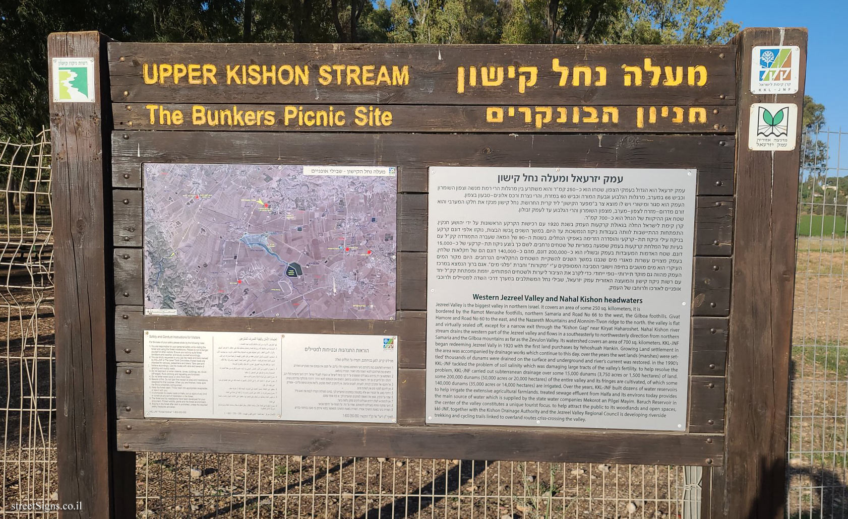
מעלה נחל קישון
חניון הבונקרים
עמק יזרעאל ומעלה נחל קישון
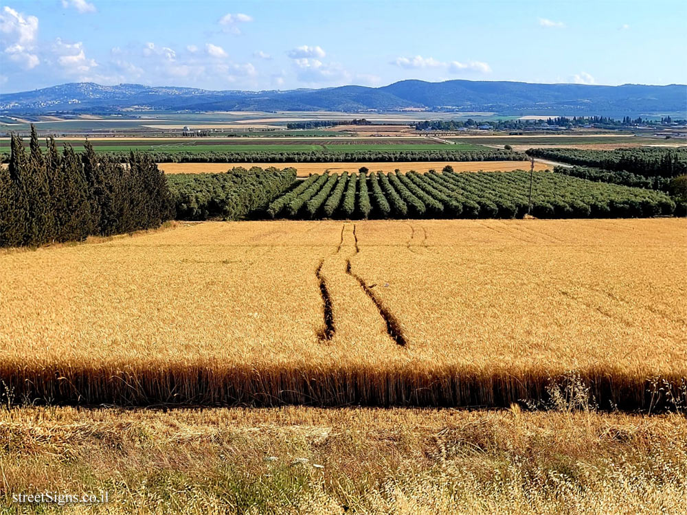
עמק יזרעאל הוא הגדול בעמקי הצפון. שטחו הוא כ-250 קמ"ר והוא משתרע בין מרגלות הרי רמת מנשה וצפון השומרון וכביש 66 במערב, מרגלות הגלבוע וגבעת המורה וכביש 60 במזרח, והרי נצרת ורכס אלונים - טבעון בצפון.
העמק הוא סגור ומישורי ויש לו מוצא צר ב"מפער הקישו" ליד קרית החרושת. נחל קישון מנקז את חלקו המערבי והוא זורם מדרום-מזרח לצפון-מערב, מצפון השומרון והרי הגלבוע עד לעמק זבולון.
שטח אגן ההיקוות של הנחל הוא כ-700 קמ"ר.
קרן קימת לישראל החלה בגאולת קרקעות העמק בשנת 1920 עם רכישות הקרקע הראשונות על ידי יהושע חנקין. התפתחות ההתיישבות לוותה בעבודות ניקוז הנמשכות עד היום. במשך השנים, יובשו הנצות, נוקזו אלפי דונם קרקע בניקוז עילי וניקוז תת-קרקעי והוסדרה הזרימה באפיקי הנחלים. בשנות ה-90 של המאה שעברה התמודדה קק"ל עם בעיות של המלחת קרקעות בעמק שפגעה בפוריות של שטחים נרחבים. לשם כך בוצע ניקוז תת-קרקעי של כ-15,000 דונם. שטח האדמות המעובדות בעמק ובשוליו הוא כ-200,000 דונם, מהם כ-140,000 דונם הם של חקלאות שלחין.
בעמק מצויים עשרות מאגרי מים שנבנו במשך השנים להשקיית השטחים החקלאיים הנרחבים. היום מקור המים העיקרי הוא מים מושבים בחיפה וישובי הסביבה המסופקים ע"י "מקורות" וחברת "פלגי מים". אגם ברוך הנמצא במרכז העמק מהווה גם מוקד תיירותי-נופי ייחודי. כדי לקרב את הציבור ליערות ולשטחים הפתוחים, יוזמת ומפתחת קק"ל יחד עם רשות ניקוז קישון והמועצה האזורית עמק יזרעאל, שבילי נחל המשתלבים במערך דרכי השדה למטיילים ולרוכבי אופניים לאורכו ולרוחבו של העמק.
[צילום אווירי - מפה - מעלה נחל הקישוון - שבילי אופניים]
[הוראות התנהגות ובטיחות למטיילים]
Symbol of the Jewish National Fund
Emblem of the Jezreel Valley Regional Council
Emblem of the Kishon Drainage Authority
Western Jezreel Valley and Nahal Kishon headwaters
Jezreel Valley is the biggest valley in northern Israel. It covers an area of some 250 sq. killometers, It is bordered by the Ramot Menashe foothills, northern Samaria and Road No 66 to the west, the Gilboa foothills, Givat Hamore and Road No 60 to the east, and the Nazareth Mountalns and Alonnim-Tivon ridge to the north. the valley is flat and virtually sealed off, except for a narrow exit through the "Kishon Gap" near Kiryat Haharoshet.
Nahal Kishon river stream drains the western part of the Jezreel valley and flows in a southeasterly to northwesterly direction from northern Samaria and the Gilboa mountains as far as the Zevulon Valley. Its watershed covers an area of 700 sq. kilometers. KKL-JNF began redeeming Jezreel Vally in 1920 with the first land purchases by Yehoshuah Hankin. Growing Land settlement in the area was accompanied by drainage works which continue to this day, over the years the wet lands (marshes) were settled thousands of dunams were drained on the surface and underground and river’s current was restored. In the 1990’s KKL-JNF tackled the problem of soil salinity which was damaging large tracts of the valley’s fertility. To help resolve the problem, KKL-JNF carried out subterranean drainage over some 15,000 dunams (3,750 acres or 1,500 hectares) of land. Some 200,0000 dunams (50,000 acres or 20,000 hectares) of the entire valley and its fringes are cultivated, of which some 140,000 dunams (35,000 acres or 14,000 hectares) are irrigated. Over the years, KKL-JNF built dozens of water reservoirs to help irrigate the extensive agricultural farmlands, treated sewage effluent from Haifa and its environs today provides the main source of water which is supplied by the state water companies Mekorot and Pilgei Mayim.
Baruch Reservoir in the center of the valley constitutes a unique tourist focus, to help attract the public to its woodlands and open spaces. KKL-JNF, together with the Kishon Drainage Authority and the Jezreel Valley Regional Council is developing riverside. trekking and cycling trails linked to overland routes criss-crossing the valley.
[Aerial photo - Map - Nahal Kishon headwaters - Bicycle paths]
[Conduct and safety instructions for travelers]


 Click for all signs belonging to JNF - Gardens and Parks
 15.72 Km |
  59.19 Km |
  83.3 Km |
  83.31 Km |
  94.02 Km


 Click for the map of all signs belonging to JNF - Gardens and Parks
  Click for the route that starts with this sign and goes through the signs belonging to JNF - Gardens and Parks
 The closest sign from this series (9.67 Km): Kiryat Tivon - Crescents on the Templar Road