The ultimate street signs, historical sites and house numbers


 Click for a larger image
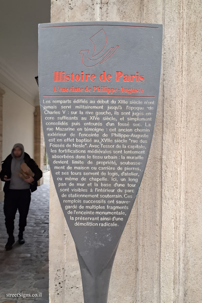
 ") Click for all signs belonging to The History of Paris (Starck's Lollipops)
Click for all signs belonging to The History of Paris (Starck's Lollipops)
 177 Meter |
  203 Meter |
  240 Meter |
  247 Meter |
  260 Meter


") Click for the map of all signs belonging to The History of Paris (Starck's Lollipops)
Click for the map of all signs belonging to The History of Paris (Starck's Lollipops) ") Click for the route that starts with this sign and goes through the signs belonging to The History of Paris (Starck's Lollipops)
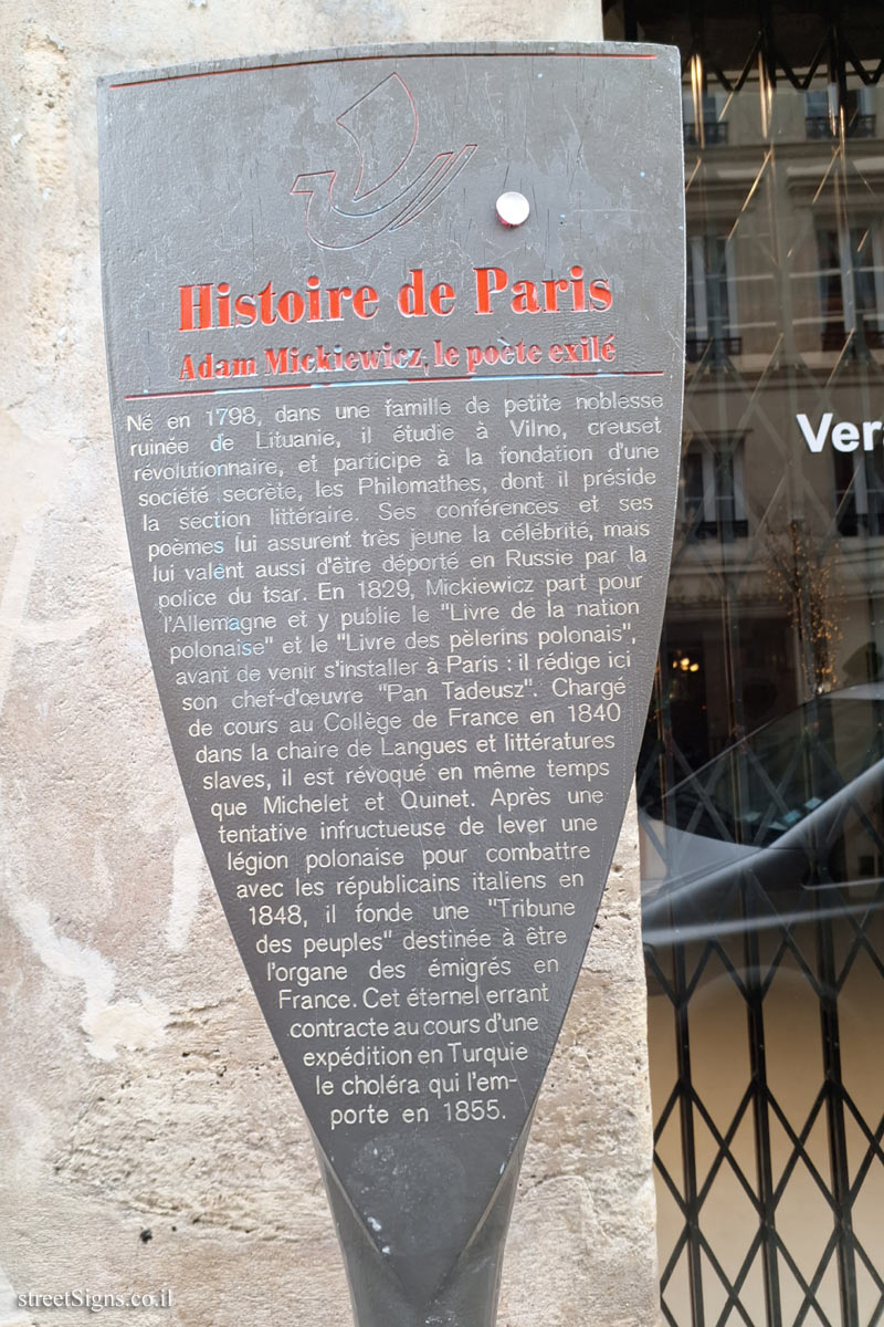
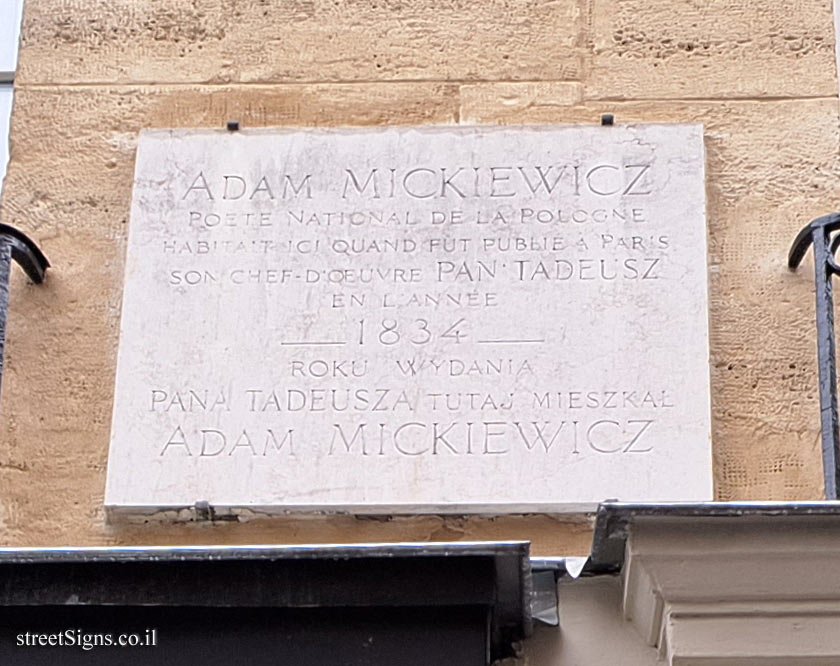
Click for the route that starts with this sign and goes through the signs belonging to The History of Paris (Starck's Lollipops)") The closest sign from this series (97 Meter): Paris - History of Paris - Adam Mickiewicz, the exiled poet
The closest sign from this series (97 Meter): Paris - History of Paris - Adam Mickiewicz, the exiled poet