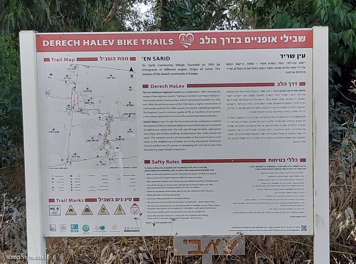
On the sign:
שבילי אופניים בדרך הלב
DERECH NALEV BIKE TRAILS
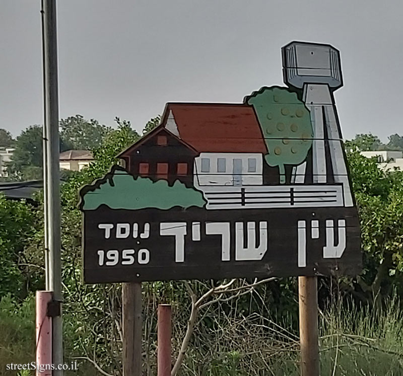
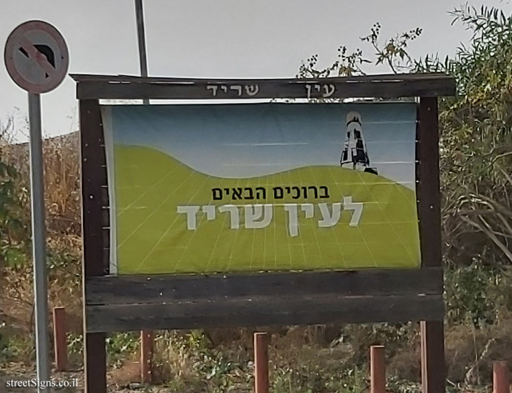
עין שריד
יישוב קהילתי. נוסד בשנת תש"י - 1950. היישוב הוקם על-ידי יוצאי גלויות שונות. מקור השם: המתיישבים העולים, שריד מיהדות אירופה.
דרך הלב
מועצה אזורית לב השרון הוקמה בשנת 1984, בעקבות איחודן של שתי מועצות אזוריות: "השרון הצפוני" ו"הדר השרון". במועצה שמונה עשר יישובים. יישובי המועצה הראשונים הוקמו בשנות ה-30 וה-40, גל ההתיישבות של שנות ה-50 הביא לעיבוי המושבים ומאמצע שנות ה-90 ואילך החלה ההרחבה ביישובים. המועצה האזורית משלבת איכות חיים גבוהה, מערכת חינוך מצוינת, חיי קהילה, תרבות וספורט עשירים ומודעות גבוהה לאיכות הסביבה.
"דרך הלב" הינה חלק מתכנית לפיתוח סביבתי, חברתי וכלכלי במועצה האזורית לב השרון, הכוללת רשת שבילי הליכה ורכיבה על אופניים. השבילים עוברים דרך שטחים חקלאיים, שטחים פתוחים ואתרים ייחודיים (מבנים היסטוריים, אתרים ארכיאולוגיים, נחלים, יערות ועוד). רשת השבילים מחברת בין כל ישובי המועצה, בין יישובי המועצה לרשויות השכנות ובין יישובי המועצה למוסדות החינוך. תושבי המועצה הינם שותפים מלאים בפיתוח הדרך ואתריה, החל משלב התכנון ועד שלב הביצוע.
כללי בטיחות
על מנת לאפשר רכיבה נוחה ומהנה, המתחשבת בכל משתמשי השביל אנא הקפידו על הכללים האלה והישמעו להנחיות השילוט בשביל:
• התאימו רכיבתכם לתנאי השטח וההתח מנפילה והחלקה
• בחרו במסלול באורך וקושי המתאימים ליכולתכם
• יש להצטייד בלבוש מתאים, קסדה ומי שתייה בכמות מספקת
• חלקים מהשביל עוברים בדרכים משותפות לרכב חקלאי.
• יש לרכוב במשנה זהירות ולתת זכות קדימה לרכב מנועי ולהולכי רגל
• יש להתחשב במשתמשים נוספים בשביל הבאים משני הצדדים.
• הרכיבה בשעות החשיכה מסוכנת ביותר
• הצטיידו בציוד הבטיחות המתאים לרכיבה ולהליכה.
• השביל עובר באזורים בעלי ערכי טבע נוף ומורשת מיוחדים - נא לשמור עליהם.
• בצידי המסלול שטחים חקלאיים פרטיים ואין להיכנס אליהם. כבדו את פרטיות השכנים ורכושם - אין לקטוף מהתוצרת החקלאית.
• אין לפגוע בחי בצומח ובדומם ואין להבעיר אש.
• הושקעו מאמצים רבים בהסדרתו וסימונו של השביל, אנא שמרו עליו ודווחו על מפגעים לאורכו.
רכיבה בטוחה ומהנה!
במקרה חירום או לדיווח מפקעים מוקד 24/7 09-7960200 או באמצעות האפליקציה
’EN SARID
’En Sarid Community Village, Founded on 1950 by immigrants of different origins. Origin of name: The remains of the Jewish community in Europe.
Derech HaLev
The Lev HaSharon Regional Council was established in 1984, following the merger of two regional councils: "HaSharon HaTzfoni" and "Hadar HaSharon"
The council includes 18 communities, of which the first were founded in the 1930s and 1940s; the settlement wave of the 1950s led to a higher concentration of communities, and from the 1990s onward, they started undergoing expansion. The Regional Council combines quality of life, an excellent school system, a rich culture, sports and community life, and environmental protection.
Derech HaLev is part of a plan for the environmental, social and economical development of the Lev HaSharon Regional Council which represents a network of walking and cycling trails. The trails pass through farmland, open spaces and unique sites (historic buildings, archaeological sites, creeks, forests and more). This network connects all communities in the Council’s area to each other, to the neighboring authorities and to the educational institutions. Council residents are full partners in developing the trail and its sites, from the planning stage though its execution.
Safty Rules
To make cycling safe, enjoyable and considerate of all users of the treil, please observe the following rules, as well as those sign-posted along the trail:
• Make sure the trail conditions suit your riding skills and beware of falling and slipping.
• Select a course which length and level of difficulty match your ability.
• Wear appropriate clothing and a helmet, and carry sufficient quantities of drinking water.
• Parts of the trail pass on shared routes with agricultural vehicles. Riders must take precautions and yield to motorized vehicles as well as to walkers.
• Please be considerate towards other users of the trall, coming from both directions.
• Riding after dark is extremely dangerous
• Use proper safety equipment for cycling and walking.
• The trail crosses zones of protected flora, fauna and landscape please protect them.
• The trail passes by agricultural and private land which is forbidden to enter. Please respect the privacy and property of the neighbors. It is forbidden to pick agricultural produce.
• Do not harm wildlife, plants and inanimate nature, and do not light fires.
• Great effort has been invested in creating the trail, regulating and marking. Please protect it and report any hazards or damages along the way.
Have a and enjoyable ride!
In case of emergency or for reports on hazards, please call 097960700, 24/7 or use the application.
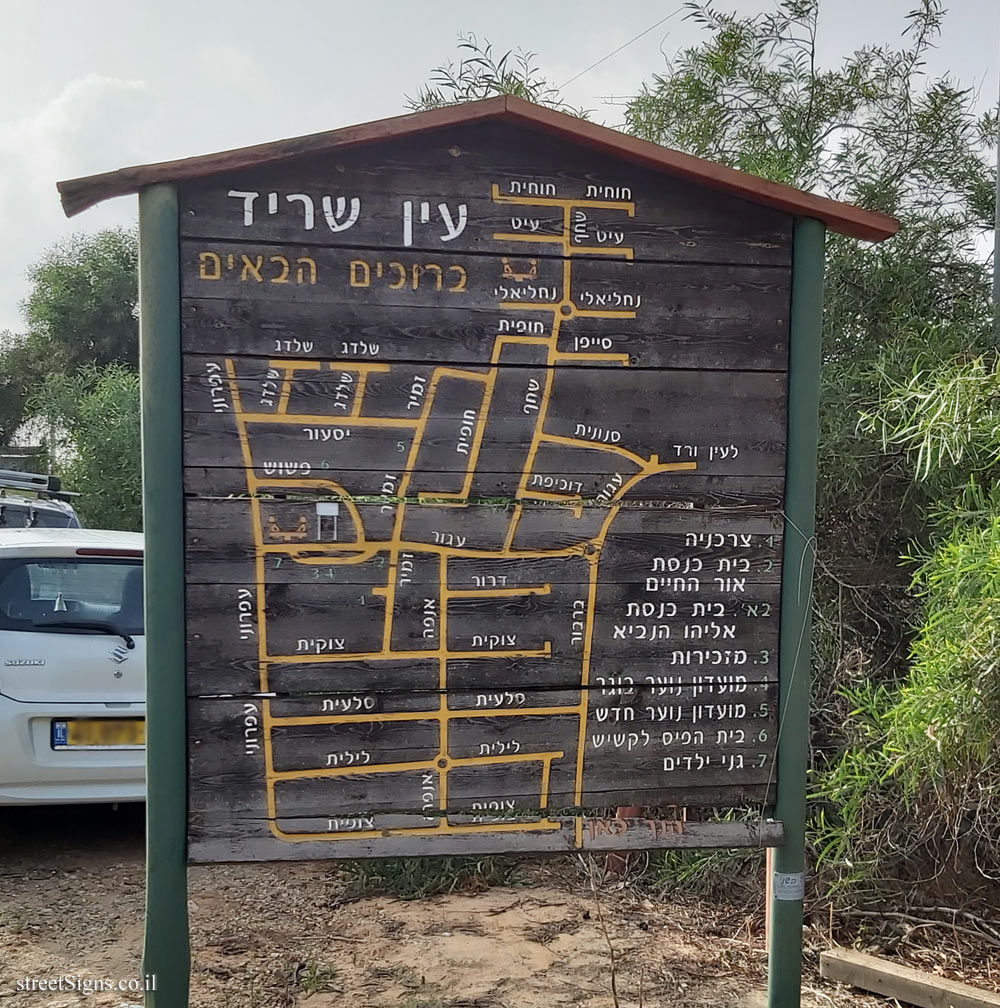
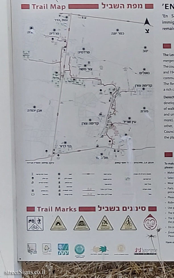
מפת השביל
Trail Map
סימונים בשביל
Trail Marks


 Click for sign's details, and the directional signs
  Click for sign's details