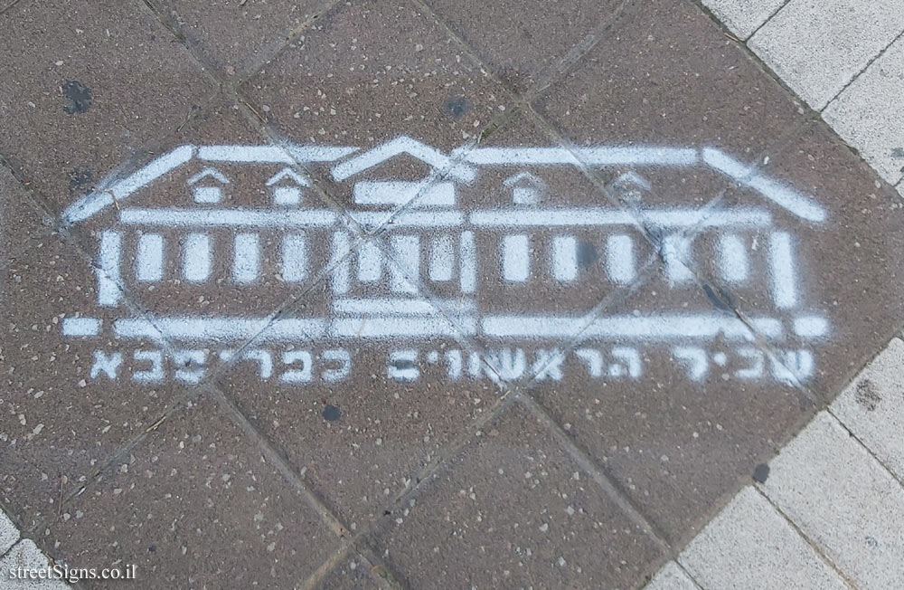
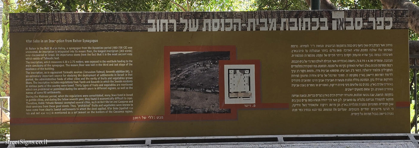
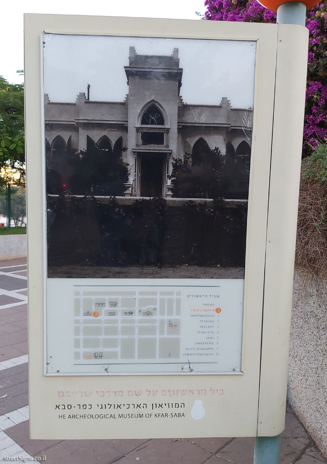
On the sign:
שביל הראשונים ע"ש מרדכי שרייבמן
[תמונה: בית שרה]
[מפת השביל]
המוזיאון הארכיאולוגי כפר סבא
THE ARCHEOLOGICAL MUSEUM OF KFAR-SABA
[הצד השני של השלט]
ה’ארמון’ בית שרה
The Palace Beit Sarah
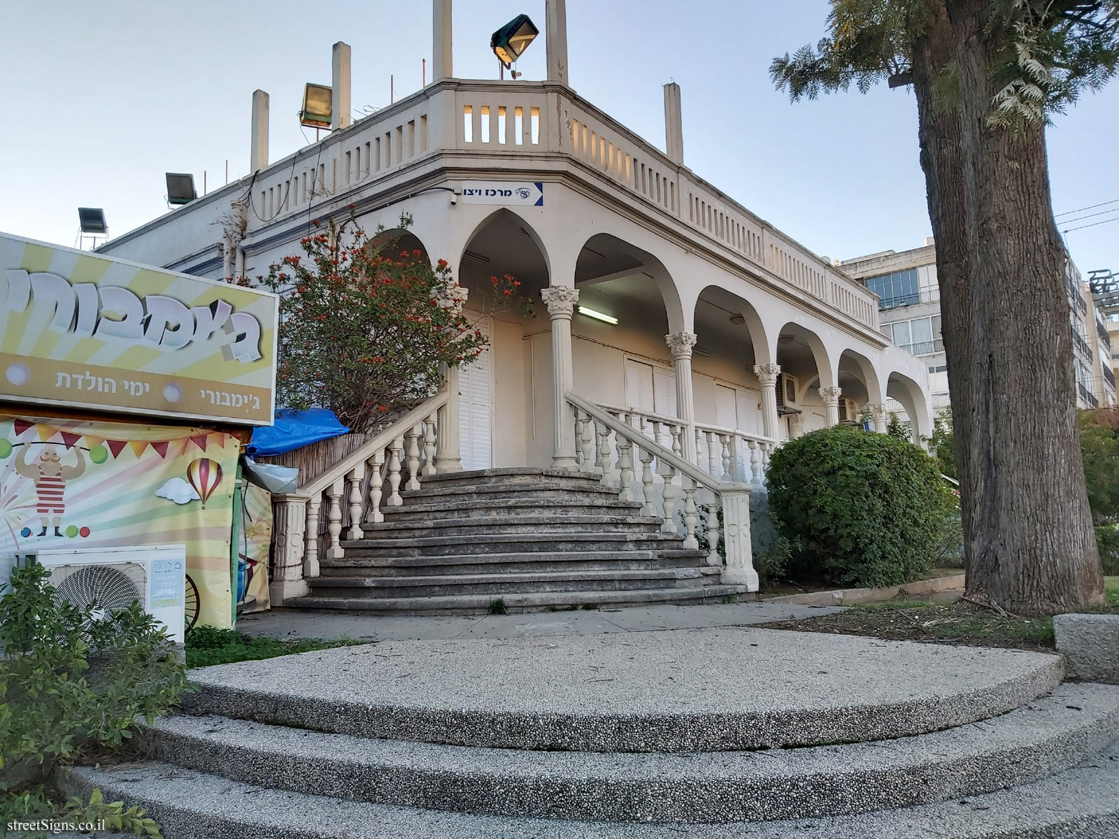
ביישובים רבים בארץ ישנו מבנה הזוכה לכינוי "ארמון", זהו בית מתיישבים ראשון, מבנה פרדס שהוזנח, וילה מפוראת או בניין ציבורי. גם בכפר-סבא יש ארמון - ביתם של בן-ציון ושרה אהרונוביץ (אהרוני), מן הפרדסנים הגדולים הראשונים במושבה כפר-סבא.
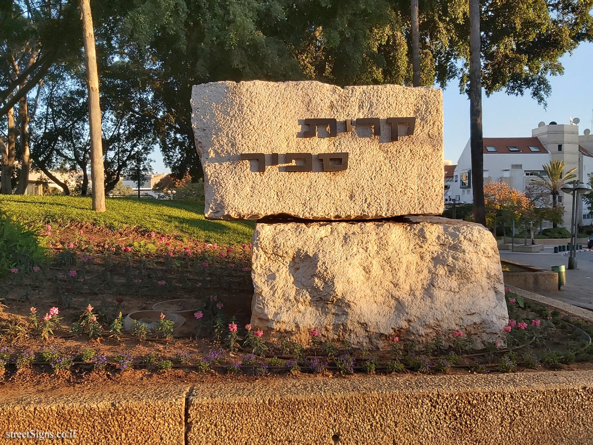
בשנת 1927, עת נבנה הבית, הקיפו אותו פרדסים מכל עבר. היום שוכן הבית ברחוב ויצמן, לצד מרכז אהרוני ובסמוך לקריית ספיר, אשר הכיכר במרכזה מנציחה את בן-ציון אהרוני. בסמיכות מקום שכן בית החרושת למיץ הדרים "מיצארון’ שהוקם בתקופת מלחמת העולם השנייה כדי לנצל את הפרי שלא ניתן היה לייצא בשל המלחמה. המפעל נחשב לסנונית ראשונה בתהליך הפיכתה של המושבה לעיר תעשייה.
בית שרה, הקרוי על שם אם המשפחה, בלט בסגנונו המזרחי, שהיה שונה מאוד משאר בתי המושבה. בשנותיו הראשונות הוקף הבית בגינה רחבת ידיים, עשירה בצומח מקומי ומיובא; שדרת דקלי וושינגטוניה הובילה לבית, ובחצרו נבנתה בריכת השקייה ששימשה גם כבריכת שחייה. שנתיים אחרי בנייתו פרצו מאורעות תרפ"ט והבית הפך לעמדה קדמית. בגלל גודלו וייחודו ערמו סביבו ובפתחו שקי חול כדי להגן עליו מהתקפות הפורעים. ואת מי שלחו הבריטים להגן על הבית? שני שוטרים ערבים, שהתבצרו מאחורי השקים וחיכו לפורעים. למזלם של תושבי המושבה, פסחו עליה הפורעים, אבל השקים נותרו במקומם שנים אחדות.
במאורעות 1936 שימש הבית מטה על ה’הגנה’, לאחר רצח ארבעה פועלים ב’משק האוצר’ (21.8.1936) הוחלט בבית אהרוני להגיב, לצאת מרמת הכובש ולתקוף את טול כרם. לימים סיפר יוסף אלמוגי, שהמטה הכללי של ה’הגנה’ בתל-אביב לא אישר את התכנית, מחשש לתגובה שתפגע קשות ביישוב היהודי בכפר-סבא ומצפון לה.
Many settlements In Israel have a bullding that has been named "the palace". This is the home of the first settlers, a building in a neglected orchard, a luxurlous villa or a public bullding. Kfar Saba also has a palace - the home of Ben Zion and Sarah Aharonovítz (Aharoni), who were among the first of the big citrus growers in the settlement of Kfar Saba. When the house was built in 1927 it was totally surrounded by citrus groves. Today the house is located on Weizmann Street next to the Aharoni Center and near the Sapir Center, whose central plaza commemorates Ben Zion Aharoni. Close by is the spot where the "Mitzaron" factory manufactured citrus juices. The factory was established during World War II to take advantage of the fruit that couldn’t be exported because of the war. It is considered to be the forerunner of the industrial city that Kfar Saba became.
Beit Sarah, named for the mother of the family, is outstanding for its Eastern architectural stylė, which was very different from the other houses in the settlement. In its first years, the house was surrounded by a broad garden, rich in local and Imported plants; an avenue of Washingtonia palms led to the house Itself, with a "rain irrigation" pool that was used as a swimming pool in the yard. Two years after it was built, the riots of 1929 occurred and the house became the frontline of fire. Because of its size and its unique construction, sand bags were piled at its front and sides to protect it from the attacks of rioters. And who did the British send to defend the house? Two Arab policemen who hid behind the sand bag forticiation and waited for the rioters. The residents of the settlement were lucky and the rioters passed them by, but the sand bags remained in place for many years afterward.
During the 1936 riots the house was used as a Haganah headquarters. After the murder of four laborers at the "Otzer Farm" (21 August 1936), Beit Aharoni decided to respond, to leave Ramat Hakovesh and to attack Tul Karm. For a long time afterward, Yosef Almogi later related that the Haganah General Headquarters in Tel Aviv did not approve of the plan and were concerned about retaliation that would damage the Jewish settlement of Kfar Saba and to the north of it.
סמל העיר כפר סבא
סמל מוזיאון כפר סבא
שביל הראשונים על שם מרדכי שרייבמן
המוזיאון הארכיאולוגי כפר-סבא
ירושלים 35 כפר-סבא
טלפון 09.7640867
THE ARCHAEOLOGICAL MUSEUM OF KFAR-SABA
www.kfar-saba-museum.org


 Click for a larger image
  Click for sign's details


 Click for all signs belonging to The Founders’ Path - Kfar Saba
 Click for the map of all signs belonging to The Founders’ Path - Kfar Saba
  Click for the route that starts with this sign and goes through the signs belonging to The Founders’ Path - Kfar Saba
 Click for more details on The Founders’ Path - Kfar Saba
 The closest sign from this series (16 Meter): Kfar Saba - The Founders’ Path
 150 Meter
 316 Meter
 375 Meter
 377 Meter
 636 Meter