You must turn on the browser location services to get the route from your current location to the sign, and the distance (as the crow flies) from your current location to the sign.
After activating location services, refresh the page.
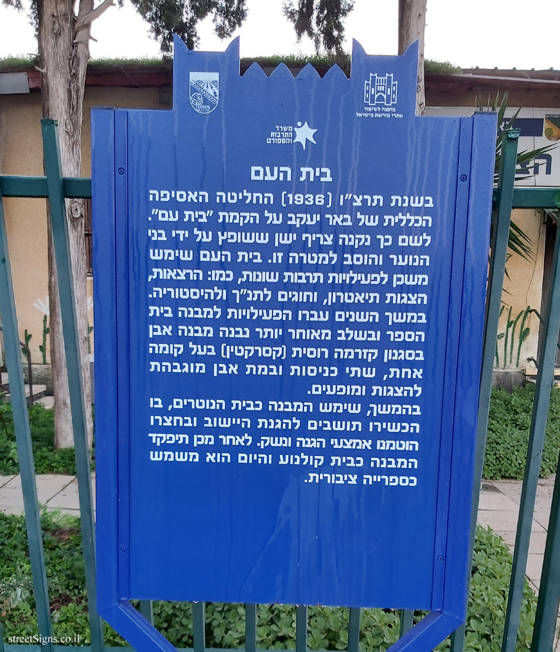
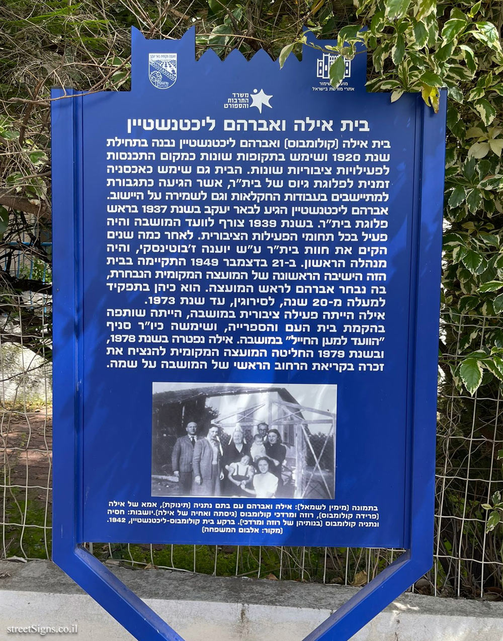
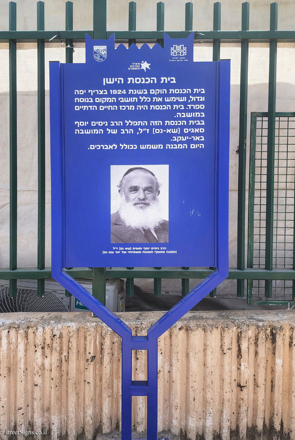
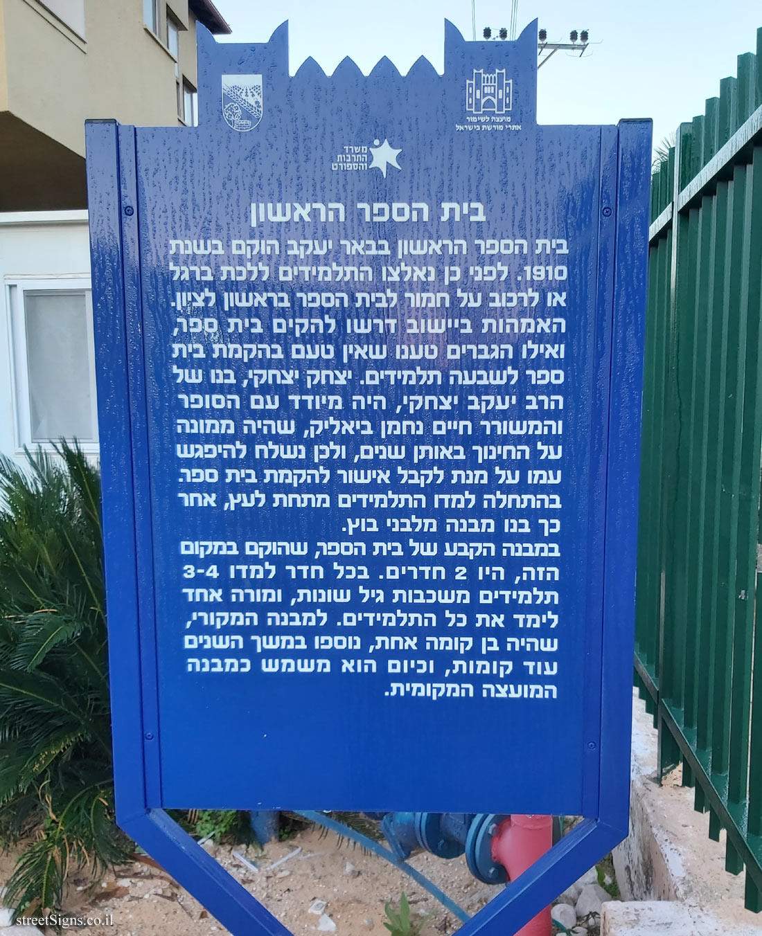
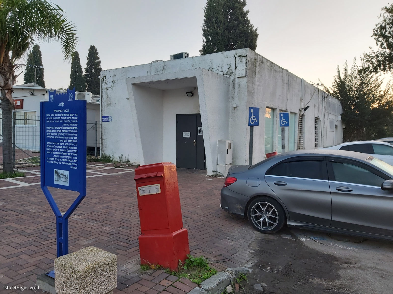
On the sign:
סמל המועצה לשימור אתרי מורשת בישראל סמל המועצה המקומית באר יעקב סמל משרד התרבות והספורט
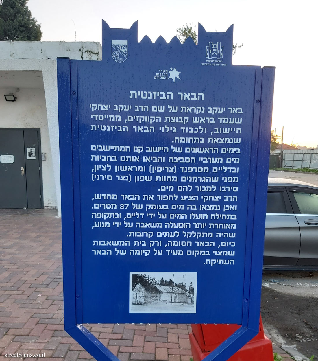
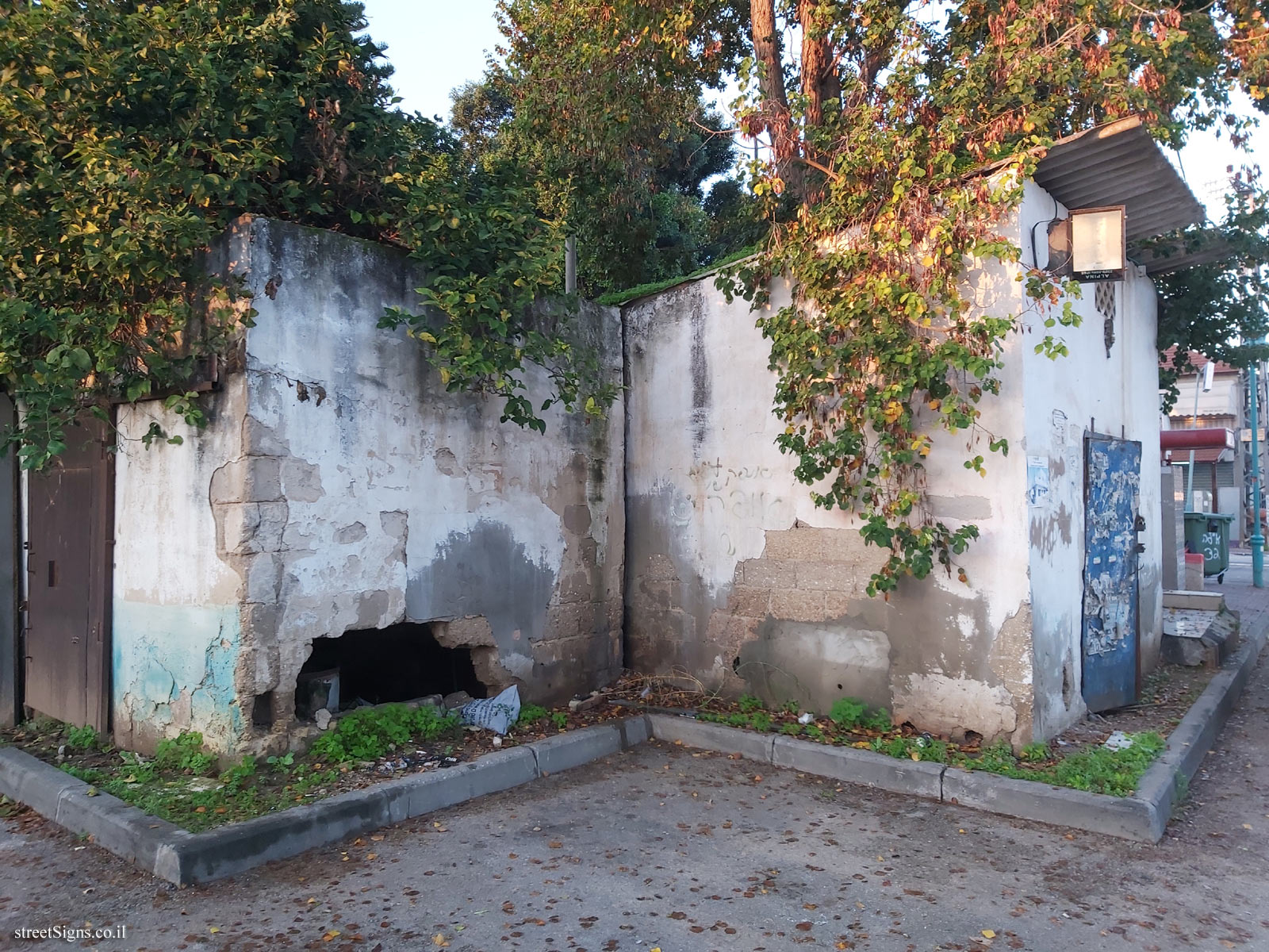
הבאר הביזנטית באר יעקב נקראת על שם הרב יעקב יצחקי שעמד בראש קבוצת הקווקזים, ממייסדי היישוב, ולכבוד גילוי הבאר הביזנטית שנמצאת בתחומה. בימים הראשונים של היישוב קנו המתיישבים מים מערביי הסביבה והביאו אותם בחביות ובדליים מסרפנד (צריפין) ומראשון לציון, מפני שהגרמנים מחוות שפון (נצר סירני) סירבו למכור להם מים. הרב יצחקי הציע לחפור את הבאר מחדש, ואכן נמצאו בה מים בעומק של 37 מטרים. בתחילה הועלו המים על ידי דליים, ובתקופה מאוחרת יותר הופעלה משאבה על ידי מנוע, שהיה מתקלקל לעתים קרובות. כיום הבאר חסומה, ורק בית המשאבות שמצוי במקום מעיד על קיומה של הבאר העתיקה.
The sign shape is rectangular but its head is designed according to the silhouette of the old building of the Gymnasia Herzliya, which serves as a logo of the Council for the Preservation of Heritage Sites in Israel
Translation of the text on the sign: Symbol of the Council for the Preservation of Israeli Heritage Sites The emblem of Be’er Ya’akov Local Council The emblem of the Ministry of Culture and Sport
The Byzantine Well Beer Yaakov is named after Rabbi Yaakov Yitzhaki, who headed the Caucasus group, one of the founders of the settlement, and in honor of the discovery of the Byzantine well in its area. In the first days of the settlement, the settlers bought water from the western part of the area and brought it in barrels and buckets from Serfand (Tzrifin) and Rishon Lezion, because the Germans from the Shafon farm (Netzer Sirani) refused to sell them water. Rabbi Yitzhaki suggested re-digging the well, and indeed water was found in it at a depth of 37 meters. Initially the water was raised by buckets, and in a later period a pump was operated by a motor, which was often broken down. Today the well is blocked, and only the pump house on the site indicates the existence of the ancient well.


 Click for a larger image


 Click for all signs belonging to Heritage Sites in Israel
 Click for the map of all signs belonging to Heritage Sites in Israel
  Click for the route that starts with this sign and goes through the signs belonging to Heritage Sites in Israel
 Click for more details on Heritage Sites in Israel
 The closest sign from this series (37 Meter): Be’er Ya’akov - Heritage Sites in Israel - Beit Ha’am
 116 Meter
 134 Meter
 136 Meter
 199 Meter
 259 Meter