You must turn on the browser location services to get the route from your current location to the sign, and the distance (as the crow flies) from your current location to the sign.
After activating location services, refresh the page.
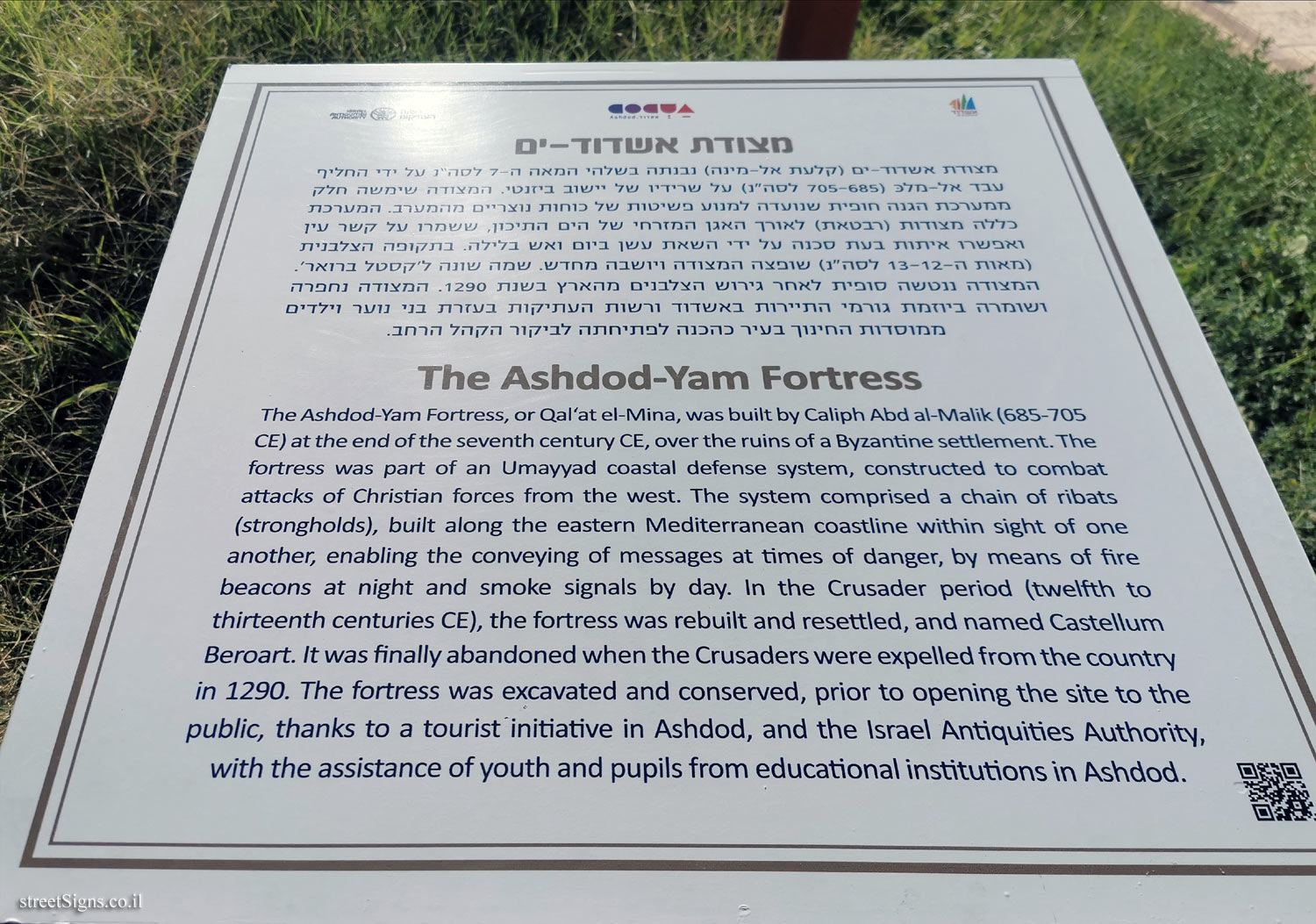
On the sign:
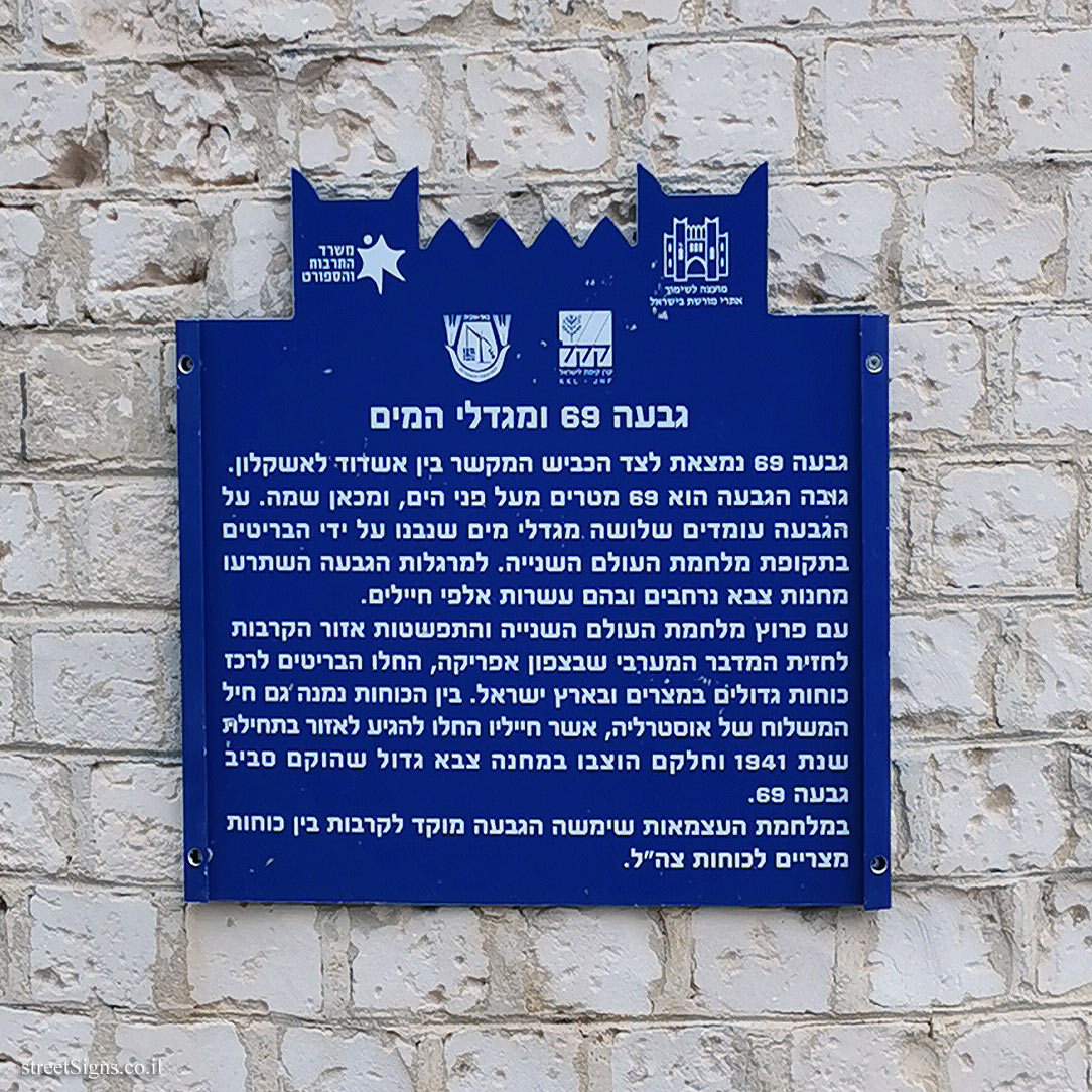
סמל המועצה לשימור אתרי מורשת בישראל סמל משרד התרבות והספורט סמל קרן קיימת לישראל סמל המועצה האזורית באר טוביה
גבעה 69 ומגדלי המים גבעה 69 נמצאת לצד הכביש המקשר בין אשדוד לאשקלון. גובה הגבעה הוא 69 מטרים מעל פני הים, ומכאן שמה. על הגבעה עומדים שלושה מגדלי מים שנבנו על ידי הבריטים בתקופת מלחמת העולם השנייה. למרגלות הגבעה השתרעו מחנות צבא נרחבים ובהם עשרות אלפי חיילים. עם פרוץ מלחמת העולם השנייה והתפשטות אזור הקרבות לחזית המדבר המערבי שבצפון אפריקה, החלו הבריטים לרכז כוחות גדולים במצרים ובארץ ישראל. בין הכוחות נמנה גם חיל המשלוח של אוסטרליה, אשר חייליו החלו להגיע לאזור בתחילת שנת 1941 וחלקם הוצבו במחנה צבא גדול שהוקם סביב גבעה 69. במלחמת העצמאות שימשה הגבעה מוקד לקרבות בין כוחות מצריים לכוחות צה"ל.
The sign shape is rectangular but its head is designed according to the silhouette of the old building of the Gymnasia Herzliya, which serves as a logo of the Council for the Preservation of Heritage Sites in Israel
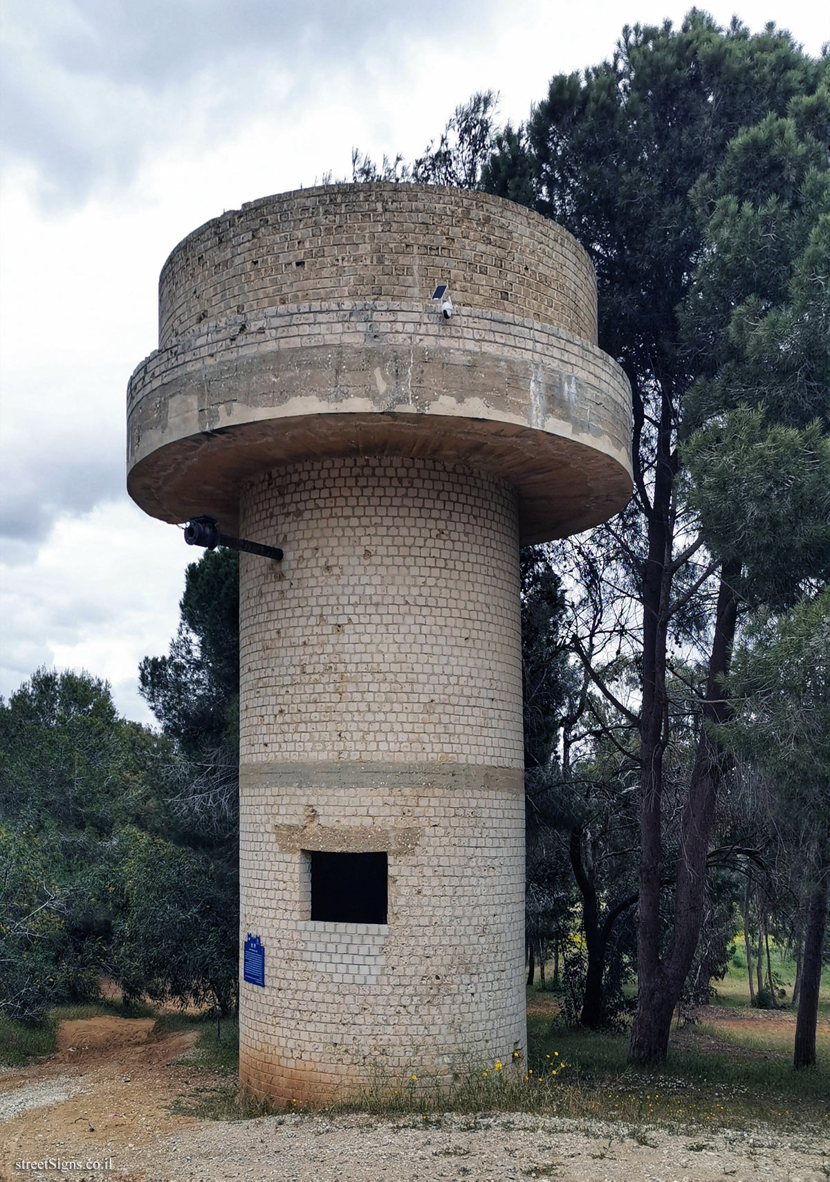
The water tower on which the sign is placed was photographed that day by the same photographer Click for a larger image
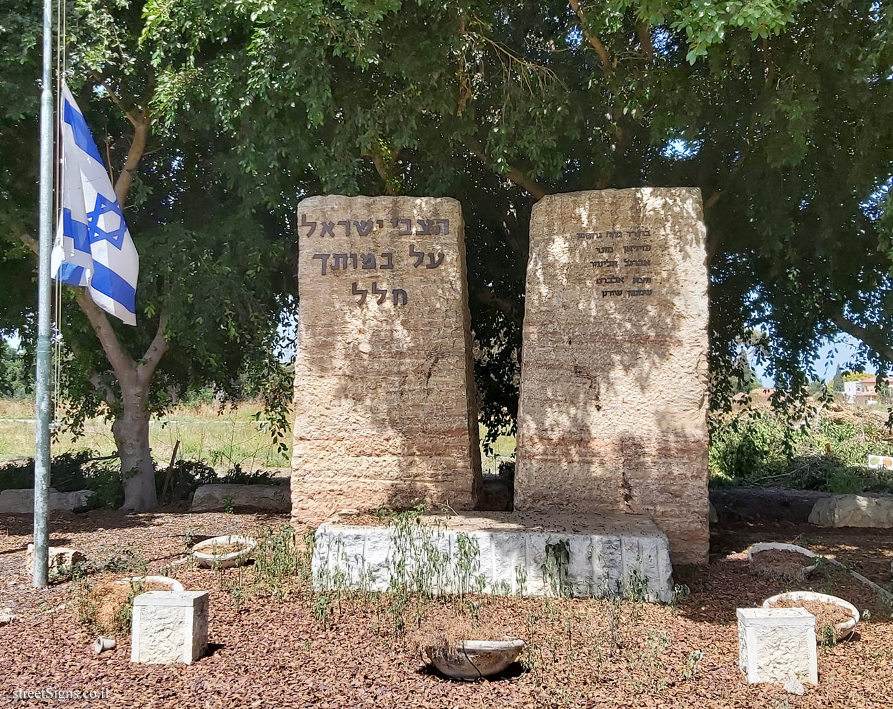
The story of the battle on the hill is also displayed in the monument placed on the site Click for sign's details
Translation of the text on the sign: Symbol of the Council for the Preservation of Israeli Heritage Sites Symbol of the Ministry of Culture and Sports Symbol of the Jewish National Fund Symbol of the Beer Tuvia Regional Council
Hill 69 and the water towers Hill 69 is located next to the road connecting Ashdod and Ashkelon. The height of the hill is 69 meters above sea level, hence its name. On the hill stand three water towers built by the British during World War II. At the foot of the hill stretched large army camps with tens of thousands of soldiers. With the outbreak of World War II and the spread of the battle zone to the western desert front in North Africa, the British began to concentrate large forces in Egypt and Israel. Among the forces was also the Australian Expeditionary Force, whose troops began arriving in the area in early 1941 and some were stationed in a large army camp set up around Hill 69. During the War of Independence, the hill served as a focal point for battles between Egyptian forces and IDF forces.


 Click for sign's details


 Click for all signs belonging to Heritage Sites in Israel
 Click for the map of all signs belonging to Heritage Sites in Israel
  Click for the route that starts with this sign and goes through the signs belonging to Heritage Sites in Israel
 Click for more details on Heritage Sites in Israel
 The closest sign from this series (7.29 Km): Be’er Tuvia - Heritage Sites in Israel - A grove in memory of Haim Yizraeli
 7.34 Km
 7.44 Km
 7.74 Km
 8.85 Km
 9.57 Km