View from the metropolitan observation deck located in the complex. The photo was taken that day by the same photographer
 Click for a larger image
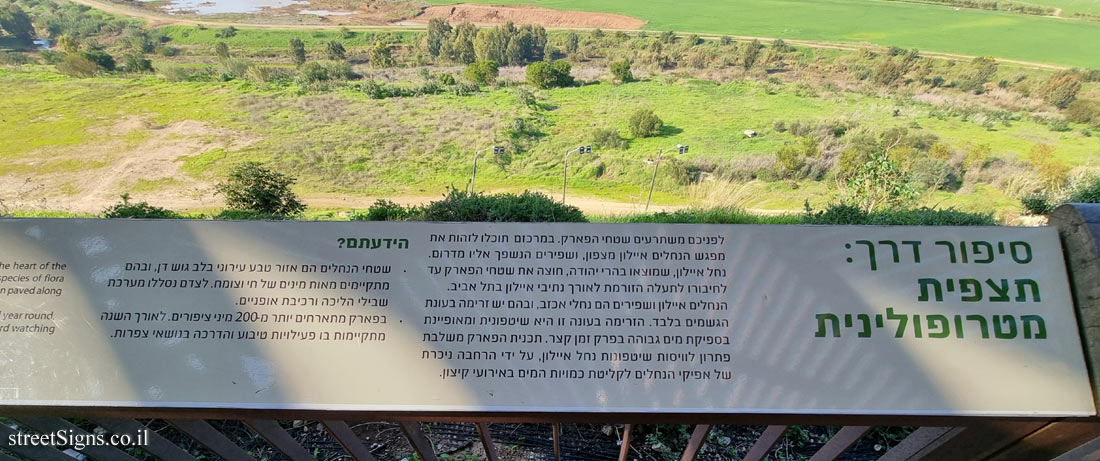
 On the observation deck is a sign depicting the view. This sign was also taken by the same photographer that day:
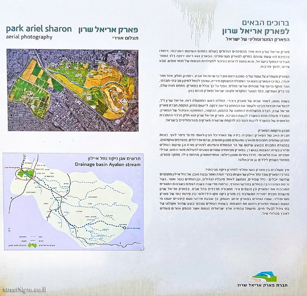
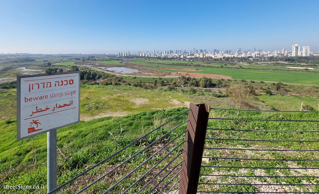
Road story: metropolitan observation In front of you are the park areas. In the center, you can identify the confluence of the Ayalon streams to the north, and Shafirim, which flows into it to the south. The Ayalon River, which originates in the Judean Mountains, crosses the park area until it is connected to a canal that flows along the Ayalon routes in Tel Aviv.
The Ayalon and Shafirim streams are seasonal streams, with flow only during the rainy season. The flow this season is flooded and is characterized by high water flow in a short period of time. The park’s plan incorporates a solution for regulating the Ayalon River floods, by significantly expanding the river channels to absorb the amounts of water in extreme events.
Did you know? • The river areas are an urban nature area in the heart of Gush Dan, where hundreds of species of flora and fauna exist, along with a system of walking and cycling paths.
• The park hosts more than 200 species of birds throughout the year, where nature and birding training activities take place.
 Click for a larger image Translation of the text on the sign
:
Welcome to Ariel Sharon Park
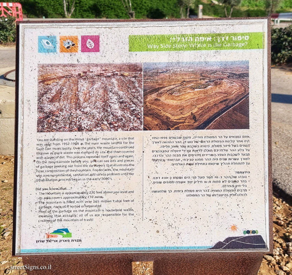
The mountain compound The mountain compound [/ b]
A mound of rubbish turned into a green lung
From the establishment of the state until 1998, the place served as the main absorption of waste from Gush Dan. For many years, the "garbage mountain of the country" was a symbol of environmental, sanitary and safety hazard, until the beginning of the restoration process during the 2000s.
The area of the mountain is about 450 dunams, it is about 70 meters above the ground and it contains about 16 million cubic meters of waste of various types!
The process of restoring the mountain and turning it into a park is considered a complex engineering-architectural project based on the principles of sustainable development, and the main ones are:
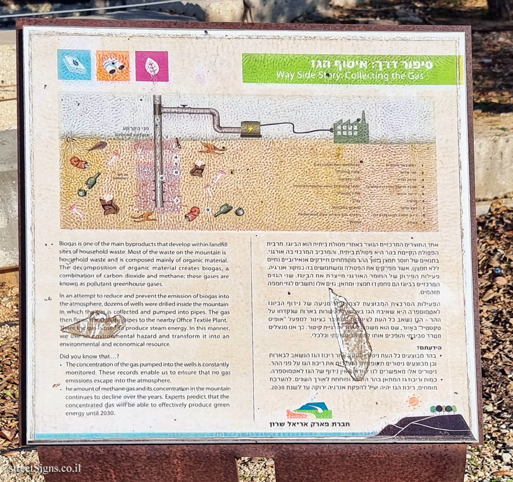
• Extraction of the methane gas generated in the belly of the mountain due to the decomposition of the organic waste contained in it. The gas collected is used to produce green energy, thus helping to reduce the emission of pollutant greenhouse gases into the atmosphere.
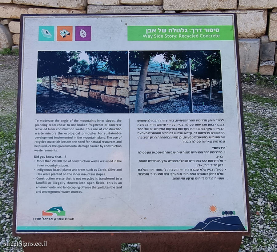
• Use of recycled construction waste in the mountain restoration process.
• Construction of underground storage ponds on the mountain, which are used to collect rainwater in the winter months for the benefit of irrigating the vegetation in the summer.
In the mountain complex you can enjoy a number of points of interest:
Spectacular vantage points overlooking Gush Dan and the surrounding area; A visitor center featuring a spectacular multimedia exhibit that tells the story of the mountain (for a fee); "Road stories" hiking trail - an accessible and controlled hiking trail that includes observations and points of knowledge and interest on the process of rehabilitating the mountain of waste and turning it from an environmental hazard into a green park; Shaded areas and lawns for leisure and recreational activities; Ecological lake and cafe.
To maintain your safety and enjoy a visit to the mountain, please pay attention to the instructions:
1. Visitors must travel on designated routes only
2. Do not cross fences or barriers, they are designed to secure you
3. The mountain has steep slopes, pay attention to the markings in the area
4. It is forbidden to light barbecues, gas stoves and fire in mountain areas
5. It is forbidden to enter the ecological lake in the heart of the mountain
6. Keep clean - waste only in the trash
7. Dogs are allowed in the leash only
Good time !
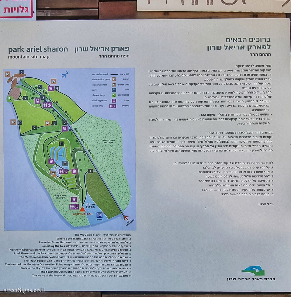
Ariel Sharon Park - Map of the mountain complex
ariel sharon park
mountain site map
[Map of the mountain complex]
Emblem of the Ariel Sharon Park Company