You must turn on the browser location services to get the route from your current location to the sign, and the distance (as the crow flies) from your current location to the sign.
After activating location services, refresh the page.
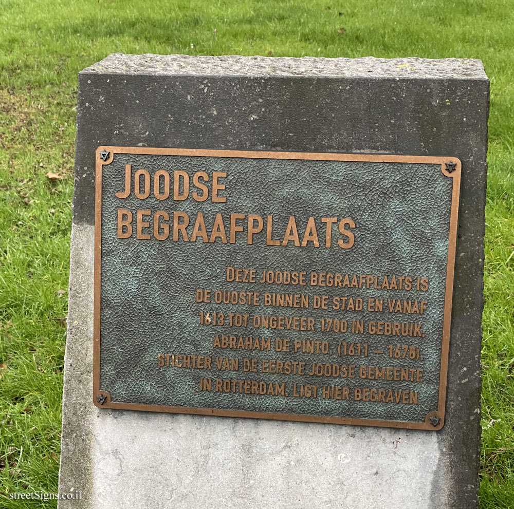
On the sign:
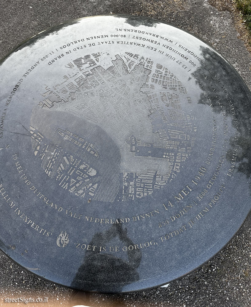
10 MEI 1940 DUITSLAND VALT NEDERLAND BINNEN 14 MEI 1940 BOMBARDEMENT VAN ROTTERDAM | 13:27 UUR IN EEN KWARTIER STAAT DE STAD IN BARND 850 DODEN | 2000 GEWONDEN | 258 HECTARE STAD IN PUIN | 25,000 WONINGEN VERWOEST | 80,000 MENSEN DAKLOOS | 11,000 ANDERE GEBOUWEN VERWOEST DULCE BELLUM INEXPERTIS ’ZOET IS DE OORILOG, TOTDAT JE HEM PROEFT’ | ERAMSUS | MEI 2010 MARKERING VAN DE BRANDEGRENS | WWW.BRANDGRENS.NL
In May 1940, a German bomb destroyed the entire center of Rotterdam in less than fifteen minutes. The city burned for days. The boundaries of the fire zone are called the fire line. The map of the area is displayed on the monument, as well as details of the losses.
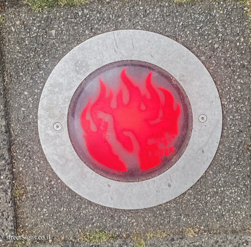
The line of fire is indicated by discs with a flame in the center, like the one taken by the same photographer a few weeks later at Vredenoordkade 137, 3061 MT Rotterdam, The Netherlands Click for a larger image
A month later an identical sign was photographed by the same photographer but in a different location: Willemskade 18b, 3016 DL Rotterdam, The Netherlands In the same sign you can see that the sign is three-dimensional and stands out above the ground Click for a larger image
Translation of the text on the sign: MAY 10, 1940 GERMANY INVADS THE NETHERLANDS 14 MAY 1940 BOMBING OF ROTTERDAM | 1:27 PM IN A QUARTER THE CITY STANDS IN BARND 850 KILL | 2000 INJURIES | 258 HECTARES TOWN IN RUINS | 25,000 HOMES DESTROYED | 80,000 PEOPLE HOMELESS | 11,000 OTHER BUILDINGS DESTROYED DULCE BELLUM INEXPERTIS ’SWEET IS THE WAR UNTIL YOU TASTE IT’ | ERAMSUS | MAY 2010 FIRE BORDER MARKING | WWW.BRANDGRENS.NL


 Click for a larger image
 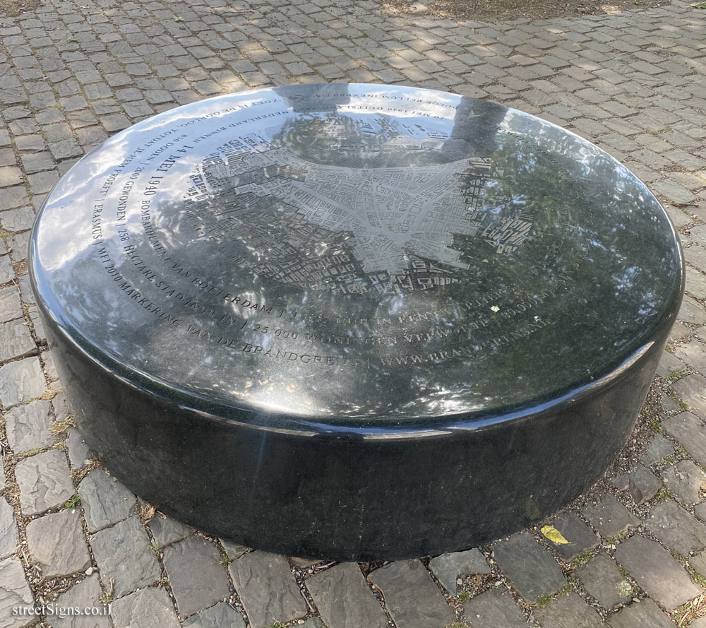 Click for a larger image