You must turn on the browser location services to get the route from your current location to the sign, and the distance (as the crow flies) from your current location to the sign.
After activating location services, refresh the page.
On the sign:
[סמל שביל הים] [Logo of the Sea Trail]
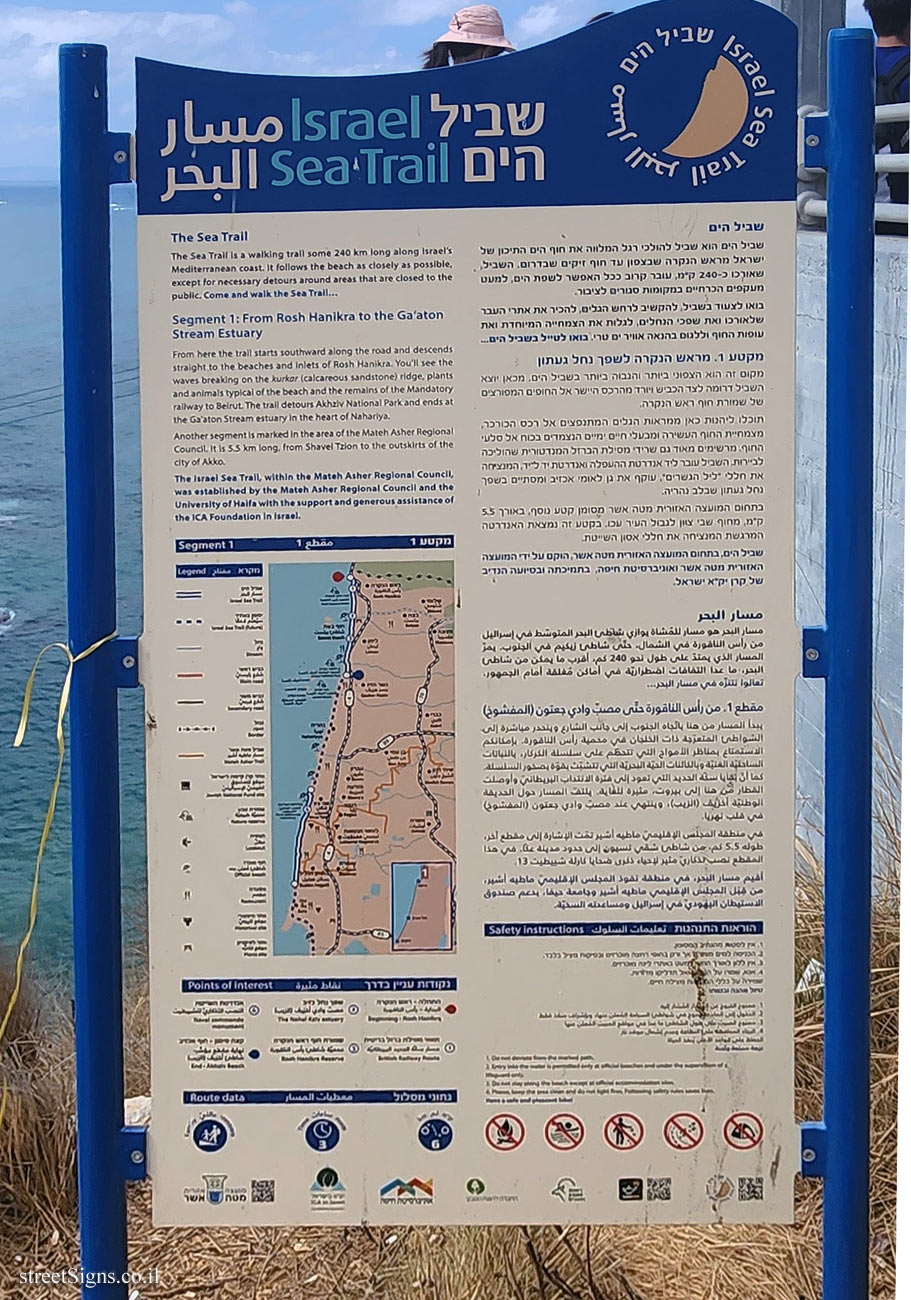
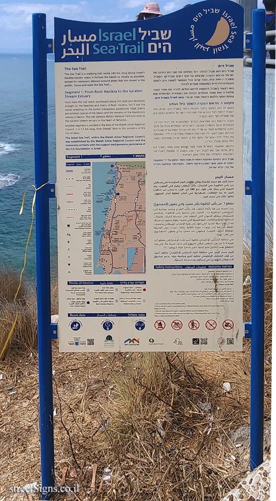
שביל הים Israel Sea Trail مسار البحر
שביל הים שביל הים הוא שביל להולכי רגל המלווה את חוף הים התיכון של ישראל מראש הנקרה שבצפון עד חוף זיקים שבדרום. השביל, שאורכו כ-240 ק"מ, עובר קרוב ככל האפשר לשפת הים, למעט מעקפים הכרחיים במקומות סגורים לציבור. בואו לצעוד בשביל, להקשיב לרחש הגלים, להכיר את אתרי העבר שלאורכו ואת שפכי הנחלים. לגלות את הצמחייה המיוחדת ואת עופות החוף וללגום בהנאה אוויר ים טרי. בואו לטייל בשביל הים...
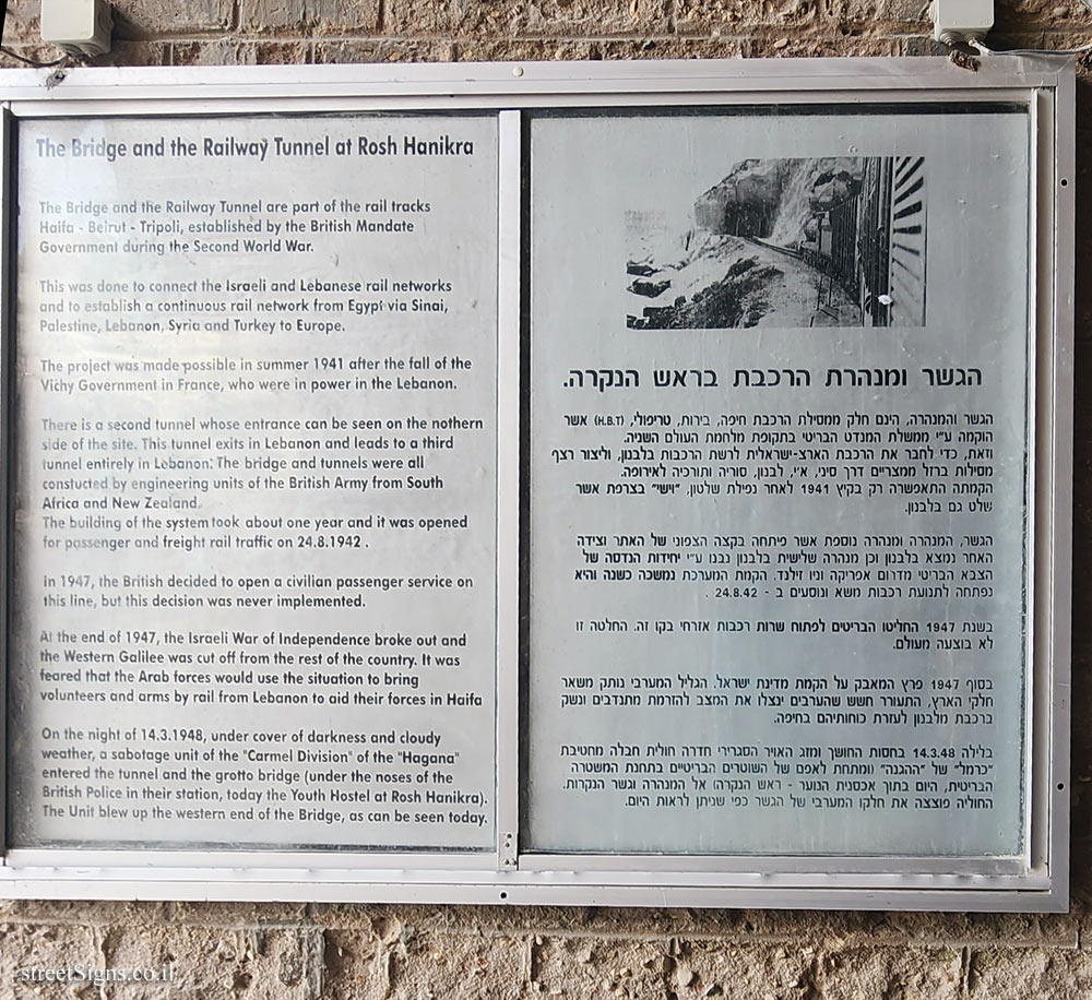
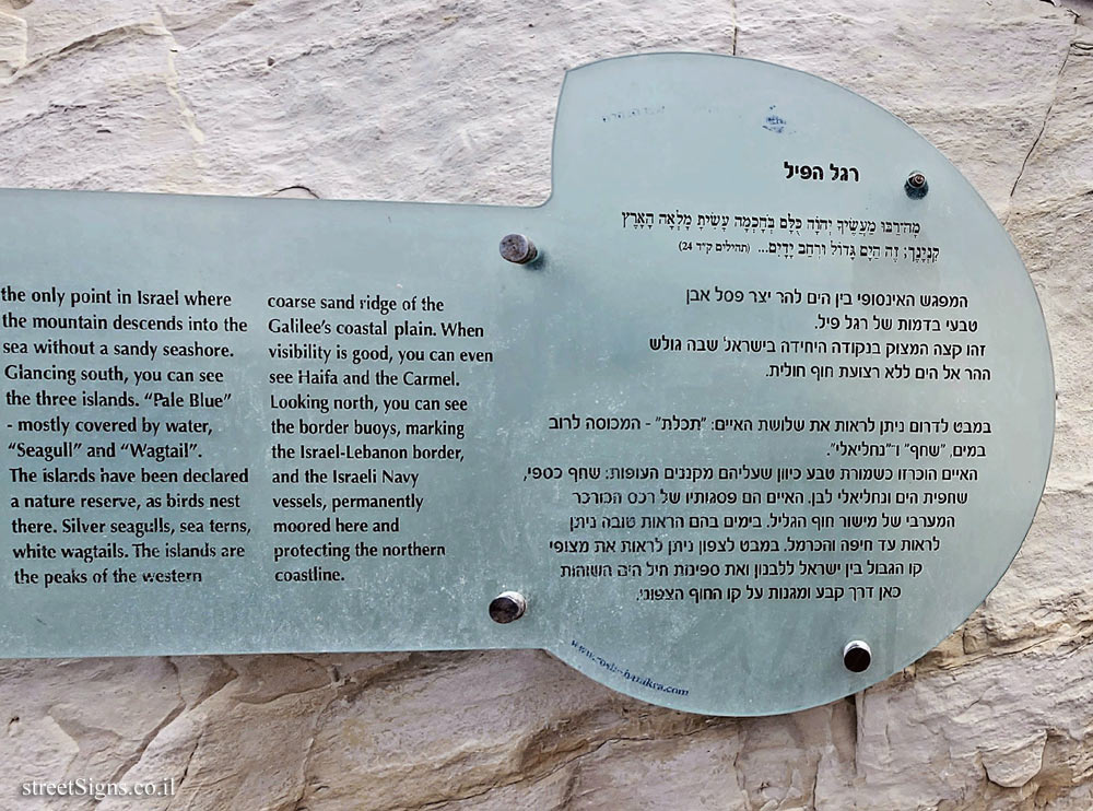
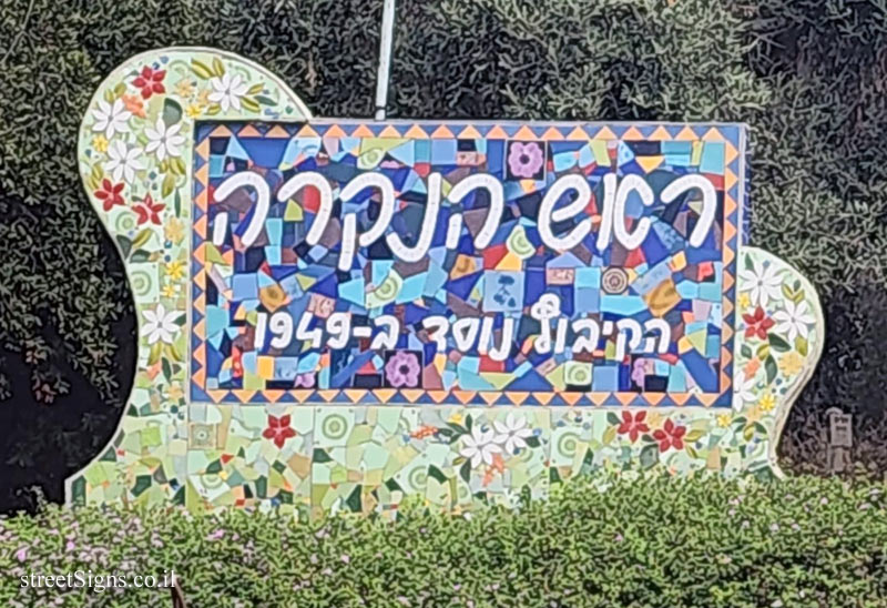
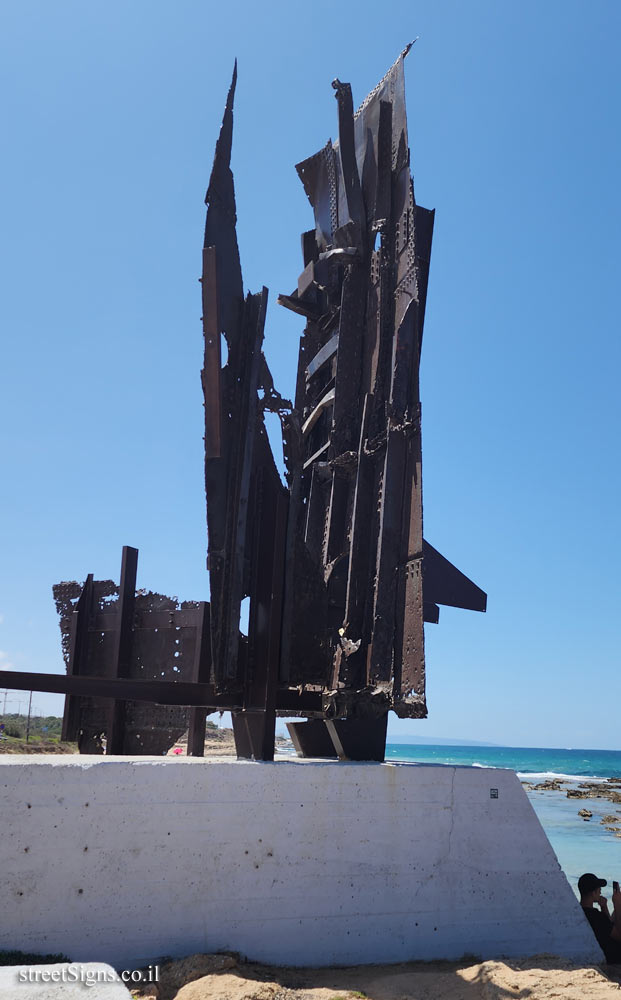
מקטע 1. מראש הנקרה לשפך נחל געתון מקום זה הוא הצפוני ביותר והגבוה ביותר בשביל הים. מכאן יוצא השביל דרומה לצד הכביש ויורד מהרכס היישר אל החופים המפורצים של שמורת חוף ראש הנקרה, תוכלו ליהנות כאן ממראות הגלים המתנפצים אל רכס הכורכר, מצמחיית החוף העשירה ומבעלי חיים ימיים הנצמדים בכוח אל סלעי החוף, מרשימים מאוד גם שרידי מסילת הברזל המנדטורית שהוליכה לביירות. השביל עובר ליד אנדרטת ההעפלה ואנדרטת יד ל-יד המנציחה את חללי "ליל הגשרים", עוקף את גן לאומי אכזיב ומסתיים בשפך נחל געתון שבלב נהריה. בתחום המועצה האזורית מטה אשר מסומן קטע נוסף, באורך 55 ק"מ, מחוף שבי ציון לגבול העיר עכו. בקטע זה נמצאת האנדרטה המרגשת המנציחה את חללי אסון השייטת.
שביל הים, בתחום המועצה האזורית מטה אשר, הוקם על ידי המועצה האזורית מטה אשר ואוניברסיטת חיפה, בתמיכתה ובסיועה הנדיב של קרן יק"א ישראל.
مسار البحر مسار البحر هو مسار للمشاة يوازي شاطئ البحر المتو ا في إسرائيل من رأس الناقورة في الشمال، حتى شاطي زيكيم في الجنوب. يمر المسار الذي يمتد على طول نحو 240 كم. أقرب ما يمكن من شاطي البحر، ما عدا التفافات اضطرارية في أماكن مغلقة أمام الجمهور. تعالوا التنزه في مسار البحر....
مقطع 1. من رأس الناقورة حتى مصب وادي جعتون (المفشوخ) يبدأ المسار من هنا بالجاه الجنوب إلى جانب الشارع ويتحدر مباشرة إلى الشواطئ المتعرجة ذات الخلجان في محمية رأس الناقورة بإمكانكم الاستمتاع بمناظر الأمواج التي تتحكم على سلسلة الكركار. بالنباتات الساحلية العلبة وبالكائنات الحية البحرية التي تتشبت بقوة بصخور السلسلة كما أن تكايا سكة الحديد التي تعوم الانتداب البريطاني وأوصلت م حنا إلى بيروت متير يلتف المسار حول الحديقة الوطنية اخليف الزيب)، وينتهي عند مصب وادي جعتون (المفشوخ) في قلب تهريا.
في منطقة المجلس الإقليمي ماضيه أشير تمت الإشارة إلى مقطع آخر. طوله 5.5 كم من شاطى شفي تسيون إلى حدود مدينة عنا. مي المقطع نصب التذكاري مثير لاحياء ذكرى ضحايا كارلة شبيطيت 13 . أقيم مسار البحر في منطقة نفوذ المجلس الإقليمي ماطيه أشير. من قتل المجلس الإقليمي ماطبه أشير وجامعة حيفا، يدعم صندوق الاستيطان اليهودي في إسرائيل ومساعده السحية.
The Sea Trail The Sea Trail is a walking trail some 240 km long along Israel’s Mediterranean coast. It follows the beach as closely as possible, except for necessary detours around areas that are closed to the public. Come and walk the Sea Trail...
Segment 1: From Rosh Hanikra to the Ga’aton Stream Estuary From here the trall starts southward along the road and descends straight to the beaches and Inlets of Rosh Hanikra. You’ll see the waves breaking on the kurkar (calcareous sandstone) ridge, plants and animals typical of the beach and the remains of the Mandatory railway to Beirut. The trail detours Akhziv National Park and ends at the Ga’aton Stream estuary in the heart of Nahariya. Another segment is marked in the area of the Mateh Asher Regional Council. It is 5.5 km long, from Shavei Tzion to the outskirts of the city of Akko.
The Israel Sea Trail, within the Mateh Asher Regional Council, was established by the Mateh Asher Regional Council and the University of Haifa with the support and generous assistance of the ICA Foundation in Israel.
[מפת מקטע 1] [Map of segment 1]
[הוראות התנהגות - Safety Instructions]
[נקודות עניין בדרך - Points of Interest]
[נתוני מסלול - Route data]
סמל מועצה מקומית מטה אשר / סמל יק"א ישראל / סמל אוניברסיטת חיפה / סמל החברה להגנת הטבע / סמל רשות הטבע והגנים Emblem of Mateh Asher Regional Council / Emblem of YKA Israel / Logo of Haifa University / Society for the Protection of Nature / Nature and Parks Authority


 Click for a larger image