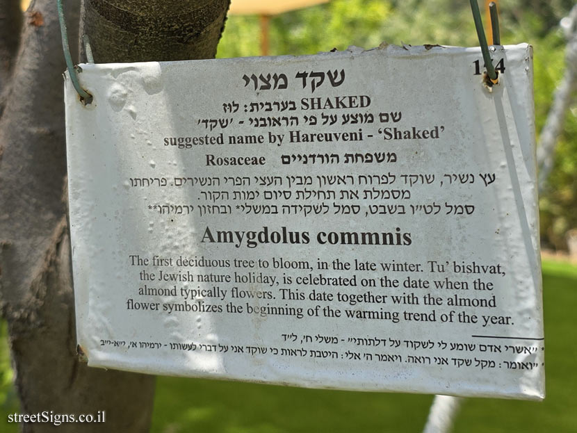
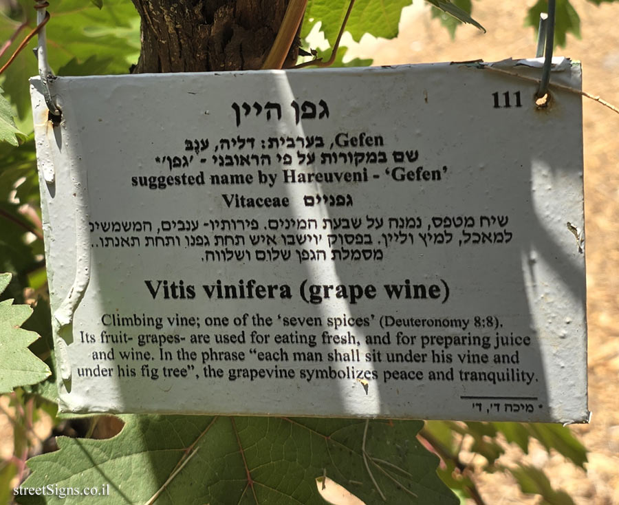
In the following photos taken by the same photographer on the same day, the various parts of the sign appear enlarged
 Click for a larger image
 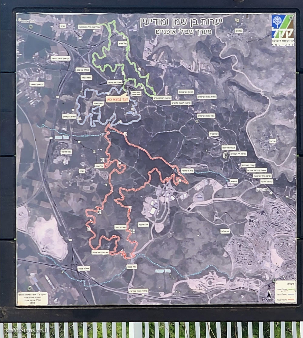 Click for a larger image
 The beginning of the route was photographed on the same day by the same photographer
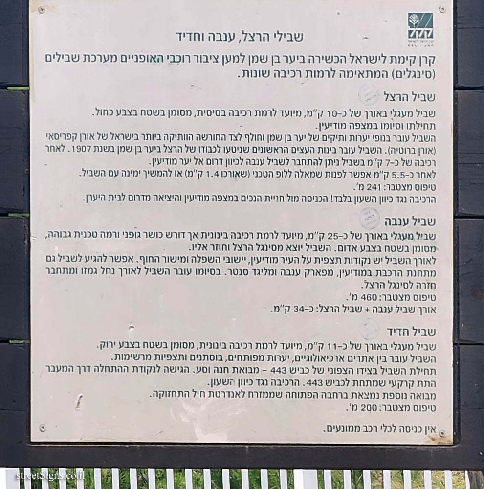
 Click for a larger image Translation of the text on the sign
:
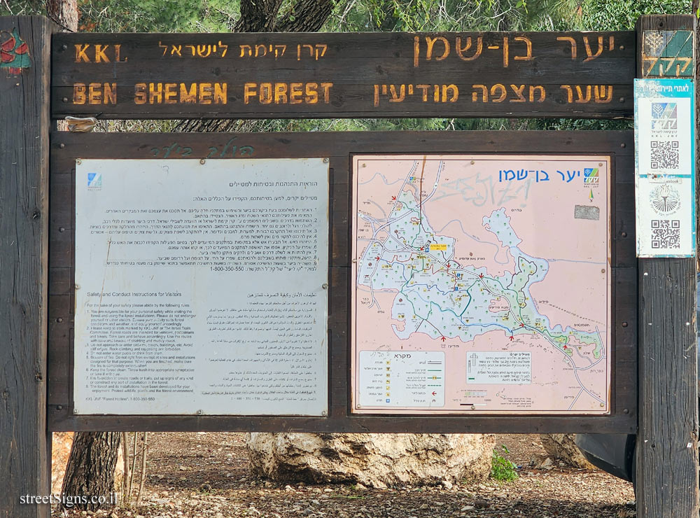
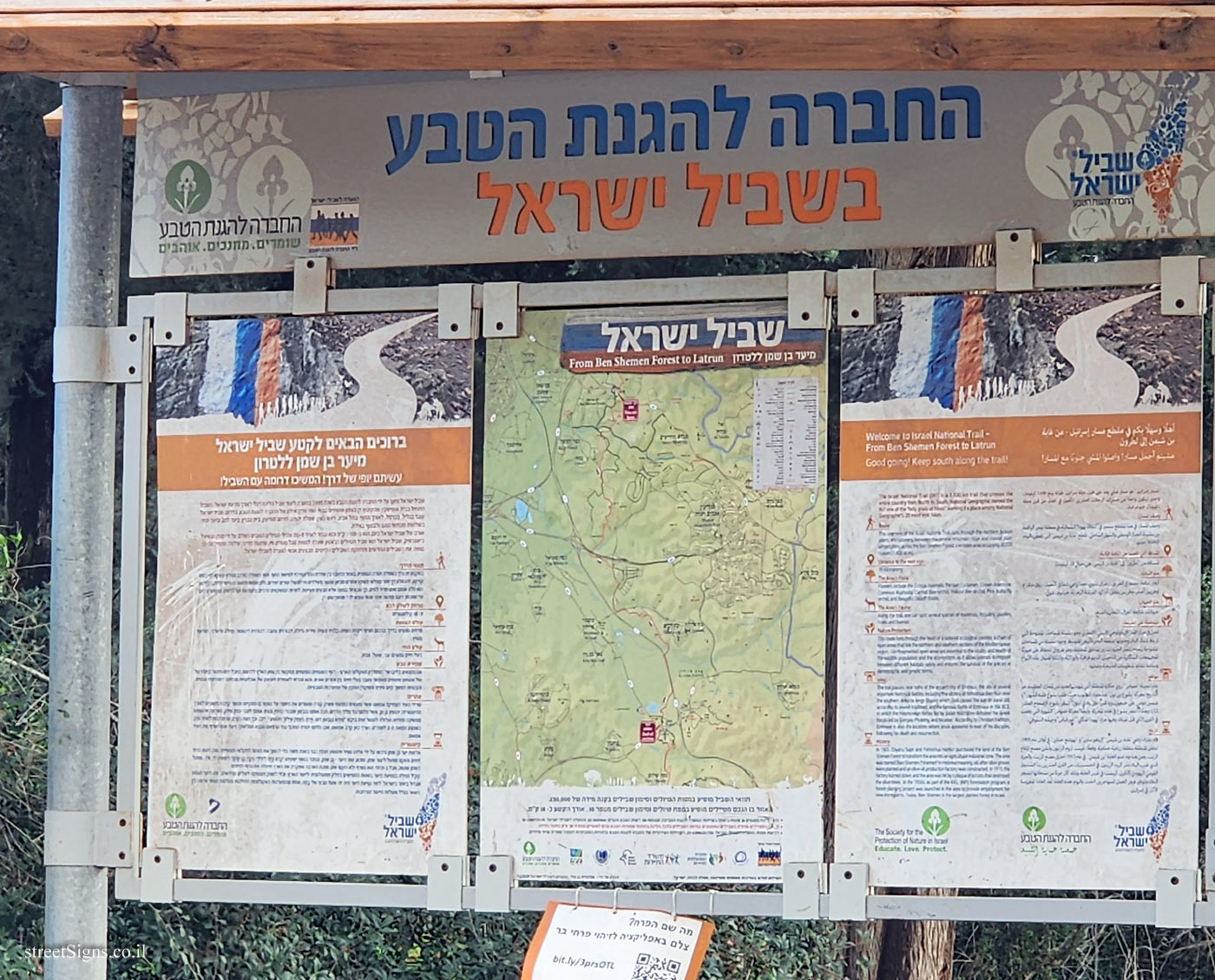
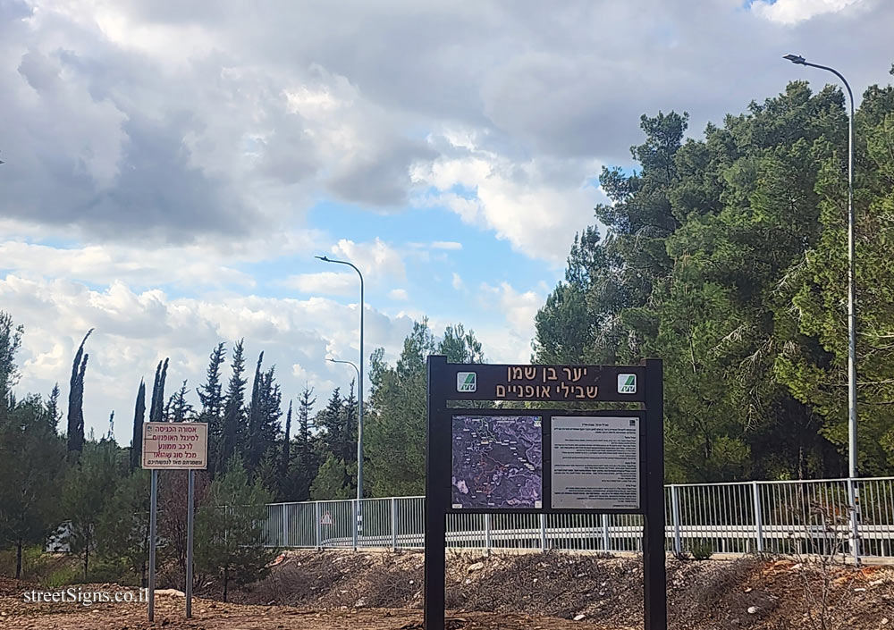
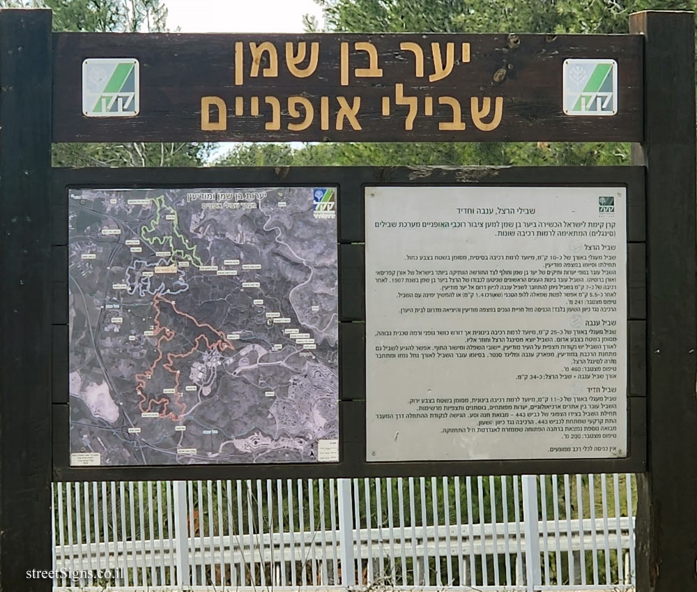
Ben-Sheman Forest
bike paths [JNF symbol]
Herzl, Anava and Hadid trails
The Keren Kayemet (JNF) Israel Foundation built in the Ben Shemen forest for the cyclists a system of trails (singles) suitable for different riding levels.
Herzl Trail A circular path about 10 km long, designed for a basic riding level, marked in the area in blue.
It begins and ends at Mitzpe Modiin:
The path passes through old forest landscapes of the Ben Shemen forest and passes next to Israel’s oldest grove of Cypriot pine (Pinus brutia). The path passes through the first trees that were planted in Herzl’s honor in the Ben Shemen Forest in 1907. After riding for about 7 km, the trail connects to the Anava trail towards the south to the Modi’in Forest. After about 5.5 km, you can turn left to the technical loop (which is 1.4 km long) or continue to the right with the path.
Cumulative climb: 241 m.
Anti-clockwise riding only! The entrance is in front of the disabled parking lot in Mitzpe Modi’in and the exit is south of Beit Hyaran.
Anava Trail A circular trail about 25 km long, designed for intermediate level riding but requiring physical fitness and a high technical level, marked in the area in red. The second trail leaves from the Herzl single and returns to it.
Along the path there are observation points on the city of Modiin, the settlements of the Shephelah and the coastal plain. You can also reach the trail from the train station in Modiin, from Anava Park and Miligad Center. At its end, the trail runs along the Gamzo River and connects back to the Herzl single.
Cumulative climb: 460 m.
Length of the Anava trail + the Herzl trail: approx. 34 km
Hadid Trail A circular trail about 11 km long, intended for intermediate level riding, marked in the area in green.
The path passes between archaeological sites, developed forests, orchards and impressive views.
The beginning of the path on the north side of road 443 - Park and Ride entrance. Access to the starting point via the underground passage under road 443. Ride anti-clockwise.
Another entrance is in the open square to the east of the Maintenance Corps monument.
Cumulative climb: 200 m.
No entry for motorized vehicles.
[route map]


 Click for all signs belonging to JNF - Gardens and Parks
 13.71 Km |
  26.1 Km |
  83.31 Km |
  88.37 Km |
  89.57 Km


 Click for the map of all signs belonging to JNF - Gardens and Parks
  Click for the route that starts with this sign and goes through the signs belonging to JNF - Gardens and Parks
 The closest sign from this series (12 Meter): Ben-Sheman Forest - The forest map