The sign is rectangular but its head is designed according to the silhouette of the old building of the Gymnasia Herzliya, which serves as a logo of the Council for the Preservation of Heritage Sites in Israel
The place was photographed on the same day by the same photographer
 Click for a larger image
 The pictures on the sign are enlarged here:
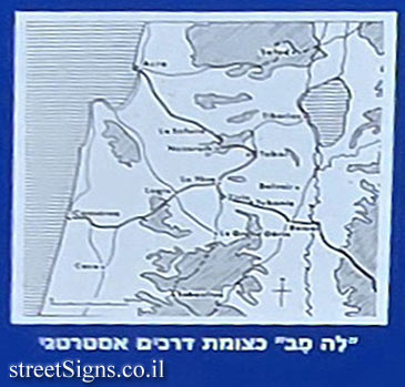
"Le Feve" as a strategic crossroads (map)
 Click for a larger image
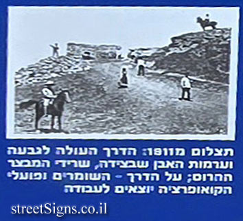
 Photo from 1911
 Click for a larger image
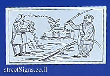
 The cartoon
 Click for a larger image
 The archaeological mound itself is commemorated with a separate plaque
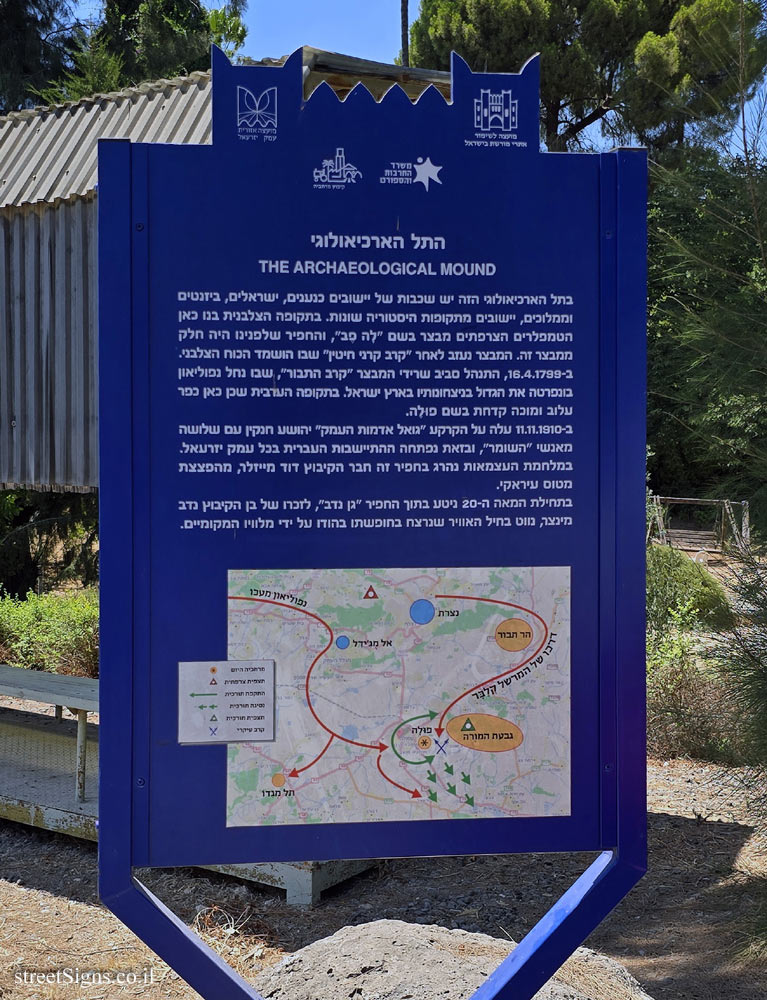 Click for sign's details Translation of the text on the sign
:
Symbol of the Council for the Preservation of Israeli Heritage Sites
Symbol of the Jezreel Valley Regional Council
The symbol of the Ministry of Culture and Sports
Kibbutz Merhavia symbol
THE CRUSADER FORTRESS "LA FEVE" The archaeological mound in front of us reached its peak during the Crusader period, when the French Templars built the fortress "Le Feve" here. Here the roads passed from Acre and Caesarea, the coastal cities of that time, to Beit Shean, and from there - to the Far East. The Crusader arch that remains on the hill is probably an introduction to an underground hall.
[Image: "Le Feve" as a strategic crossroads]
The fort was abandoned after the Battle of Hattin in 1187, in which the Crusader army was destroyed by Saladin, who also destroyed the fort. They were used for re-hewing and building the stone houses of the Great courtyard, and probably also for the Blumenfeld house and the Zaberski house in the nearby settlement.
[Photo: Photograph from 1911: the road going up to the hill and the piles of stone beside it, the remains of the destroyed fort; On the road - the guards and the cooperative workers go to work]
A Muslim cartoon, published in Beirut in 1911, shows Saladin trying to prevent Joshua Hankin with his sword from purchasing the land around the fort, visible in the background, but Hankin does not hesitate, pays what is due and purchases the land.
[Image: the cartoon]

 Click for a larger image
  Click for a larger image
  Click for a larger image
  Click for a larger image
  Click for sign's details