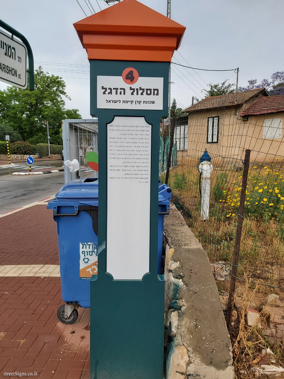
Station # 5 on the Ness Ziona Flag trail, a route that describes historical points in the history of Ness Ziona.
Raising the Israeli flag for the first time after which the route is named, plays an important role in Ness Ziona’s legacy, the flag appears in the city’s emblem, and even the city’s house numbers contain this motif
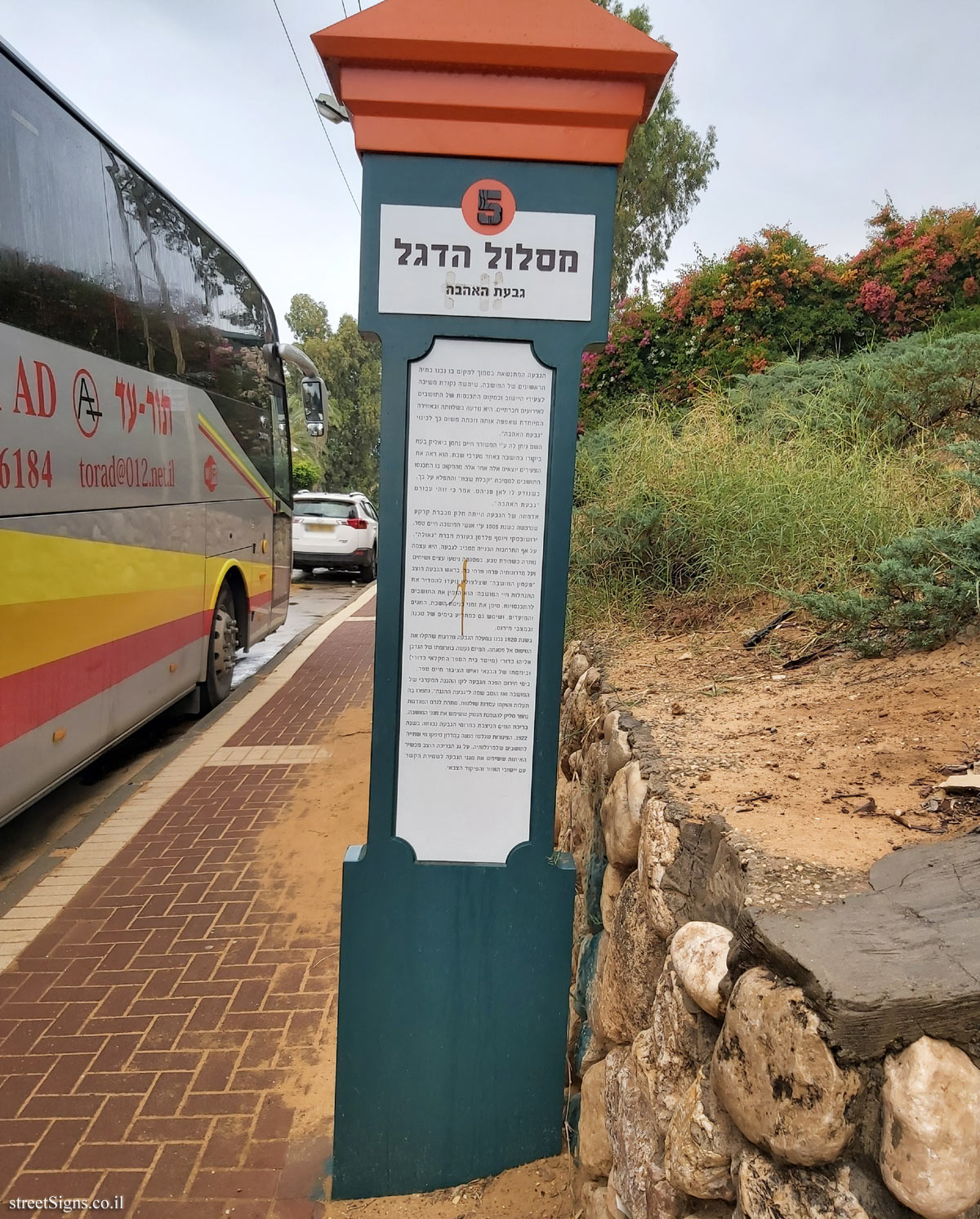
 Click for sign's details
 The following image enlarges the text on the sign
 Click for a larger image
 The following picture was taken up the hill
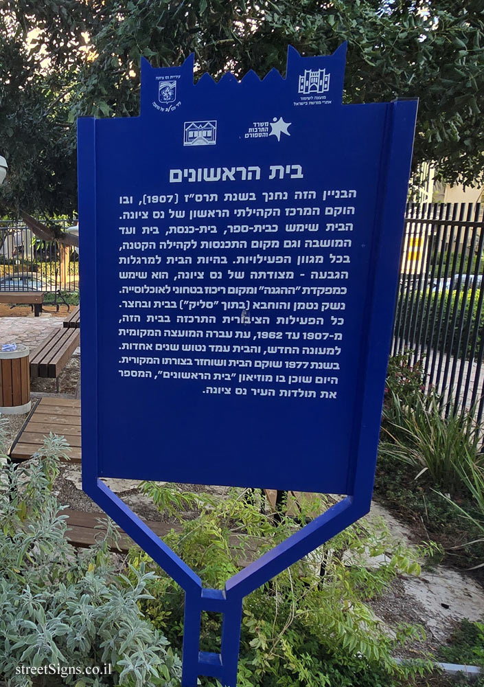
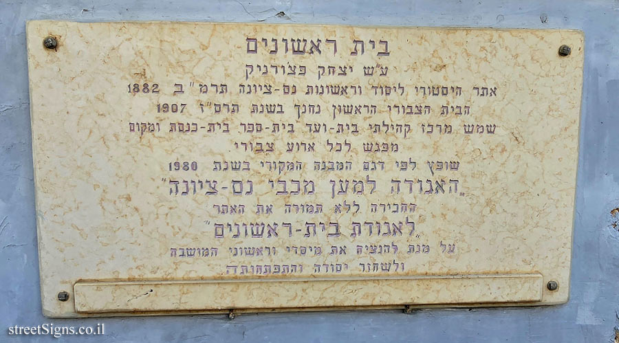
 Click for a larger image Translation of the text on the sign
:
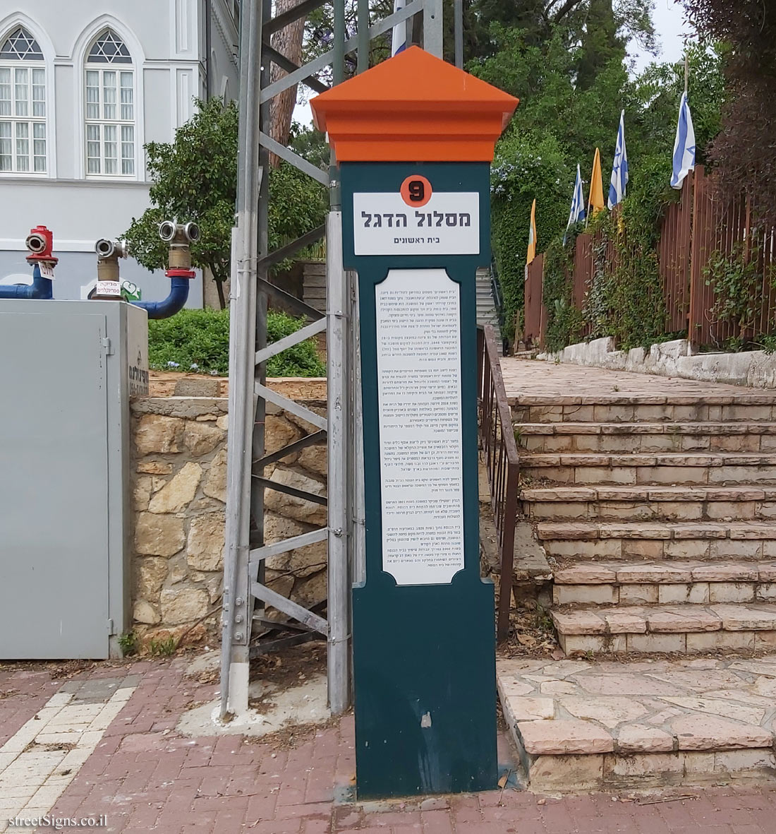
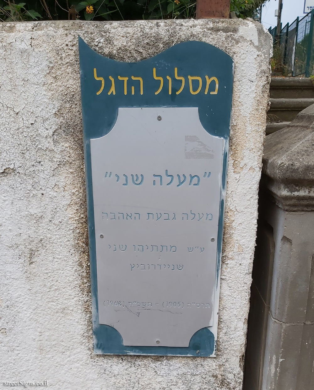
5
The Flag trail
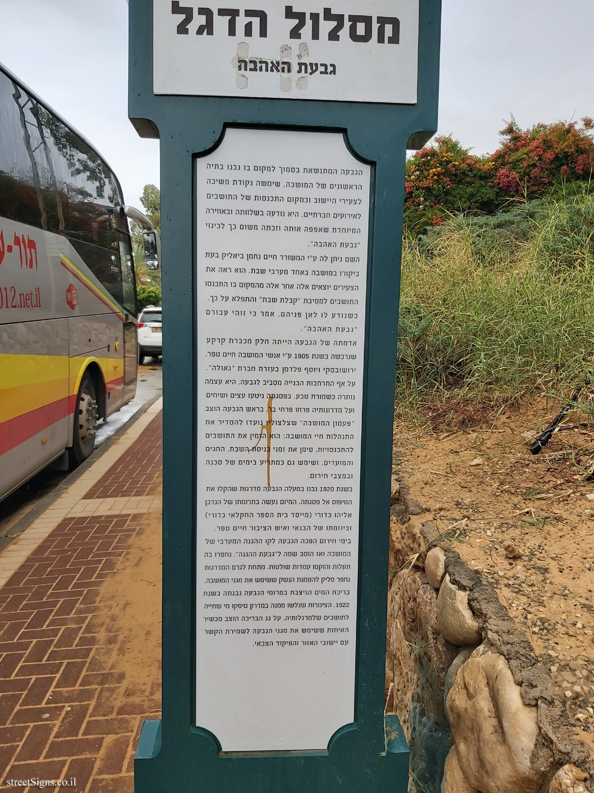
Love Hill
The hill, which is located near where the first houses of the colony were built, served as a point of attraction for the youth of the community and as a gathering place for residents for social events. It was known for its peace and the special atmosphere that enveloped it and was therefore nicknamed "Love Hill."
The name was given by poet Haim Nachman Bialik while visiting the colony on one of the Sabbath evenings.
He saw the young people coming out one after the other from the place where the residents gathered for the "Kabalat Shabbat" party and was surprised about it. When he learned where they were going, he said it was "Love Hill" for them.
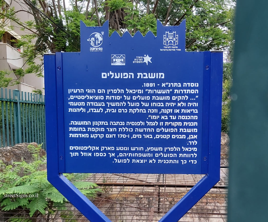
The hill’s land was part of a plot of land purchased in 1905 by the people of the colony Haim Tepper, Jerushovsky and Joseph Feldman with the help of the Geula Company.
Despite the expansion of construction around the hill, it has remained a natural reserve. At its top, trees and shrubs were planted and wild flowers bloomed on its slopes. At the top of the hill was the "Colony Bell, whose rims are intended to regulate the life of the Colony: it invited residents to gatherings, marked the Sabbath, holidays, and also served as a warning in times of danger and emergencies.
In 1920, steps were built up the hill that facilitated the climb to its summit. The project was donated by donor Eliyahu Kaduri (founder of Kaduri Agricultural School) and initiated by the builder and public figure Haim Topper.
During emergencies, the hill became the western line of defense of the colony and then was renamed the "hill of defense", ditches were dug there and governing positions were erected. Under the staircase, a stash was excavated to deposit the weapons used by the colony’s defenders.
The water pool at the top of the hill was built in 1922. The pipes that ran down the slope provided drinking water to the residents at its foot. A signaling device was used on the roof of the pool, which was used by hill protectors to maintain contact with local communities and military command.


 Click for all signs belonging to The Flag trail, Ness Ziona
 Click for the map of all signs belonging to The Flag trail, Ness Ziona
  Click for the route that starts with this sign and goes through the signs belonging to The Flag trail, Ness Ziona
 Click for more details on The Flag trail, Ness Ziona
 The closest sign from this series (151 Meter): Ness Ziona - Flag trail - The Jewish National Fund Neighborhood
 175 Meter
 197 Meter
 202 Meter
 270 Meter
 329 Meter