You must turn on the browser location services to get the route from your current location to the sign, and the distance (as the crow flies) from your current location to the sign.
After activating location services, refresh the page.
On the sign:
סמל המועצה לשימור אתרי מורשת בישראל סמל מושב חרות סמל משרד התרבות והספורט סמל החברה הממשלתית לתיירות לוגו "עושים מהפכה בתיירות"
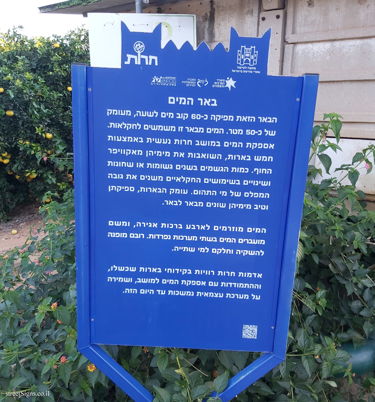
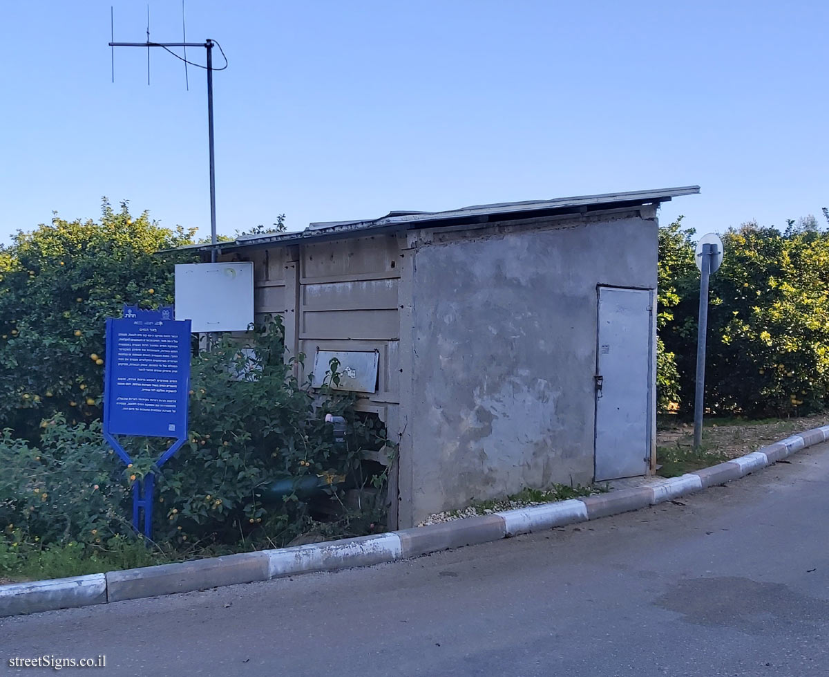
באר המים הבאר הזאת מפיקה כ-60 קוב מים לשעה, מעומק של כ-50 מטר. המים מבאר זו משמשים לחקלאות. אספקת המים במושב חרות נעשית באמצעות חמש בארות, השואבות את מימיהן מאקוויפר החוף. כמות הגשמים בשנים גשומות או שחונות ושינויים בשימושים החקלאיים משנים את גובה המפלס של מי התהום. עומק הבארות, ספיקתן וטיב מימיהן שונים מבאר לבאר.
המים מוזרמים לארבע ברכות אגירה, ומשם מועברים המים בשתי מערכות נפרדות. רובם מופנה להשקיה וחלקם למי שתייה.
אדמות חרות רוויות בקידוחי בארות שכשלו, וההתמודדות עם אספקת המים למושב, ושמירה על מערכת עצמאית נמשכות עד היום הזה.
The sign shape is rectangular but its head is designed according to the silhouette of the old building of the Gymnasia Herzliya, which serves as a logo of the Council for the Preservation of Heritage Sites in Israel
Translation of the text on the sign: Symbol of the Council for the Preservation of Israeli Heritage Sites Emblem of Moshav Herut The emblem of the Ministry of Culture and Sport The emblem of the Government Tourism Company "Tourism Revolution Logo"
The water well This well produces about 60 cubic meters of water per hour, from a depth of about 50 meters. The water from this well is used for agriculture. The water supply in Moshav Herut is done through five wells, which draw their water from the coastal aquifer. The amount of rainfall in rainy years or drought years and changes in agricultural uses change the height of the groundwater level. The depth of the wells, their flow and the quality of their waters differ from well to well.
The water is flowed into four storage ponds, and from there the water is transferred in two separate systems. Most of them are directed to irrigation and some to drinking water.
The lands of Moshav Herut are saturated with failed well drilling, and dealing with the supply of water to the moshav, and maintaining an independent system continues to this day.


 Click for all signs belonging to Heritage Sites in Israel
 Click for the map of all signs belonging to Heritage Sites in Israel
  Click for the route that starts with this sign and goes through the signs belonging to Heritage Sites in Israel
 Click for more details on Heritage Sites in Israel
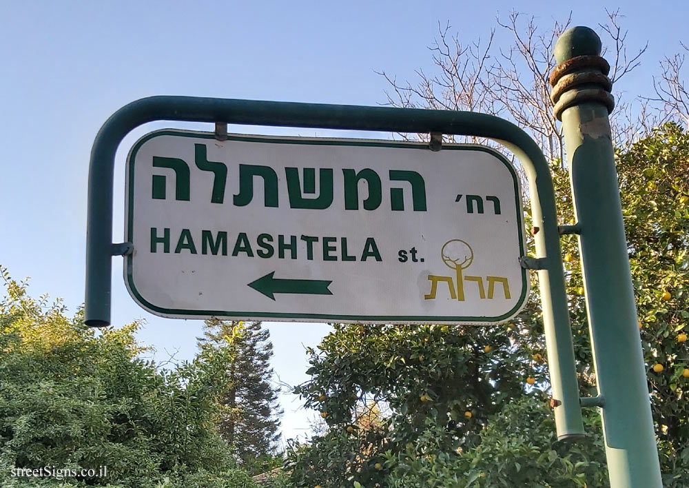
 The closest sign from this series (171 Meter): Herut - Heritage Sites in Israel - The cold store
 180 Meter
 197 Meter
 209 Meter
 237 Meter
 238 Meter