You must turn on the browser location services to get the route from your current location to the sign, and the distance (as the crow flies) from your current location to the sign.
After activating location services, refresh the page.
On the sign:
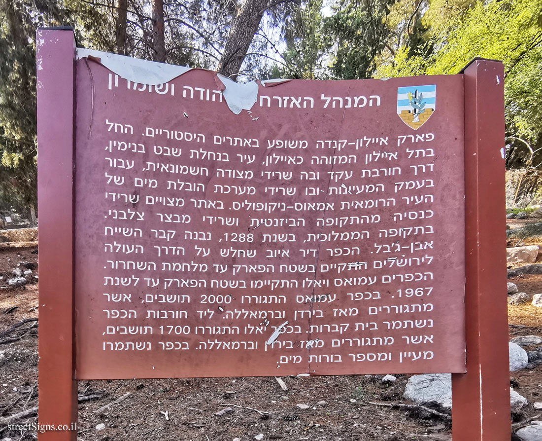
סמל המנהל האזרחי ביהודה ושומרון המנהל האזרחי ביהודה ושומרון
פארק איילון-קנדה משופע באתרים היסטוריים. החל בתל-איילון המזוהה כאיילון, עיר בנחלת שבט בנימין, דרך חורבת עקד ובה שרידי מצודה חשמונאית, עבור בעמק המעיינות ובו שרידי מערכת הובלת מים של העיר הרומאית אמאוס-ניקופוליס. באתר מצויים שרידי כנסיה מהתקופה הביזנטית ושרידי מבצר צלבני. בתקופה הממלוכית, בשנת 1288, נבנה קבר השייח אבן-ג’בל. הכפר דיר איוב שחלש על הדרך העולה לירושלים התקיים בשטח הפארק עד מלחמת השחרור. הכפרים עמואס ויאלו התקיימו בשטח הפארק עד לשנת 1967. בכפר עמואס התגוררו 2000 תושבים, אשר מתגוררים מאז בירדן וברמאללה. ליד חורבות הכפר נשתמר בית קברות. בכפר יאלו התגוררו 1700 תושבים, אשר מתגוררים מאז בירדן וברמאללה. כפר נשתמרו מעיין ומספר בורות מים
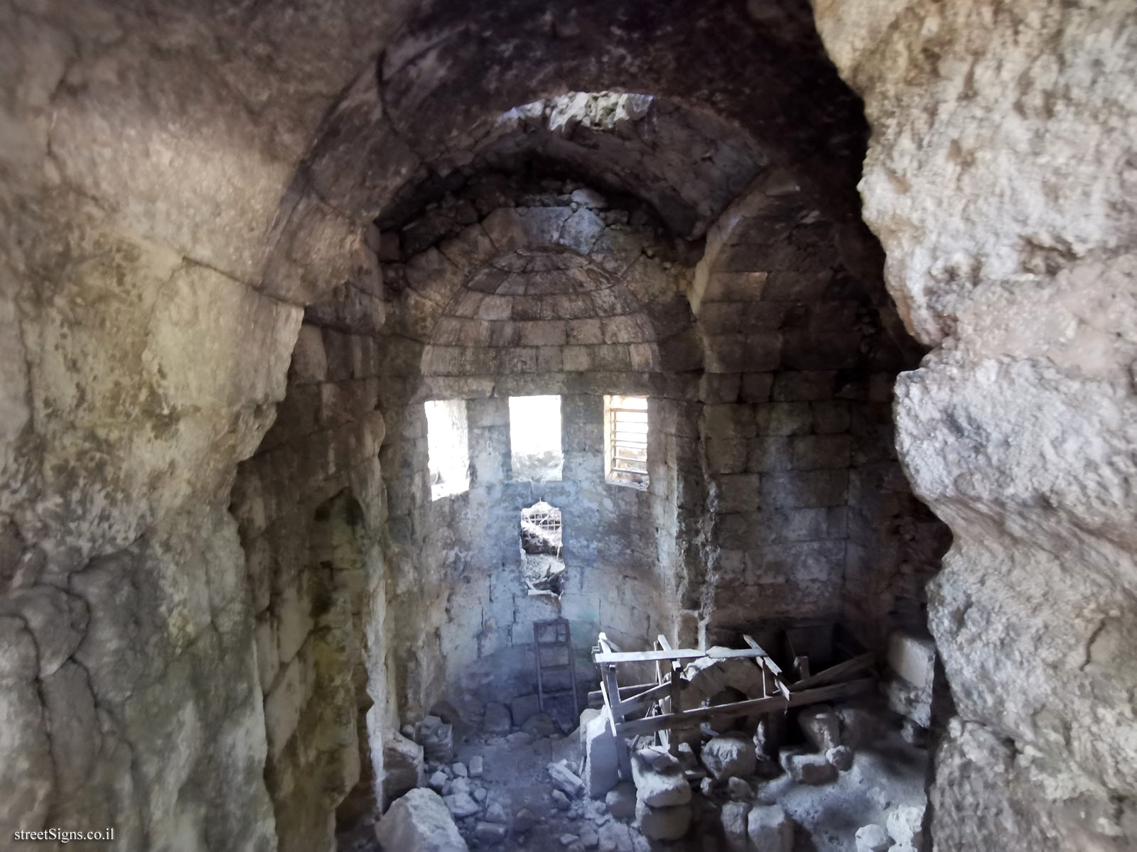
The remains of an ancient building in the park were photographed that day by the same photographer Click for a larger image
Translation of the text on the sign: Symbol of the Civil Administration in Judea and Samaria The Civil Administration in Judea and Samaria
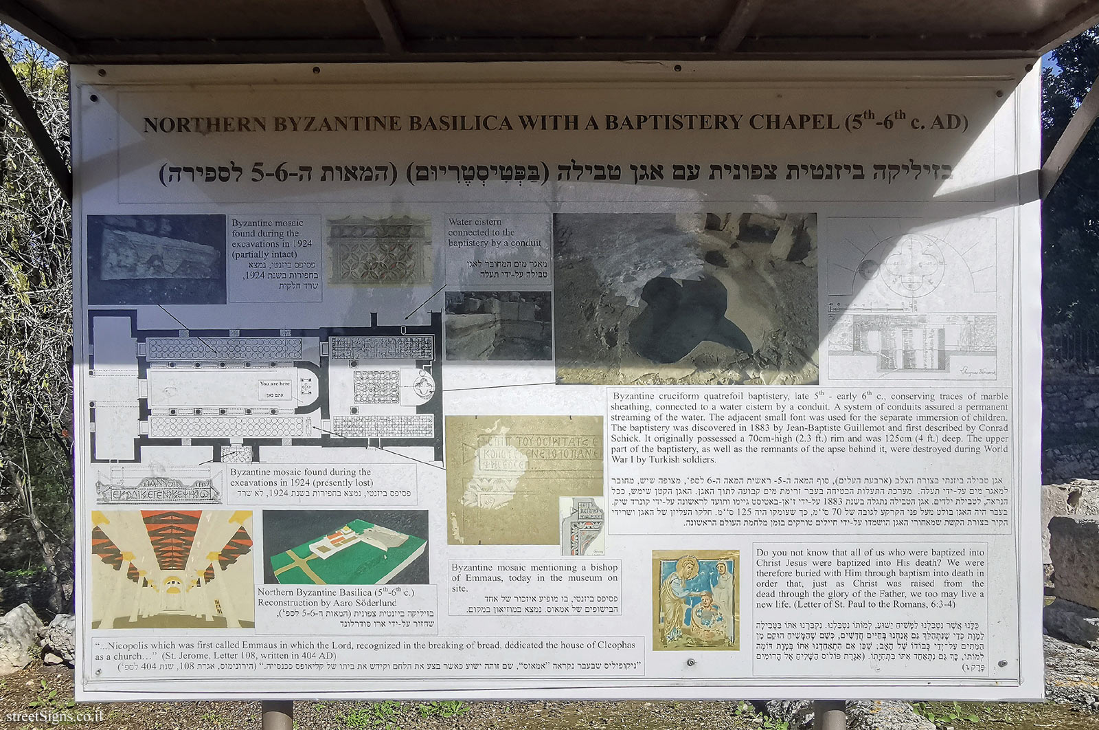
Ayalon-Canada Park abounds in historic sites. Starting at Tel Ayalon, known as Ayalon, a city in the Nahalat Shevet Binyamin, through Horbat Eqed with the remains of a Hasmonean fortress, to the Valley of the Springs with the remains of a water transport system of the Roman city of Emmaus-Nicopolis. The site contains the remains of a church from the Byzantine period and the remains of a Crusader fortress. During the Mamluk period, in 1288, the tomb of Sheikh Ibn Jabal was built. The village of Deir Ayub, which dominated the road to Jerusalem, existed in the park until the War of Independence. The villages of Amouas and Yalu existed in the park until 1967. The village of Amouas was inhabited by 2,000 residents, who have lived in Jordan and Ramallah ever since. A cemetery has been preserved near the ruins of the village. The village of Yalu was home to 1,700 residents, who have lived in Jordan and Ramallah ever since. A village and a number of cisterns have been preserved