Various signs
The ultimate street signs, historical sites and house numbers
× Want to add signs? There is an app! Get it on Google Play Download on the App Store

Sign: Modi’in - Giv’at HaTitora - Archaeological Garden


Address:
Giv’at HaTitora, Derech Yigal Alon, Modi’in-Maccabim-Re’ut, Israel
Shape:
Material:
Placement:
Click here for a map that contains other items in the area

On the sign:
גן ארכיאולוגי גבעת תיתורה
בתחילת שנות ה-90 של המאה העשרים החל פיתוח מואץ באזור מודיעין ובעקבותיו נבנתה העיר מודיעין. במהלך שנים אלו נערכו עשרות חפירות וסקרים ארכיאולוגיים שחשפו את ההיסטוריה של האזור, החל מהתקופה הניאוליתית הקדומה (האלף העשירי לפסה"נ) ועד ימינו. בגן הארכיאולוגי מוצגים מתקנים חקלאיים ופריטים אדריכליים שהתגלו בחפירות שנערכו בגבעת התיתורה ובסביבות מודיעין. ממצאים אלה מעידים על ייחודו וחשיבותו של האזור בתולדותיה של ארץ ישראל, בעיקר בתקופת הברזל ובימי בית שני. בגבעת התיתורה נחשפו שרידים של מרחב חקלאי - חוות שלהן אופי משפחתי ותעשייתי, שהותאמו לתנאי האזור, וכן מחילות מסתור, בתי קברות, מחצבות, מתקנים, בורות מים ודרך עתיקה.

סמל רשות העתיקות
סמל מיתוג של עיריית מודיעין מכבים רעות

אוצרות: עדנה אייש, אוצרות המדינה, רשות העתיקות
טיפול שימורי: מנהל שימור, רשות העתיקות
שחזור מתקנים: יהושע (ישו) דריי, שחזור טכנולוגיה עתיקה
התצוגה באדיבותרשות העתיקות

Photography:
Add comments, corrections, or missing information. After clicking the "Submit" button you will be taken to a page where you will be required to specify your name and email address.
Please note, you do not need to specify details about the item, these details will be automatically added


Comments:
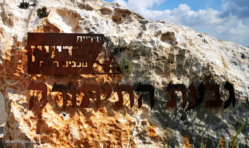
More details about the hill, and the origin of its name on the sign that is also on the site Click for sign's details

Archaeological finds on the hill were taken that day by the same photographer Click for a larger image

Translation of the text on the sign:

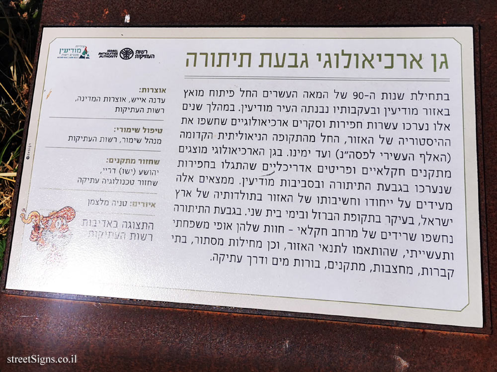
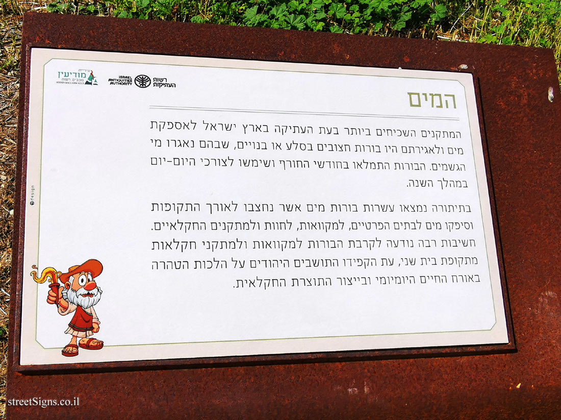
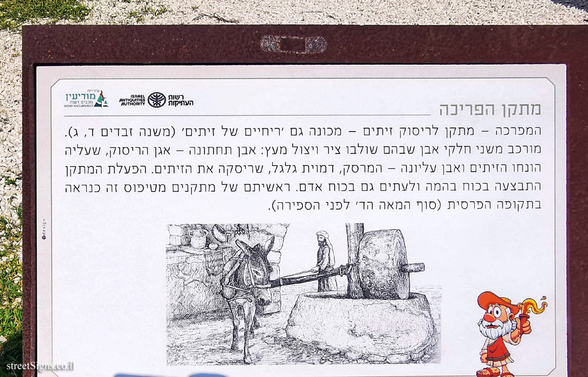
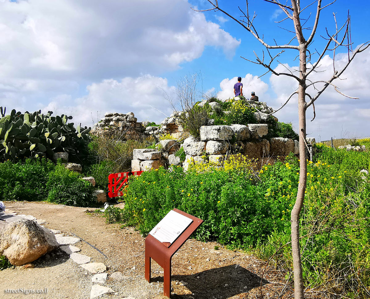
Givat Titura Archaeological Garden
In the early 1990s, accelerated development began in the Modi’in area, following which the city of Modi’in was built. During these years dozens of archeological excavations and surveys were conducted that revealed the history of the area, from the Early Neolithic period (tenth millennium BCE) to the present day. The archeological garden displays agricultural installations and architectural items discovered in excavations conducted at Givat Hatitora and in the vicinity of Modi’in. These findings indicate the uniqueness and importance of the area in the history of the Land of Israel, especially during the Iron Age and the Second Temple period. Remains of an agricultural area were exposed in Givat Hatitora - farms with a family and industrial character, adapted to the conditions of the area, as well as hiding places, cemeteries, quarries, installations, cisterns and an ancient road.

Symbol of the Israel Antiquities Authority
Branding symbol of the Modiin Maccabim Reut Municipality

Curators: Edna Aish, State Treasures, Israel Antiquities Authority
Conservation treatment: Conservation Director, Israel Antiquities Authority
Restoration Facilities: Joshua (Jesus) Drey, Restoration of Ancient Technology
The display is courtesy of the Antiquities Authority

Learn about:


The ultimate street signs, historical sites and house numbers

Initiating the site - Eli Zvuluny - Programming and building the site Possible Worlds Ltd. Possible Worlds Ltd. © 2019-2024

© ALL RIGHTS RESERVED - The site and its content are copyright protected. The full copyrights of the site's content belong to Eli Zvuluny. All images in the site (unless another photographer is mentioned) were taken by Eli Zvuluny that has the full copyrights on them. The use of any images or other materials included herein, in whole or part, for any purpose is expressly prohibited without the written permission of Eli Zvuluny. .