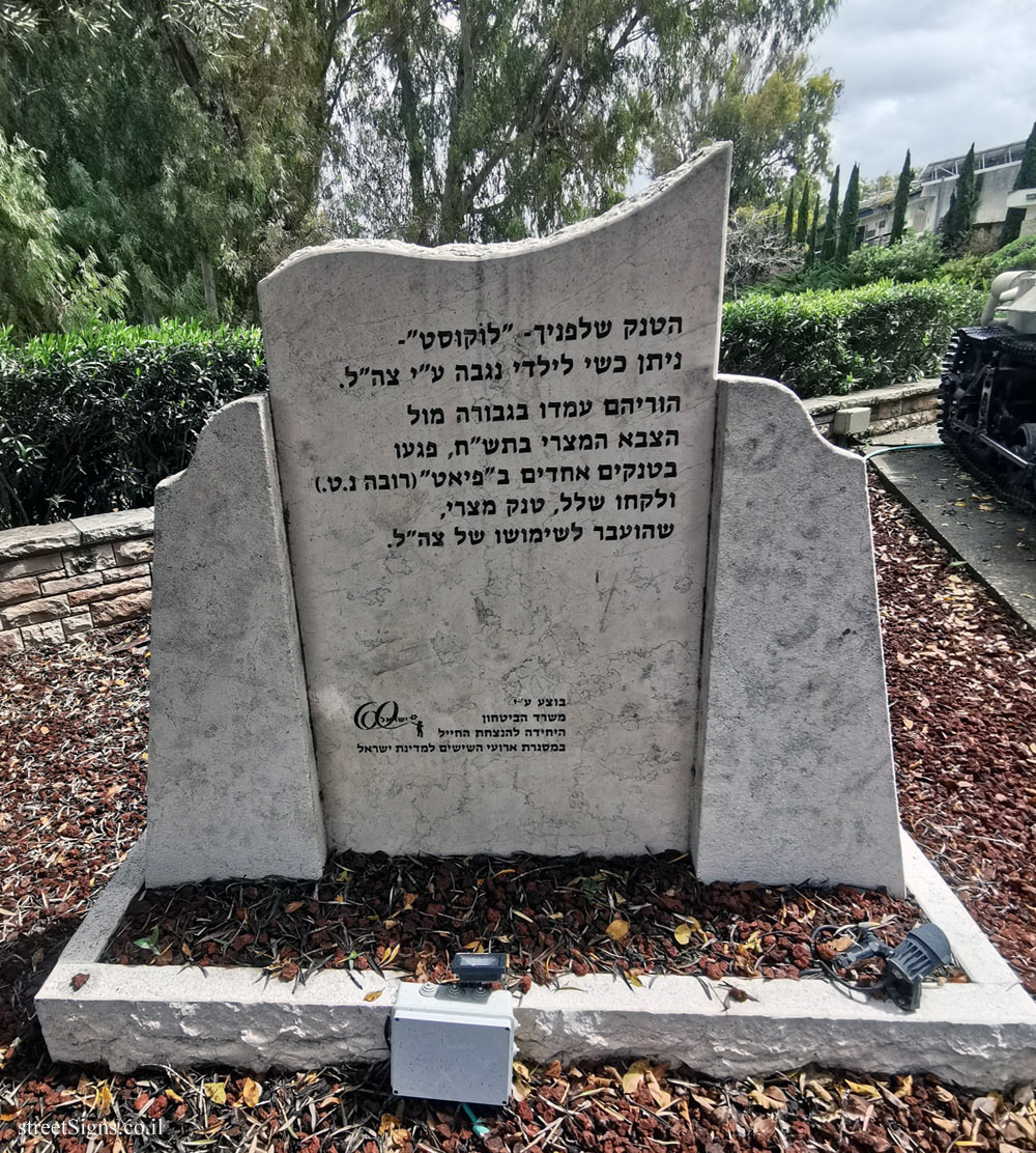
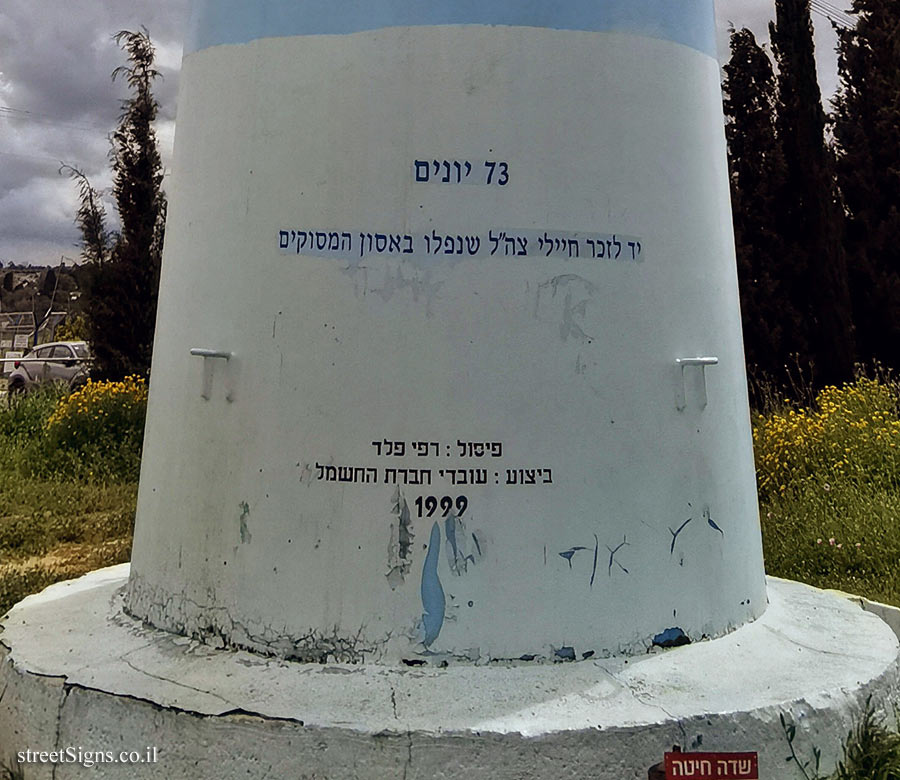
On the sign:
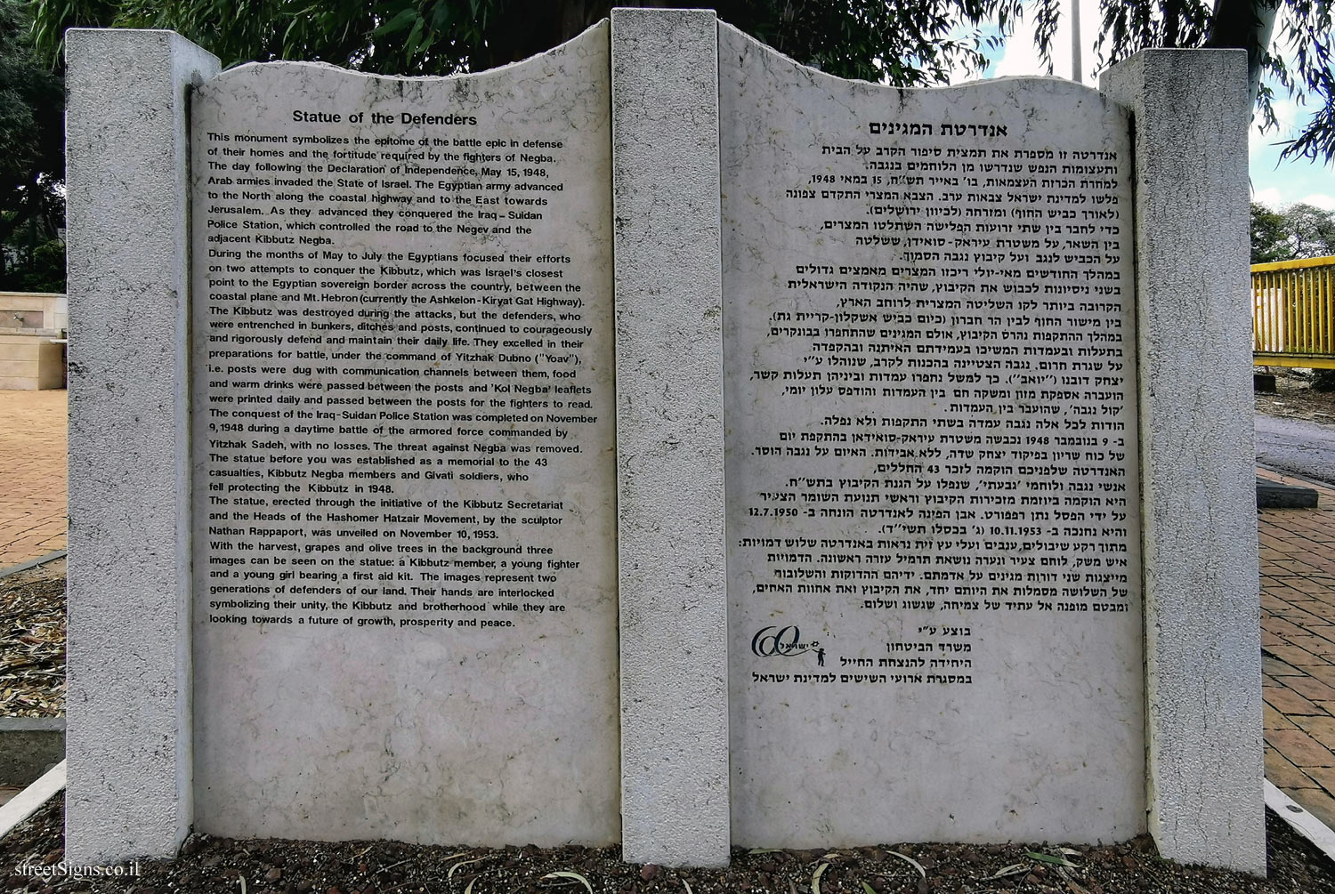
אנדרטת המגינים
אנדרטה זו מספרת את תמצית סיפור הקרב על הבית ותעצומות הנפש שנדרשו מן הלוחמים בנגבה. למחרת הכרזת העצמאות, בו ’ באייר תש"ח, 15 במאי1948 , פלשו למדינת ישראל צבאות ערב. הצבא המצרי התקדם צפונה (לאורך כביש החוף) ומזרחה (לכיוון ירושלים).
כדי לחבר בין שתי זרועות הפלישה השתלטו המצרים, בין השאר, על משטרת עיראק-סואידן, ששלטה על הכביש לנגב ועל קיבוץ נגבה הסמוך.
במהלך החודשים מאי-יולי ריכזו המצרים מאמצים גדולים בשני ניסיונות לכבוש את הקיבוץ, שהיה הנקודה הישראלית הקרובה ביותר לקו השליטה המצרית לרוחב הארץ, בין מישור החוף לבין הר חברון (כיום כביש אשקלון - קריית גת).
במהלך ההתקפות נהרס הקיבוץ, אולם המגינים שהתחפרו בבונקרים, בתעלות ובעמדות המשיכו בעמידתם האיתנה ובהקפדה על שגרת חרום, נגבה הצטיינה בהכנות לקרב, שנוהלו ע"י יצחק דובנו ("יואב"), כך למשל נחפרו עמדות וביניהן תעלות קשר, הועברה אספקת מזון ומשקה חם בין העמדות והודפס עלון יומי, ’ קול נגבה ’, שהועבר בין העמדות.
הודות לכל אלה נגבה עמדה בשתי התקפות ולא נפלה.
ב- 9 בנובמבר 1948 נכבשה משטרת עיראק-סואידאן בהתקפת יום של כוח שריון בפיקוד יצחק שדה, ללא אבידות. האיום על גגבה הוסר. האנדרטה שלפניכם הוקמה לזכר 43 החללים, אנשי נגבה ולוחמי’ גבעתי ’, שנפלו על הגנת הקיבוץ בתש"ח.
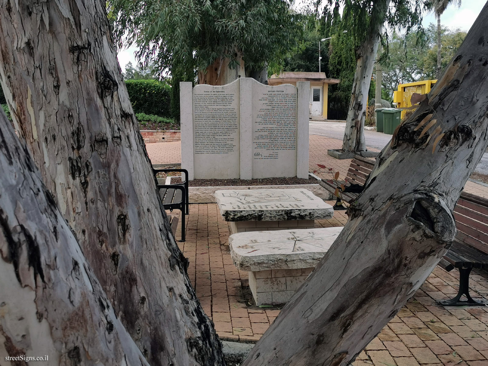
היא הוקמה ביוזמת מזכירות הקיבוץ וראשי תנועת השומר הצעיר על ידי הפסל נתן רפפורט. אבן הפינה לאנדרטה הונחה ב- 12.7.1950 והיא נחנכה ב- 10.11.1953 (ג ’ בכסלו תשי"ד).
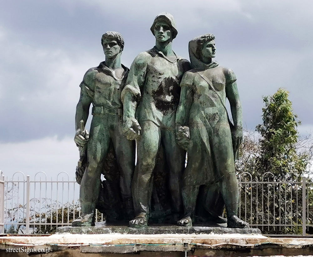
מתוך רקע שיבולים, ענבים ועלי עץ זית נראות באנדרטה שלוש דמויות :איש משק, לוחם צעיר ונערה נושאת תרמיל עזרה ראשונה. הדמויות מייצגות שני דורות מגינים על אדמתם. ידיהם ההדוקות והשלובות של השלושה מסמלות את היותם יחד, את הקיבוץ ואת אחוות האחים, ומבטם מופנה אל עתיד של צמיחה, שגשוג ושלום.
בוצע ע"י משרד הביטחון
היחידה להנצחת החייל
במסגרת ארועי השישים למדינת ישראל
Statue of the Defenders
This monument symbolizes the epitome of the battle epic in defense of their homes and the fortitude required by the fighters of Negba.
The day following the Declaration of Independence, May 15, 1948, Arab armies invaded the State of Israel. The Egyptian army advanced to the North along the coastal highway and to the East towards Jerusalem. As they advanced they conquered the Iraq-Suidan Police Station, which controlled the road to the Negev and the adjacent Kibbutz Negba.
During the months of May to July the Egyptians focused their efforts on two attempts to conquer the Kibbutz, which was Israel’s closest point to the Egyptian sovereign border across the country, between the coastal plane and Mt. Hebron (currently the Ashkelon-Kiryat Gat Highway).
The Kibbutz was destroyed during the attacks, but the defenders, who were entrenched in bunkers, ditches and posts, continued to courageously and rigorously defend and maintain their daily life. They excelled in their preparations for battle, under the command of Yitzhak Dubno ("Yoav"), i.e. posts were dug with communication channels between them, food and warm drinks were passed between the posts and ’Kol Negba’ leaflets were printed daily and passed between the posts for the fighters to read.
The conquest of the Iraq-Suidan Police Station was completed on November 9,1948 during a daytime battle of the armored force commanded by Yitzhak Sadeh, with no losses. The threat against Negba was removed.
The statue before you was established as a memorial to the 43 casualties, Kibbutz Negba members and Givati soldiers, who fell protecting the Kibbutz in 1948.
The statue, erected through the initiative of the Kibbutz Secretariat and the Heads of the Hashomer Hatzair Movement, by the sculptor Nathan Rappaport, was unveiled on November 10, 1953.
With the harvest, grapes and olive trees in the background three images can be seen on the statue: a Kibbutz member, a young fighter and a young girl bearing a first aid kit. The images represent two generations of defenders of our land. Their hands are interlocked symbolizing their unity, the Kibbutz and brotherhood while they are looking towards future of growth, prosperity and peace.


 Click for a larger image
 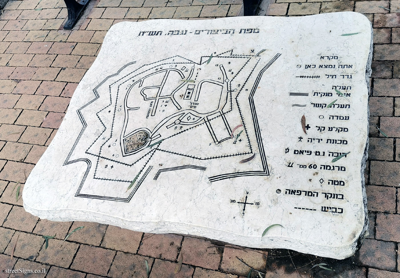 Click for a larger image
  Click for a larger image