You must turn on the browser location services to get the route from your current location to the sign, and the distance (as the crow flies) from your current location to the sign.
After activating location services, refresh the page.
On the sign:
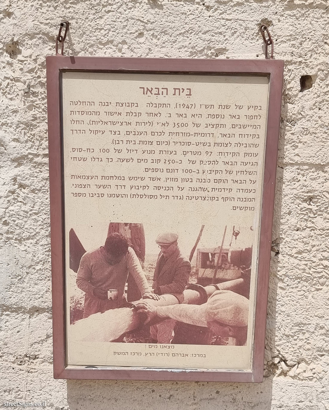
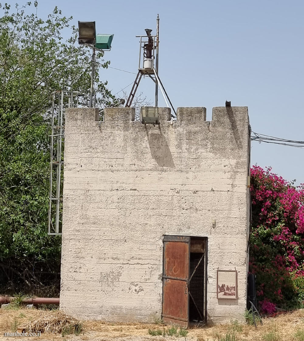
בֵּית הַבְּאֵר בקיץ של שנת תש"ז (1947), התקבלה בקבוצת יבנה ההחלטה לחפור באר נוספת, היא באר ב’. לאחר קבלת אישור מהמוסדות המיישבים, ותקציב של 3500 לא"י (לירות ארצישראליות), החלו בקידוח הבאר, דרומית-מזרחית לכרם הענבים, בצד עיקול הדרך שהובילה לצומת בשיט - סוכריר ( כיום צומת בית רבן ). עומק הקידוח: 97 מטרים. בעזרת מנוע דיזל של 100 כח-סוס, הגיעה הבאר להספק של כ -250 קוב מים לשעה. כך גדלו שטחי השלחין של הקיבוץ ב -100 דונם נוספים. על הבאר הוקם מבנה בטון מזוין, אשר שימש במלחמת העצמאות כעמדה קידמית שהגנה על הכניסה לקיבוץ דרך השער הצפוני. המבנה הוקף בקונצרטינה (גדר תיל מסולסלת) והוטמנו סביבו מספר מוקשים.
[תמונה: מצאנו מים! במרכז: אברהם (רודי) הרץ, מרכז המשק]
Beit Habe’er In the summer of 1947, the Yavneh group decided to dig another well, Beer B. After receiving approval from the settler institutions, and a budget of 3,500 Israeli pounds (Palestine pounds), they began drilling the well, southeast of the grape vineyard. On the side of the bend in the road that led to the Bashit-Sukhrir junction (now Beit Raban junction). Drilling depth: 97 meters. With the help of a 100-horsepower diesel engine, the well reached a capacity of about 250 cubic meters of water per hour. Thus, the kibbutz’s irrigated areas increased by an additional 100 dunams. A reinforced concrete structure was erected on the well, which served during the War of Independence as a front post that protected the entrance to the kibbutz through the northern gate. The building was surrounded by a concertina (a curled barbed wire fence) and a number of mines were planted around it.
[Image: We found water! In the center: Avraham (Rudy) Hertz, Kibbutz Secretary]