You must turn on the browser location services to get the route from your current location to the sign, and the distance (as the crow flies) from your current location to the sign.
After activating location services, refresh the page.
On the sign:
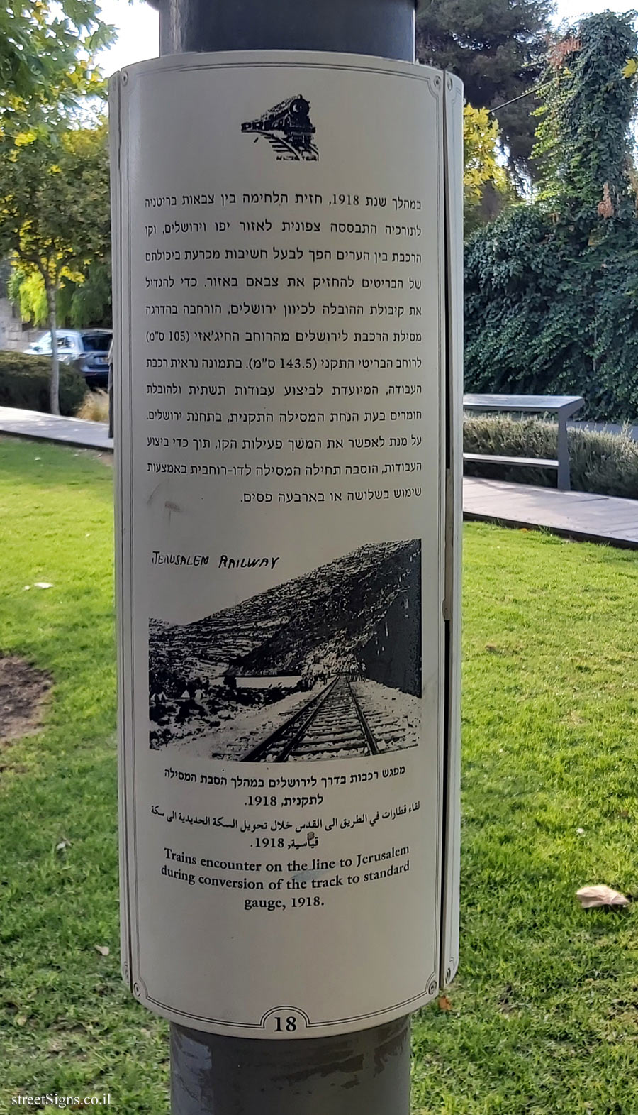
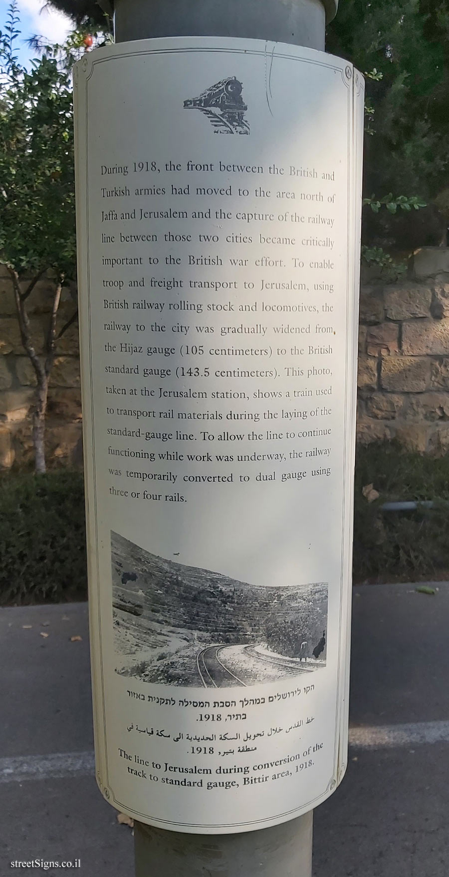
במהלך שנת 1918, חזית הלחימה בין צבאות בריטניה לתורכיה התבססה צפונית לאזור יפו וירושלים, וקו הרכבת בין הערים הפך לבעל חשיבות מכרעת ביכולתם של הבריטים להחזיק את צבאם באזור. כדי להגדיל את קיבולת ההובלה לכיוון ירושלים, הורחבה בהדרגה מסילת הרכבת לירושלים מהרוחב החיג’אזי (105 ס"מ) לרוחב הבריטי התקני (143.5 ס"מ). בתמונה נראית רכבת העבודה, המיועדת לביצוע עבודות תשתית ולהובלת חומרים בעת הנחת המסילה התקנית, בתחנת ירושלים. על מנת לאפשר את המשך פעילות הקו, תוך כדי ביצוע העבודות, הוסבה תחילה המסילה לדו-רוחבית באמצעות שימוש בשלושה או בארבעה פסים. [מדובר על התמונה המוצגת ב: צד-2] [This is the image shown in: Side-2]
[תמונה] [Image] מפגש רכבות בדרך לירושלים במהלך הסבת המסילה לתקנית, 1918 لقاء قطارات في الطريق الى القدس خلال تحويل السكة الحديدية الى مكة قياسية , 1918 Trains encounter on the line to Jerusalem during conversion of the track to standard gauge, 1918.
18
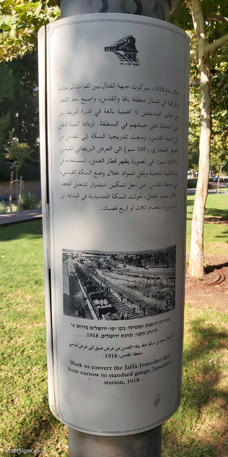
[צד 2] [Side 2] عام 1918 ، تمركزت جبهة القتال بين القوات البريطانية رتبه في شمال منطقة يافا والقدس ، واصبح خط الفقار بين هاتين المدينتين ذا أهمية بالغة في قدرة البريطانيين على الحفاظ على جيشهم في المنطقة . لزيادة كمية النقل في اتجاه القدس ، وسعت تدريجيا السكة إلى القدس من العرض الحجازي (105 سم) إلى العرض البريطاني القياسي (143.5 سم) . في الصورة يظهر قطار العمل ، المستخدم في بناء البنية التحتية ونقل المواد خلال وضع السكة القياسي ، في مع با محطة القدس ، من اجل تمكين استمرار تشغيل الخط ، خلال تنفيذ العمل ، حولت السكة الحديدية في البداية إلى مسارين باستخدام ثلاث أو أربع قضبان .
[תמונה] [Image] עבודות להסבת המסילה בקו יפו-ירושלים מורחב צר לרוחב תקני. תחנת ירושלים, 1918 اعمال تحويل سكة خط يافا - القدس من عرض ضيق الى عرض قياسي محطة القدس ، 1918 Work to convert the Jaffa-Jerusalem line from narrow to standard gauge, Jerusalem station, 1918.
[צד 3] [Side 3] During 1918, the front between the British and Turkish had moved to the area north of Jaffa and Jerusalem and the capture of the railway line between those two cities became critically important to the British war effort. To enable troops and freight transport to Jerusalem, using British railway rolling stock and locomotives, the railway to the city was gradually widened from the Hijaz gauge (105 centimeters) to the British standard gauge (143.5 centimeters). This photo, taken at the Jerusalem station, shows a train used to transport rail materials during the laying of the standard-gauge line. To allow the line to continue functioning while work was underway, the railway was temporarily converted to dual gauge using three or four rails. [מדובר על התמונה המוצגת ב: צד-2] [This is the image shown in: Side-2]
[תמונה] [Image] הקו לירושלים במהלך הסבת המסילה לתקנית באזור בתיר, 1918 خط القدس خلال تحويل السكة الحديدية الى مكة قياسية في منطقة بشيرد 1918 The line to Jerusalem during conversion of the track to standard gauge, Bittir area, 1918.
Sign No. 18 in a series of signs placed on or around lighting poles, including the history of the old railway line to Jerusalem, along which its route extends the HaMesila (Railway) Park.
In the next picture taken that day you can see the old railway track that became a pedestrian track, a bike path next to it, and the sign that surrounds one of the lighting poles Click for a larger image


 Click for a larger image
 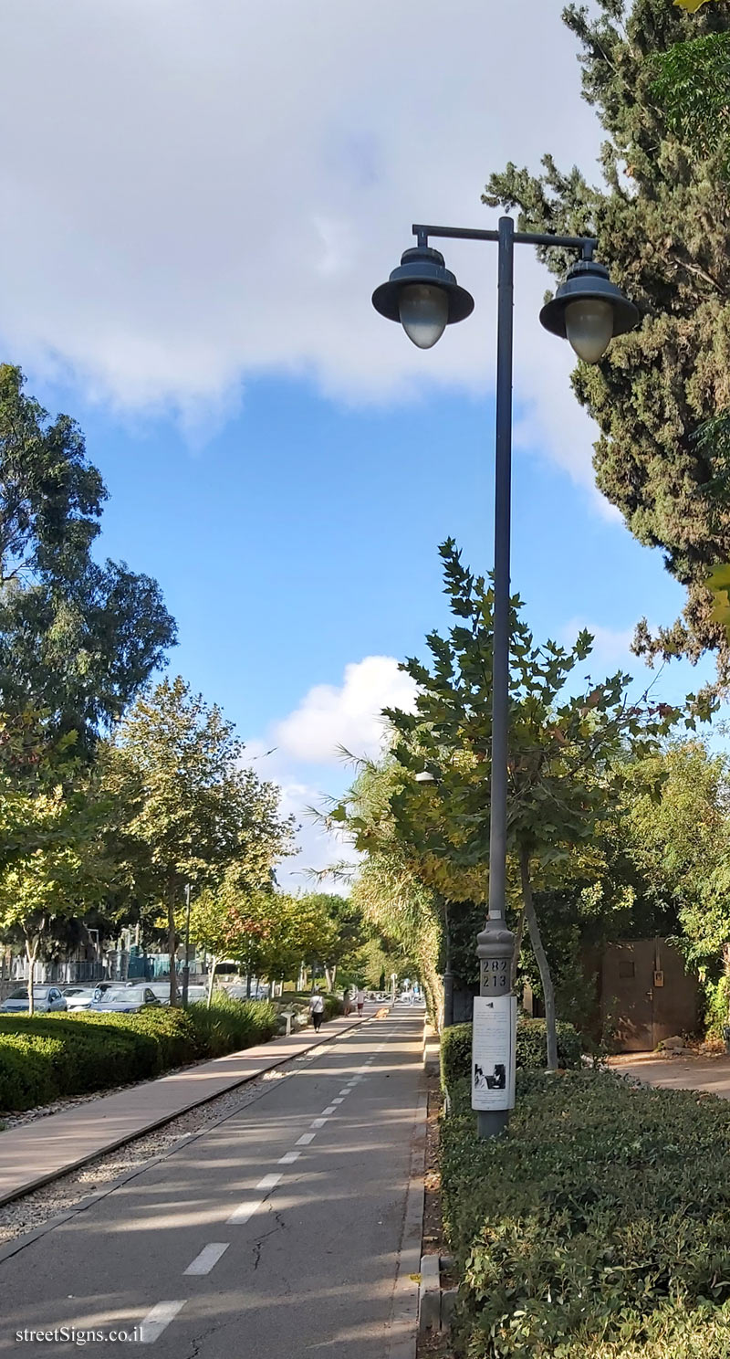 Click for a larger image


 Click for all signs belonging to Jerusalem - HaMesila Park - History of the railway line
 Click for the map of all signs belonging to Jerusalem - HaMesila Park - History of the railway line
  Click for the route that starts with this sign and goes through the signs belonging to Jerusalem - HaMesila Park - History of the railway line
 Click for more details on Jerusalem - HaMesila Park - History of the railway line
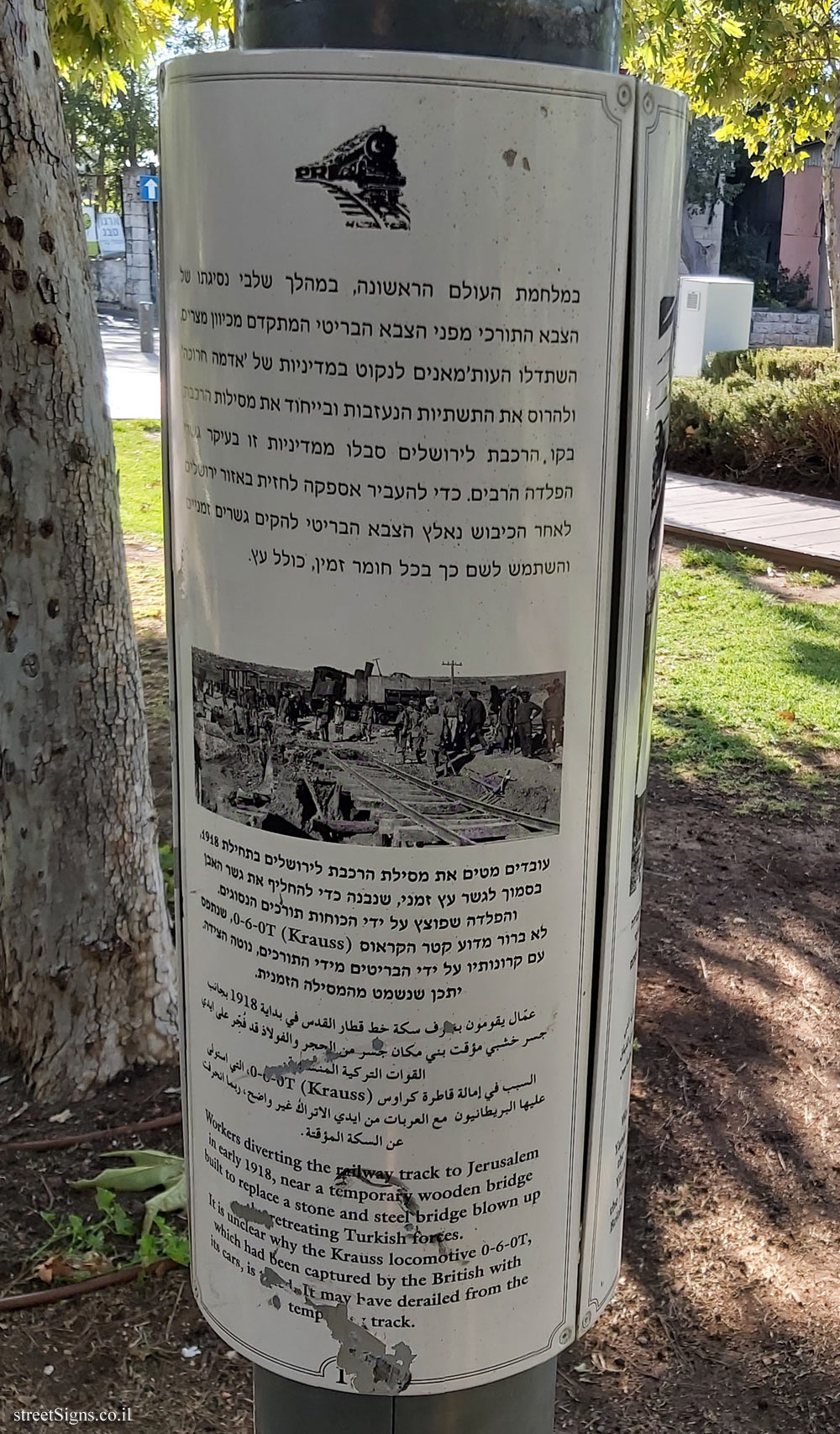
 The closest sign from this series (36 Meter): Jerusalem - HaMesila Park - 1918 - Destruction of the railway by the Turks (17)
 ")
") 37 Meter
37 Meter") 56 Meter
56 Meter") 74 Meter
74 Meter") 93 Meter
93 Meter") 93 Meter
93 Meter