The battle took place on September 10, 1956. In many places, the incident is referred to as the "Al-Dawayima Incident" as opposed to the "Battle of Al-Dawayima" (or the Al-Dawayima Affair, the Al-Dawayima Massacre), an event during the War of Independence in which dozens of Arab civilians were killed during the occupation of the village.
The sign is one of a series of signs located in the shed located at the Lachish command training base.
The shed was photographed on the same day by the same photographer
 Click for a larger image
 The location is approximate since no geographic information was attached to the image
Translation of the text on the sign:
[Israel Defense Forces Symbol]
[Symbol of the Midrasha of the South]
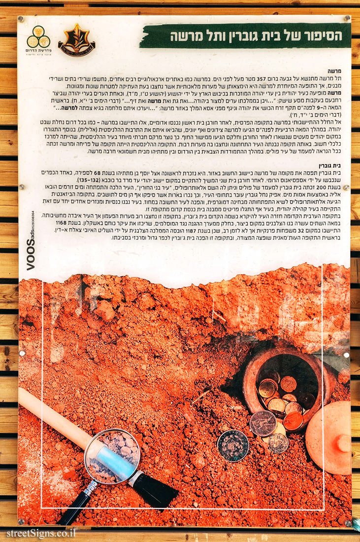
The story of Beit Govrin and Tel Mareshah Mareshah
Tel Mareshahrises on a hill 357 meters above sea level. In Mareshah, as in many other archaeological sites, remains of houses and remains of buildings were uncovered, but the phenomenon that is special to Mareshah is the presence of artificial caves that were carved in ancient times for different and diverse purposes. Mareshah appears as a Jewish city among the cities of Judah mentioned in the conquest of the land by Joshua (Joshua 15, 44), and as one of the cities in the cities of Judah that Rehoboam besieged following the campaign of Shishak: "...and built cities for defence in Judah .. and Gath, and Mareshah, and Ziph..." (2 Chronicles 11:8). At the beginning of the 9th century BC, Zerah the Ethiopian attacked Judah and defeated King Asa in the area of Marsha: "...and they set the battle in array in the valley of Zephath at Mareshah.. ." (2 Chronicles 14:8).
Into the settlement space in Mareshah during the Persian period, after the destruction of the First Temple, Edomites entered, they settled in Marsha - as in the entire southern portion of the tribe of Judah. During the fourth century BC, Sidonians and even Greeks arrived in Marsha, bringing with them the Hellenistic (pagan) culture. In addition, a few Jews who remained after the destruction lived there and some of them came from the coastal plain. This is how a special social fabric was created in the Hellenistic city, which was an important economic center. At that time, it was built the lower city and many caves were excavated in it. The Hellenistic period was a period of prosperity and Mareshah probably gained the status of a polis city. During the military confrontation between Herod and Matthias of the Hasmonean house, Mareshah was destroyed.
Beit Guvrin
Beit Govrin took Marsha’s place as the most important settlement in the region. It is mentioned for the first time by Josephus ben Mattathias in 68 AD, as one of the villages conquered by the Roman Vespasian. After the destruction of the Second Temple, a Jewish settlement continued to exist there until the Bar Kochba Revolt (132-135).
In 200, Beit Govrin gained the status of a polis and was given the name Alaotropolis, "City of the Free", the city continued to develop and flowing water was brought to it through aqueducts. The channel of Nahal Govrin passes through the city limits, and thus wells were dug which also supplied water to the residents. During the Byzantine period, Altaotropolis reached the peak of its demographic development, and became the most important city in the district. Several churches and monasteries were built in the city, at the same time a Jewish community existed in the city, items from an ancient synagogue building from this period were even discovered in the city.
In the early Arab period, the city went back to being called by its old name Beit Jubrin, during this period most of the bell caves were carved but the city lost its importance. In the twelfth century, the Crusaders built a fortification instead, as part of the defense system against the Muslims, who concentrated most of their power in Ashkelon. In 1168, 32 Frankish families settled there, but not for long, as in 1187 the Crusader kingdom was defeated by the Ayyubid ruler Saladin. At the beginning of the Ottoman period, the citadel was renovated, and during this period Beit Jobrin became a large and central village in its surroundings.
Learn about: