You must turn on the browser location services to get the route from your current location to the sign, and the distance (as the crow flies) from your current location to the sign.
After activating location services, refresh the page.
On the sign:
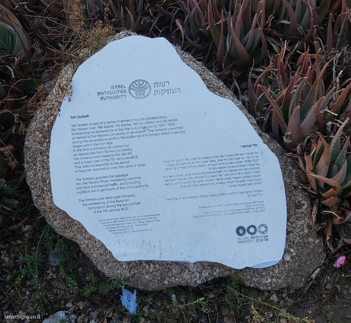
רשות העתיקות ISRAEL ANTIQUITIES AUTHORITY
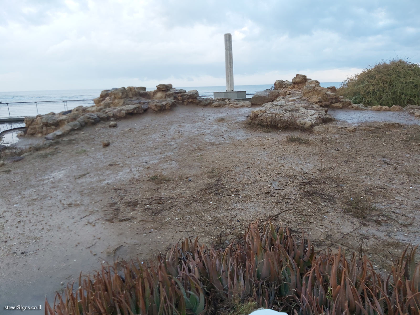
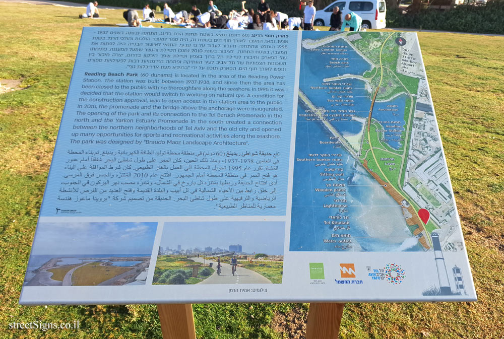
תל קודאדי תל קודאדי הוא חלק ממערך של תלים המשתרעים לאורך נחל הירקון. תל קסילה, תל ג’ריסה, תל אבו-זיתון ותל אפק. באתר נערכו חפירות ארכיאולוגיות בשנים 1937-1938 מטעם האוניברסיטה העברית, ונחשפו שרידים המעידים על קיומה של מצודה משלבים שונים בתקופת הברזל. בפרסום החפירות שנעשה בידי חוקרים מאוניברסיטת תל-אביב, תוארכו השרידים לשלהי המאה ה-8 ולחלק הארי של המאה ה-7 לפנה"ס, פרק זמן אשר תואם את תקופת השלטון האשורי בארץ-ישראל. המצודה חלשה על הכניסה לירקון, שימשה תחנת בקרה ומכסה על תובלה יבשתית וימית וסיפקה עזרה לוגיסטית לחילות מצב מטעם השלטון.
המצודה חרבה עם היחלשות הלשטון האשורי במהלך המחצית השנייה של המאה ה-7 לפנה"ס.
בשנת 2007 בוצעו עבודות שימור וחיזוק ע"י רשות העתיקות. במסגרת עבודת פיתוח האתר. ניהול: חב’ אתרים בע"מ. תכנון: ברוידא - מעוז אדריכלות נוף בע"מ. פיקוח: שגיאבר הנדסה וניהול פרויקטים בע"מ. ביצוע: דלויה מרכז הבנייה בע"מ.
לוגו אוניברסיטת תל אביב
Tell Quadadi Tell Qudadi is part of a series of ancient mounds situated along the Yarqon river: Tell Qasile, Tel Gerisa, Tell Abu Zeitun and Tel Aphek. Archaeological excavations at the site took place during 1937-1938 on behalf of the Hebrew University of Jerusalem. The remains unearthed during the excavations point to the existence fortress dated to several stages within the Iron Age. In the final publication as carried out by researches from Tel Aviv University. the remains were dated to the late 8th and a major part of the 7th centuries BCE. This date corresponds to the period of Assyrian domination over the Land of Israel.
The fortress guarded the passage into the Yarqon River, monitoring maritime and land commercial traffic, and providing logistical aid to garrisons of the ruling authority.
The fortress was destroyed following the weakening of the Assyrian domination during the second half of the 7th century BCE.
Conservation works were carried out by the Israel Antiquities Authority in 2007 as part of the development of the site. Project management: Alarim Lid Design Braudo Maoz Landscape Architecture Ltd. Supervision: Sagibar Engineering Ltd. Contractor Delouya Building Center Ltd