You must turn on the browser location services to get the route from your current location to the sign, and the distance (as the crow flies) from your current location to the sign.
After activating location services, refresh the page.
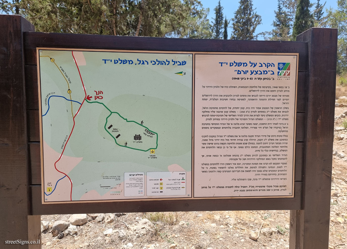
On the sign:
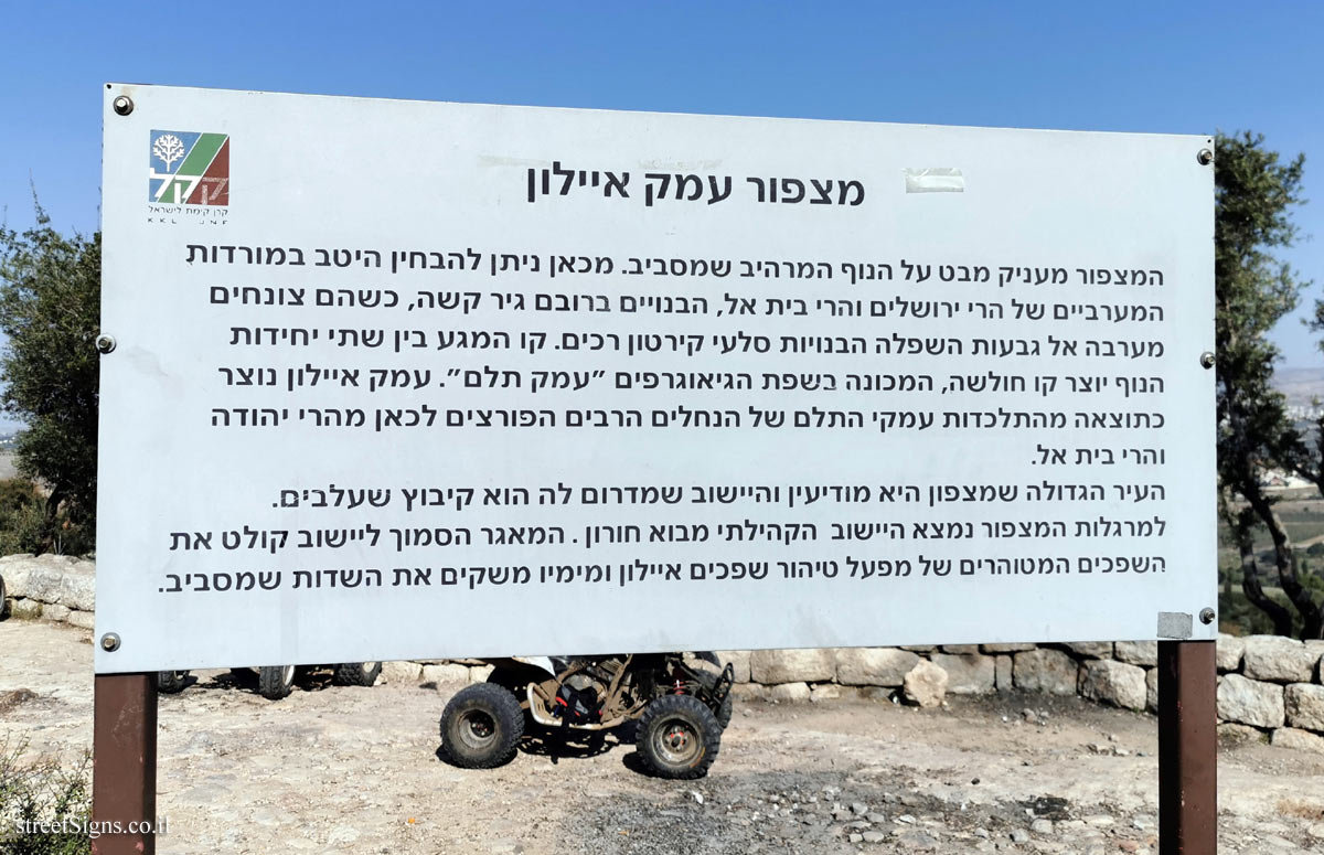
מצפור עמק איילון סמל קרן קיימת לישראל
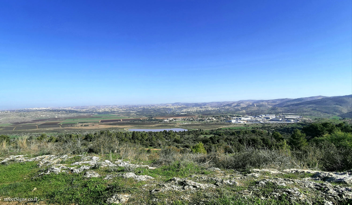
המצפור מעניק מבט על הנוף המרהיב שמסביב. מכאן ניתן להבחין היטב במורדות המערביים של הרי ירושלים והרי בית אל, הבנויים ברובם גיר קשה, כשהם צונחים מערבה אל גבעות השפלה הבנויות סלעי קירטון רכים. קו המגע בין שתי יחידות הנוף יוצר קו חולשה, המכונה בשפת הגיאוגרפים "עמק תלם". עמק איילון נוצר כתוצאה מהתלכדות עמקי התלם של הנחלים הרבים הפורצים לכאן מהרי יהודה והרי בית אל. העיר הגדולה שמצפון היא מודיעין והיישוב שמדרום לה הוא קיבוץ שעלבים. למרגלות המצפור נמצא היישוב הקהילתי מבוא חורון. המאגר הסמוך ליישוב קולט את השפכים המטוהרים של מפעל טיהור שפכים איילון ומימיו משקים את השדות שמסביב.
Translation of the text on the sign: Ayalon Valley Lookout Symbol of the Jewish National Fund
The lookout gives a view of the spectacular scenery around. From here one can clearly see the western slopes of the Jerusalem Mountains and the Beit El Mountains, most of which are built of hard limestone, as they fall west to the lowland hills built of soft chalk rocks. The line of contact between the two landscape units creates a line of weakness, known in the language of geographers as the "Furrow Valley". The Ayalon Valley was formed as a result of the fusion of the furrow valleys of the many streams that flow here from the Judean Mountains and the Beit El Mountains. The large city to the north is Modi’in and the settlement to the south is Kibbutz Sha’alvim. At the foot of the lookout is the Mevo Horon community. The reservoir near the settlement receives the purified sewage from the Ayalon sewage treatment plant and its waters irrigate the surrounding fields.