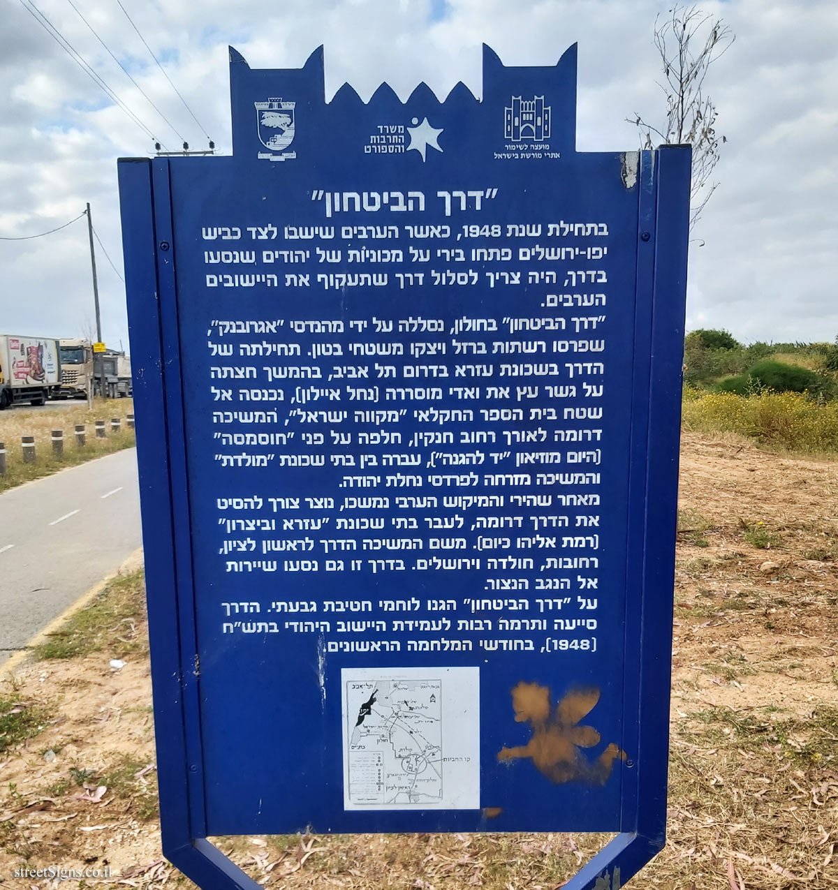
The sign shape is rectangular but its head is designed according to the silhouette of the old building of the Gymnasia Herzliya, which serves as a logo of the Council for the Preservation of Heritage Sites in Israel
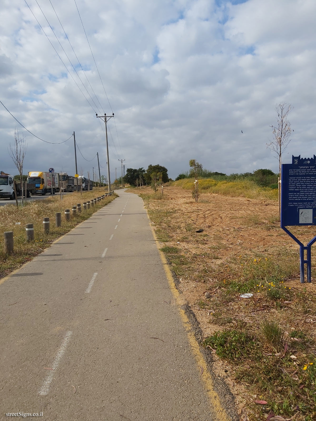
The road was photographed that day
 Click for a larger image
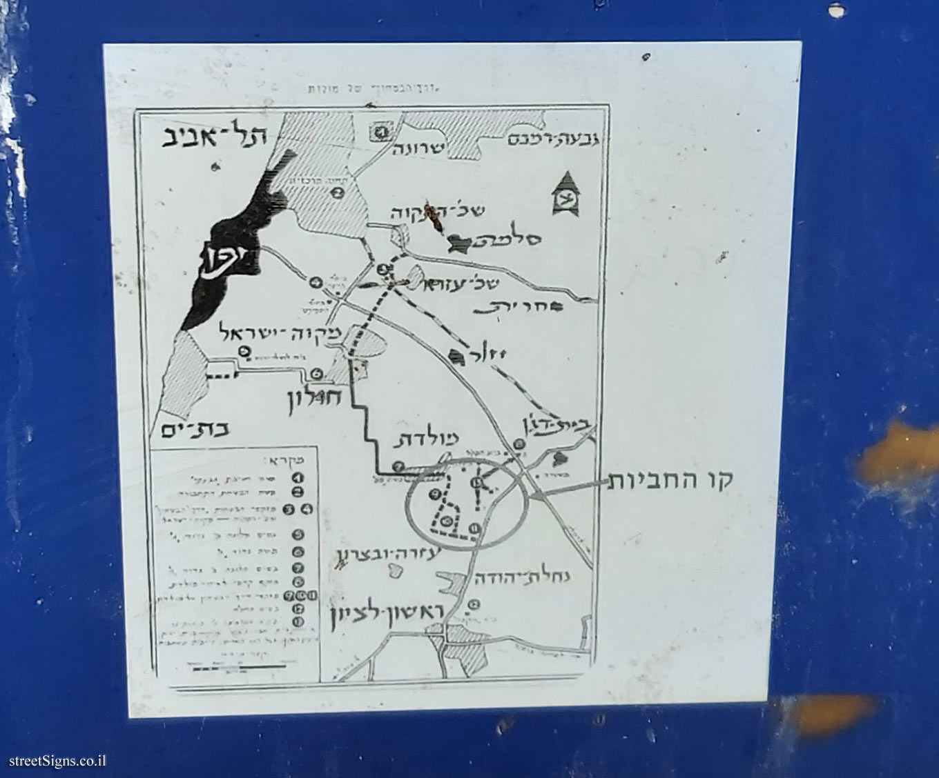
 The security road map shown on the sign is shown here in magnification
 Click for a larger image
 Another sign indicates the "barrel line" that was part of the "security road" and indicated by a circle on the map
 Click for sign's details
 The same security route is also on the sign in Mikve Israel, which has the same map as the one on the current sign
 Click for sign's details
 A section of road from the security road is preserved and indicated on the following sign
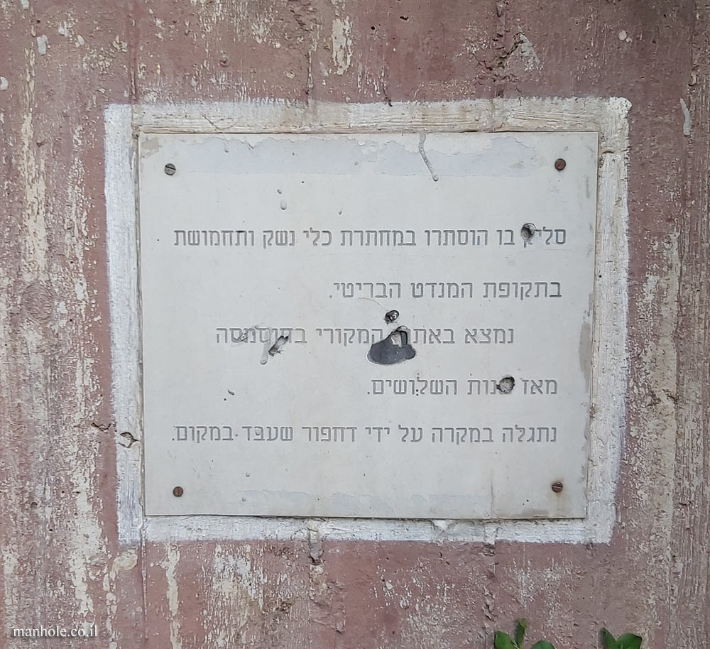
 Click for sign's details Translation of the text on the sign
:
Symbol of the Council for the Preservation of Israeli Heritage Sites
The emblem of the Ministry of Culture and Sport
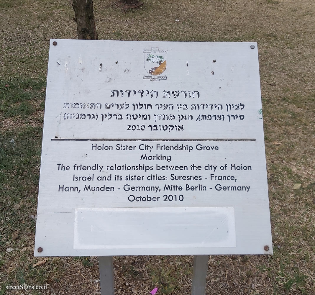
Holon city emblem
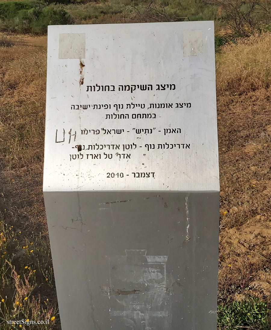
"Security Road" At the beginning of 1948, when the Arabs sitting next to the Jaffa-Jerusalem road opened fire on the cars of Jews traveling on the road, a road had to be paved to bypass the Arab settlements.
The "Security Road" in Holon was paved by Agrobank engineers, who deployed iron nets and poured concrete surfaces. The beginning of the road in the Ezra neighborhood in south Tel Aviv, later it crossed Wadi Musrara (Nahal Ayalon) on a wooden bridge, entered the area of the "Mikve Israel" agricultural school, continued south along Henkin Street, passed the "Hosmasa" (today the "Yad Museum" For HaHagana"), passed between the houses of the "Moledet "neighborhood and continued east to the orchards of Nahalat Yehuda.
As the firing and the Arab mines continued, there was a need to divert the road south, towards the houses of the "Ezra and Bitzaron" neighborhood (Ramat Eliyahu today). From there, the road continued to Rishon Lezion, Rehovot, Hulda and Jerusalem. In this way, convoys also traveled to the besieged Negev.
The Givati Brigade fighters defended the "Security Road". The road helped and contributed greatly to the Jewish community’s standing in 1948, during the first months of the war.
[Map of the security road]


 Click for all signs belonging to Heritage Sites in Israel
 Click for the map of all signs belonging to Heritage Sites in Israel
  Click for the route that starts with this sign and goes through the signs belonging to Heritage Sites in Israel
 Click for more details on Heritage Sites in Israel
 The closest sign from this series (597 Meter): Holon - Heritage Sites in Israel - "Barrel Line"
 619 Meter
 1.67 Km
 1.75 Km
 1.88 Km
 1.97 Km