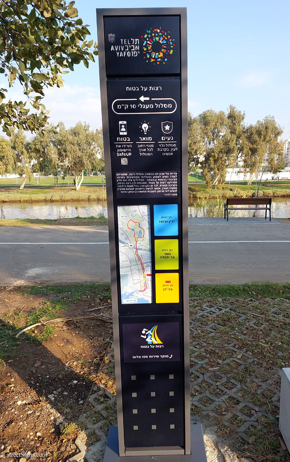
The sign that was photographed near its placement, marks the starting point for a 10 km long running track intended for women.
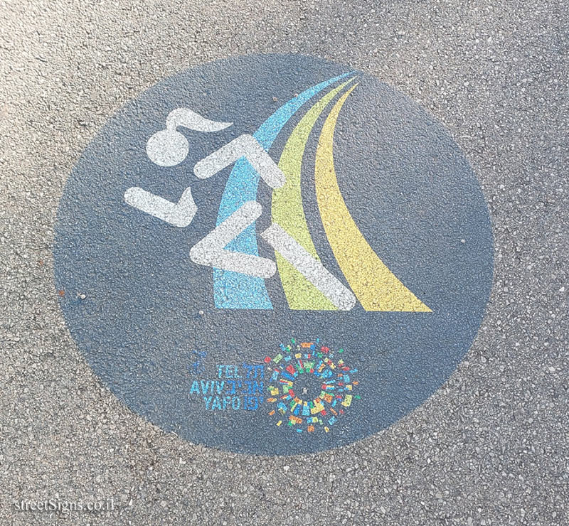
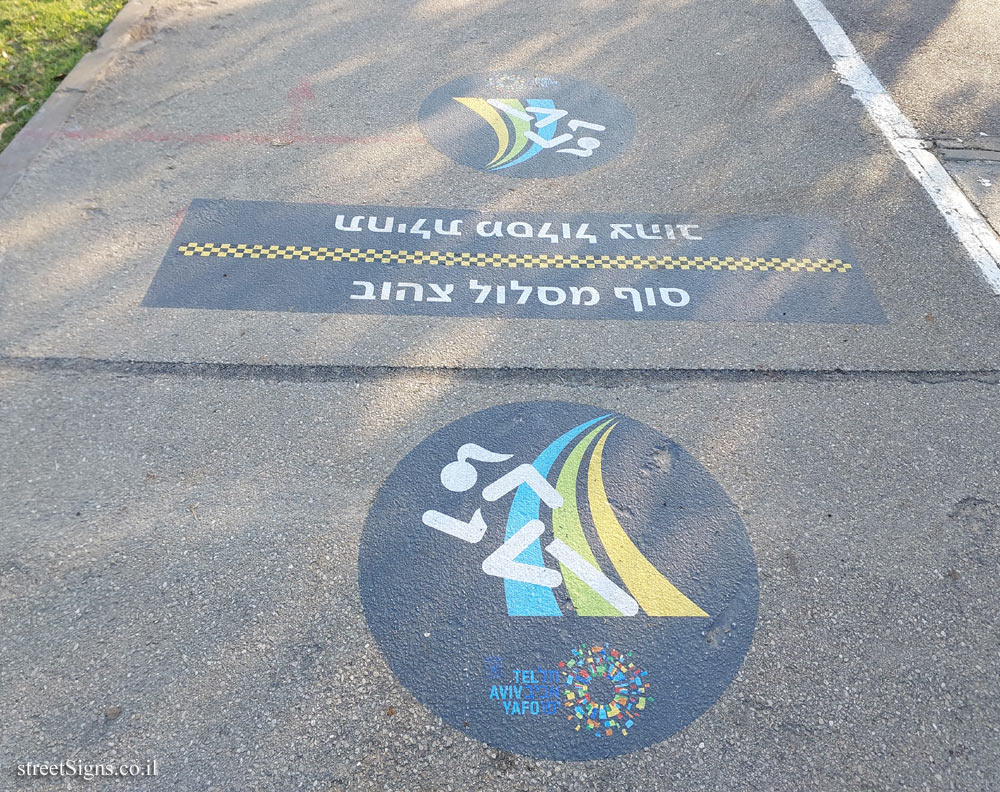
Along the route, the logo of the project "Run Safely" appears on the ground
 Click for a larger image
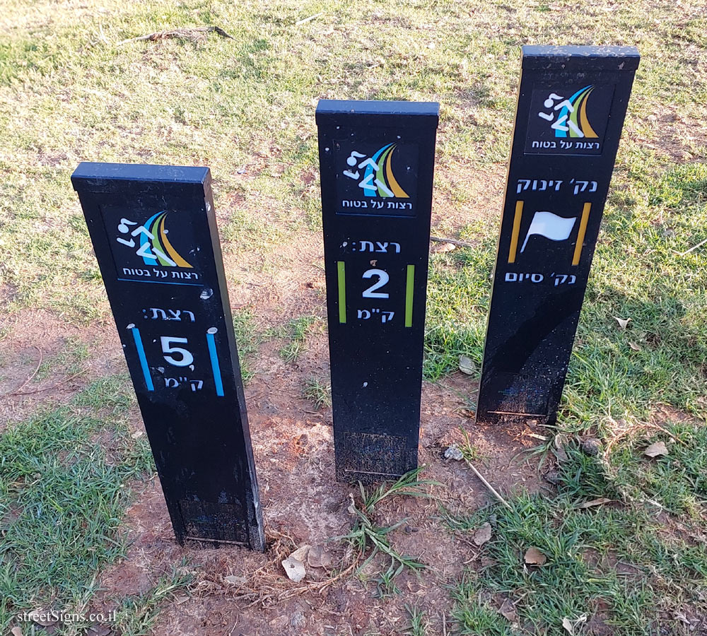
 At this point, 3 signs are placed, describing the distance traveled by the runners in each of the routes:
[Bnei Dan’s starting point]
Starting point
End point
[Starting point Bar Yehuda Bridge]
You ran 2 km
[Yakhin and Boaz starting point]
You ran 5 km
 Click for a larger image
 And next to these signs, the start/finish line is drawn on the ground
The beginning of a yellow route
end of yellow route
 Click for a larger image
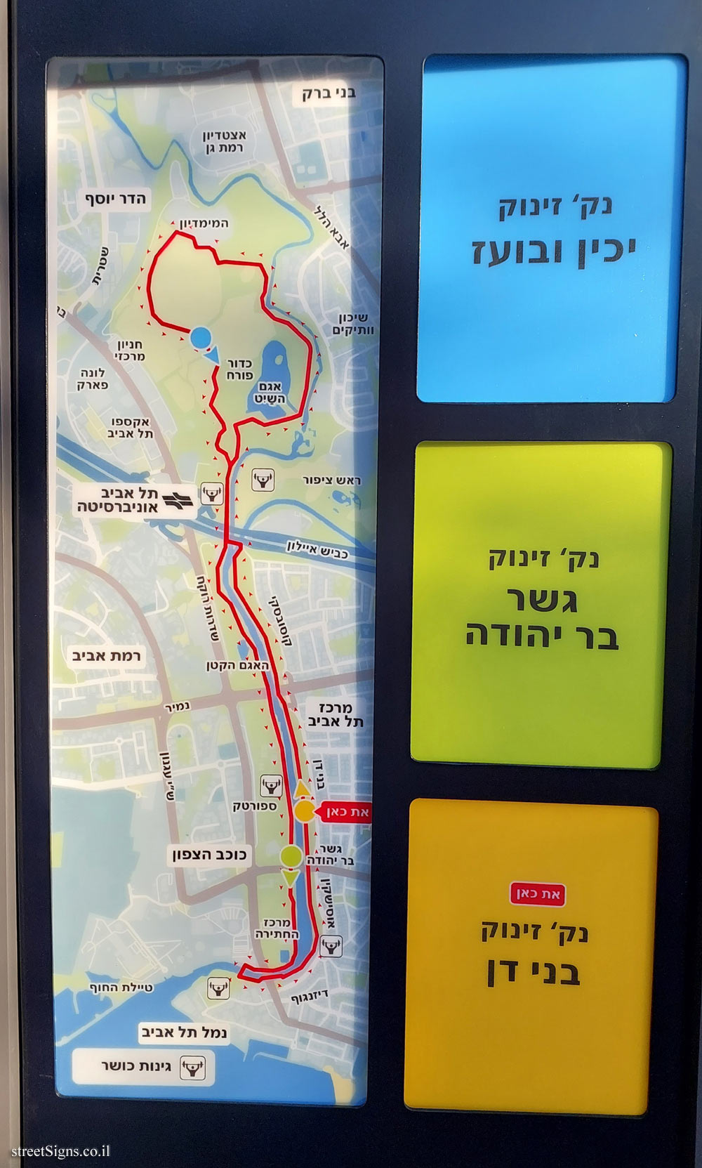
 In the next picture, the route map is enlarged
 Click for a larger image
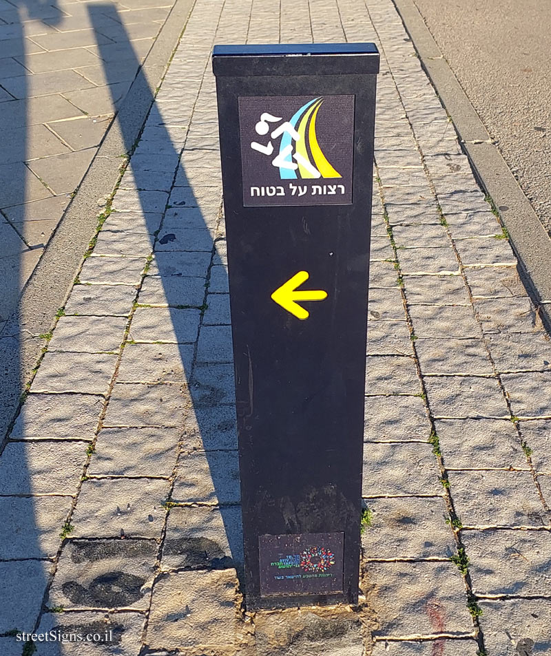
 At intersections or places where the continuation of the route is not clear, there is a post with an arrow indicating the direction
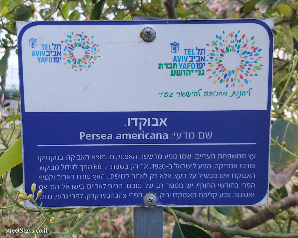
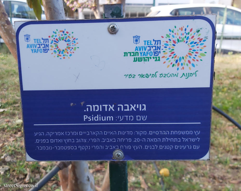
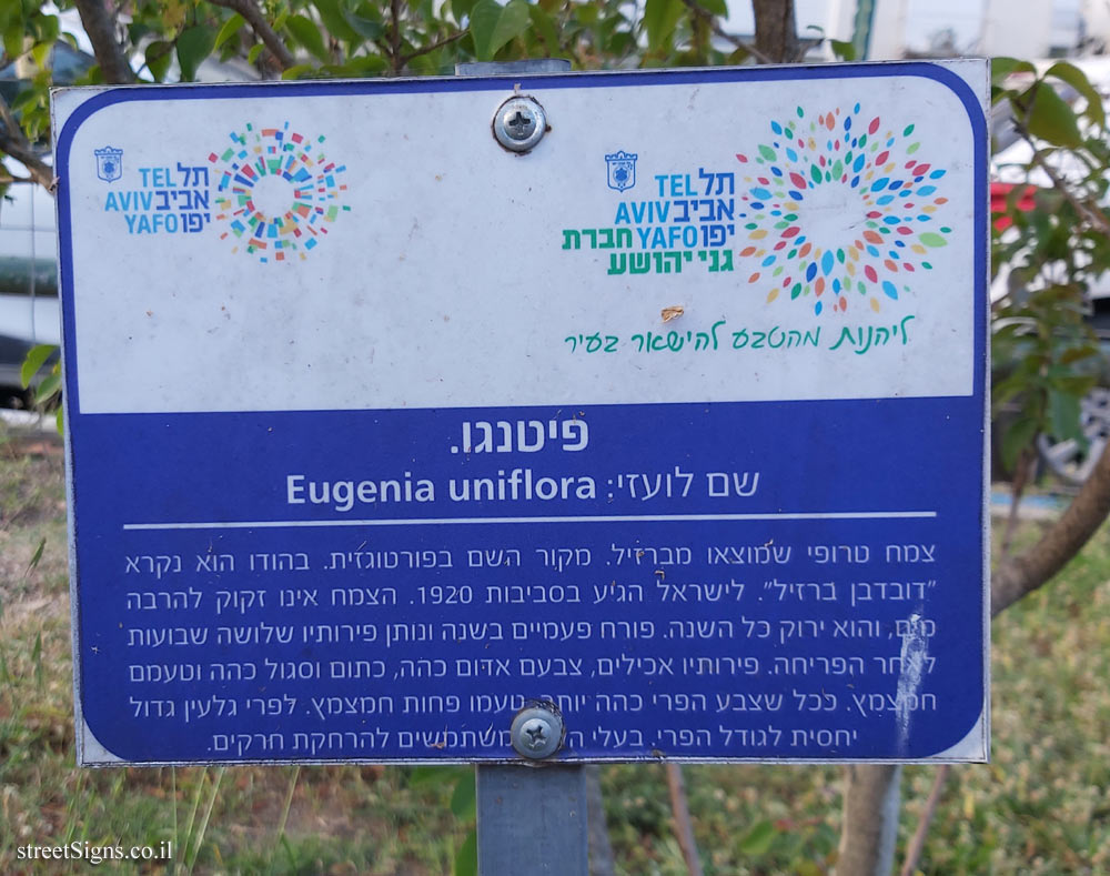
 Click for a larger image Translation of the text on the sign
:
[branding symbol of the city of Tel Aviv - Jaffa]
Safe Running
10 km circular route
Pleasant visible track; Near people!
Illuminated Street lights along the entire route
Safe Download the SafeUP app
QR code The Municipality of Tel Aviv-Yafo has established running tracks, the purpose of which is to encourage women to engage in sports activities in the public space comfortably and safely. These routes are part of the ’Safe Running’ project, which guarantees you a pleasant run, in a well-lit environment, alone or in a group, at all hours of the day. If necessary, you can use the SafeUP application that offers women remote escort to increase the sense of personal security.
Let’s go!
[Map showing the three starting points
Yehakin and Boaz
Bar Yehuda Bridge
Bnei Dan (current point)
Logo "Safe Running"
Service center 106 plus