The fortress designed to protect both against enemies and against sea water was built in 1583.
The fort was photographed on the same day by the same photographer
 Click for a larger image Translation of the text on the sign
:
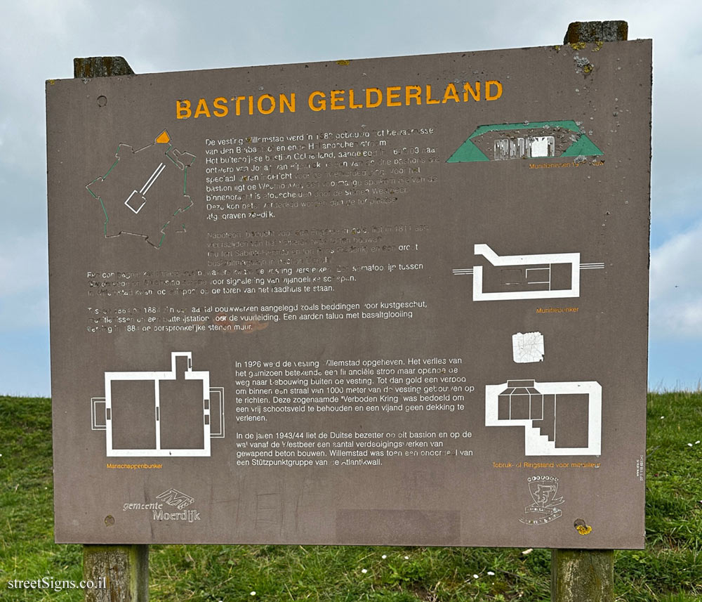
BASTION GELDERLAND
The Willemstad fortress was built in 1583 "to guard the Brabantschen ende Hollandschen Stroom". The Gelderland bastion outside the dykes, built in 1602/03 after a design by Johan van Rijswijck, is one of the many bastions specially designed for river defence. In front of the bastion is the Westhouwer, a former sluice basin that is separated from the inner moat by the stone Westbee. This could have been better defended than the seawall excavated on site.
Napoleon, fearful of an English invasion, had two fouen built on both sides of the Volkerak in 1811 (now Fort Sabina Henrica and Fort Prins Frederik) and a large buski outhouse in Haston Ulech:
A company of gunners-coastal guards came to reinforce the fortress. A semaphore line between Goedereede and Willemstad provided a signal for enemy ships.
In Willemstad, the signal box was placed on the tower of the town hall.
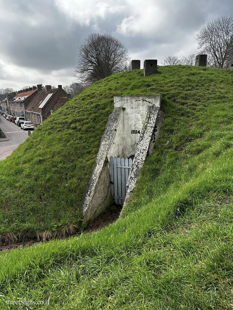
Between 1864 and 1884, a number of structures were built, such as emplacements for coastal guns, ammunition niches and a battery station for the gunnery. An earth embankment with basalt glow replaced the original stone wall in 1884.
In 1926 the Willemstad fortress was closed. The loss of the garrison meant a financial blow, but opened the way for development outside the fortress. Until then, it was forbidden to erect buildings within a radius of 1000 meters from the fortress. This so-called "Forbidden Circle" was intended to maintain a clear field of fire and not to cover an enemy.
In the years 1943/44, the German occupiers built a number of reinforced concrete defenses on this bastion and on the rampart from the Westbear. Willemstad was then part of a Stützpunktgruppe of the Atlantic Wall.
Learn about: