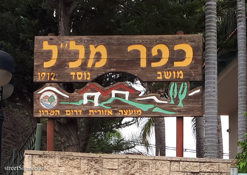
The sign shape is square but its head is designed according to the silhouette of the old building of the Gymnasia Herzliya, which serves as a logo of the Council for the Preservation of Heritage Sites in Israel
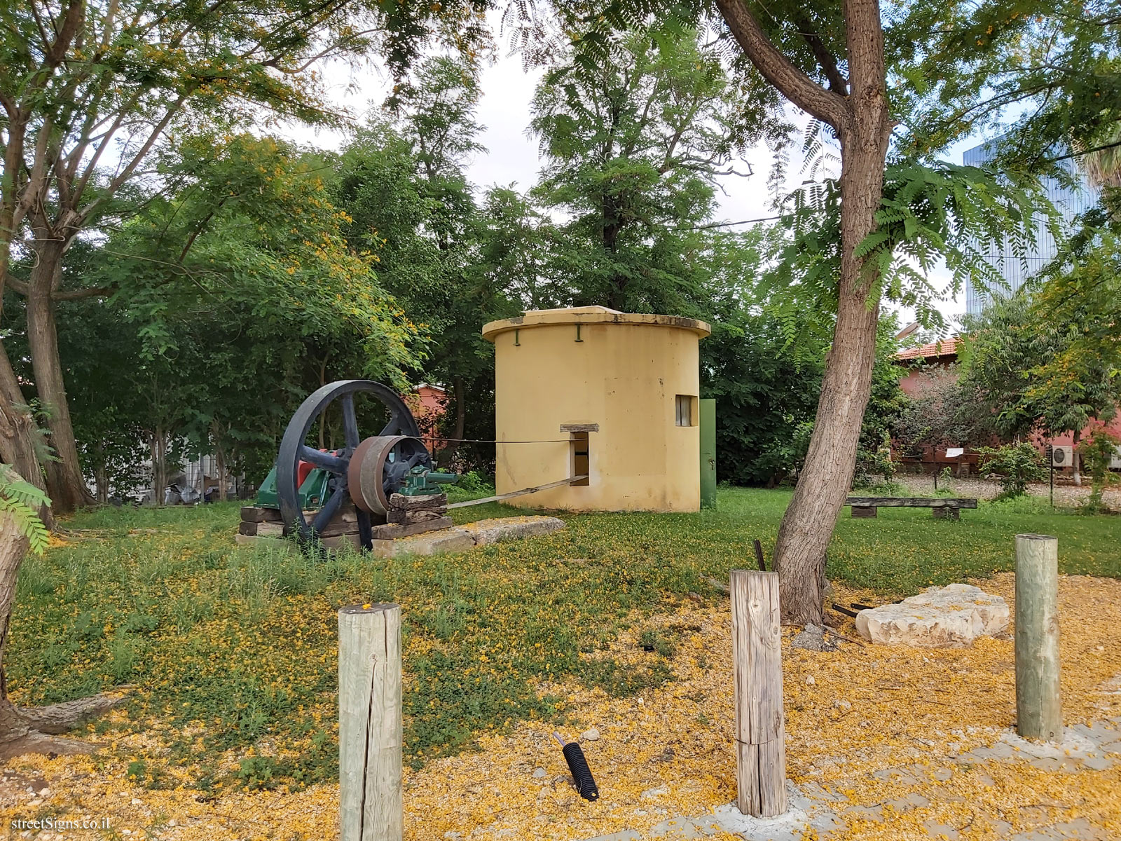
The well was taken that day
 Click for a larger image
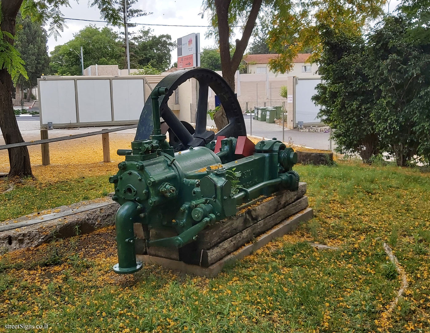
 The engine indicated on the sign is in the following image
 Click for a larger image
 On the other side of the well is another sign that also describes the history of Kfar Malal, from a rather personal point of view
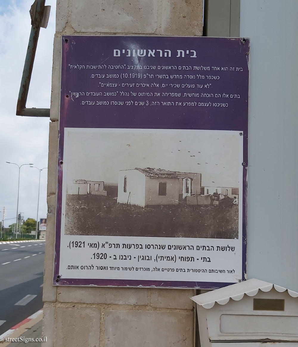
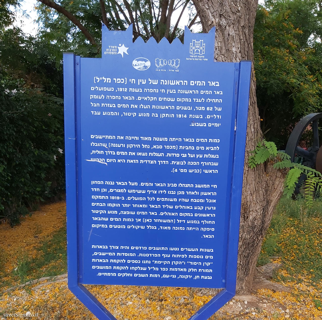
 Click for sign's details Translation of the text on the sign
:
Symbol of the Council for the Preservation of Israeli Heritage Sites
The emblem of the Ministry of Culture and Sport
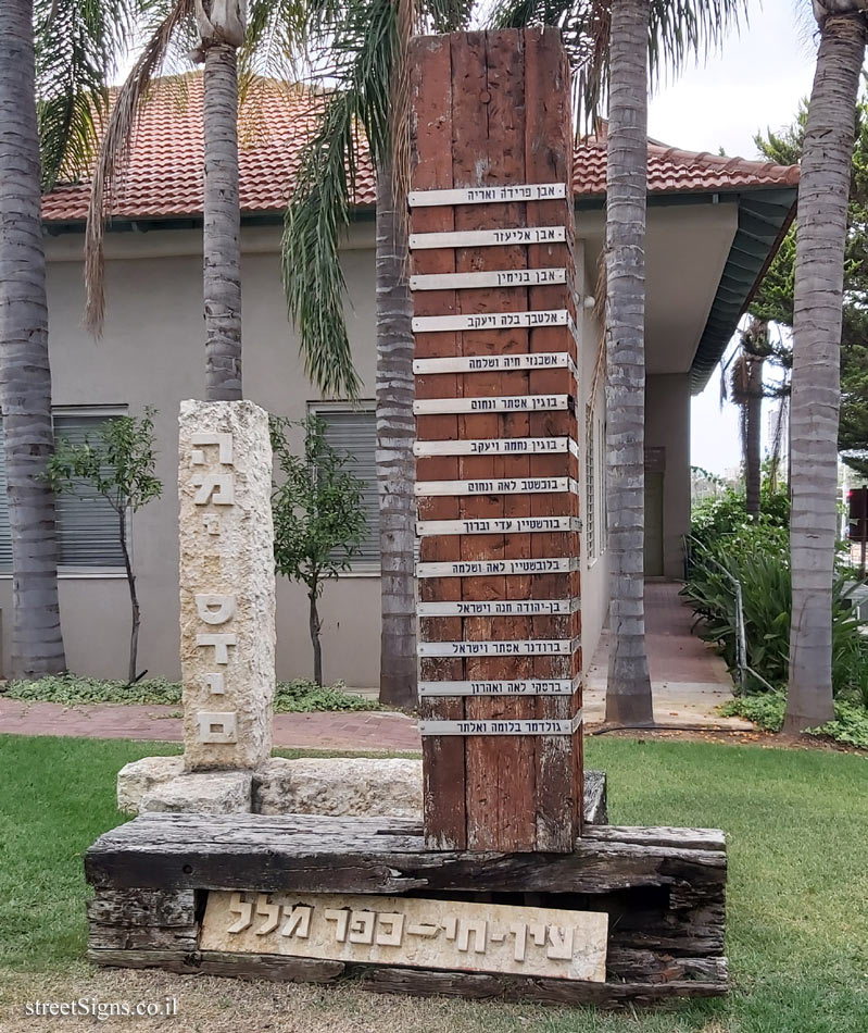
The emblem of the Kfar Malal village
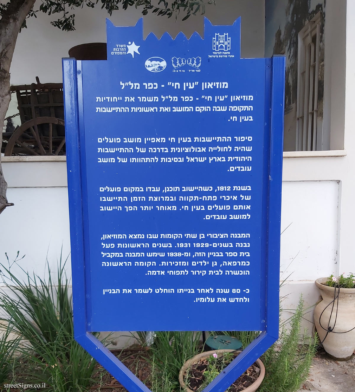
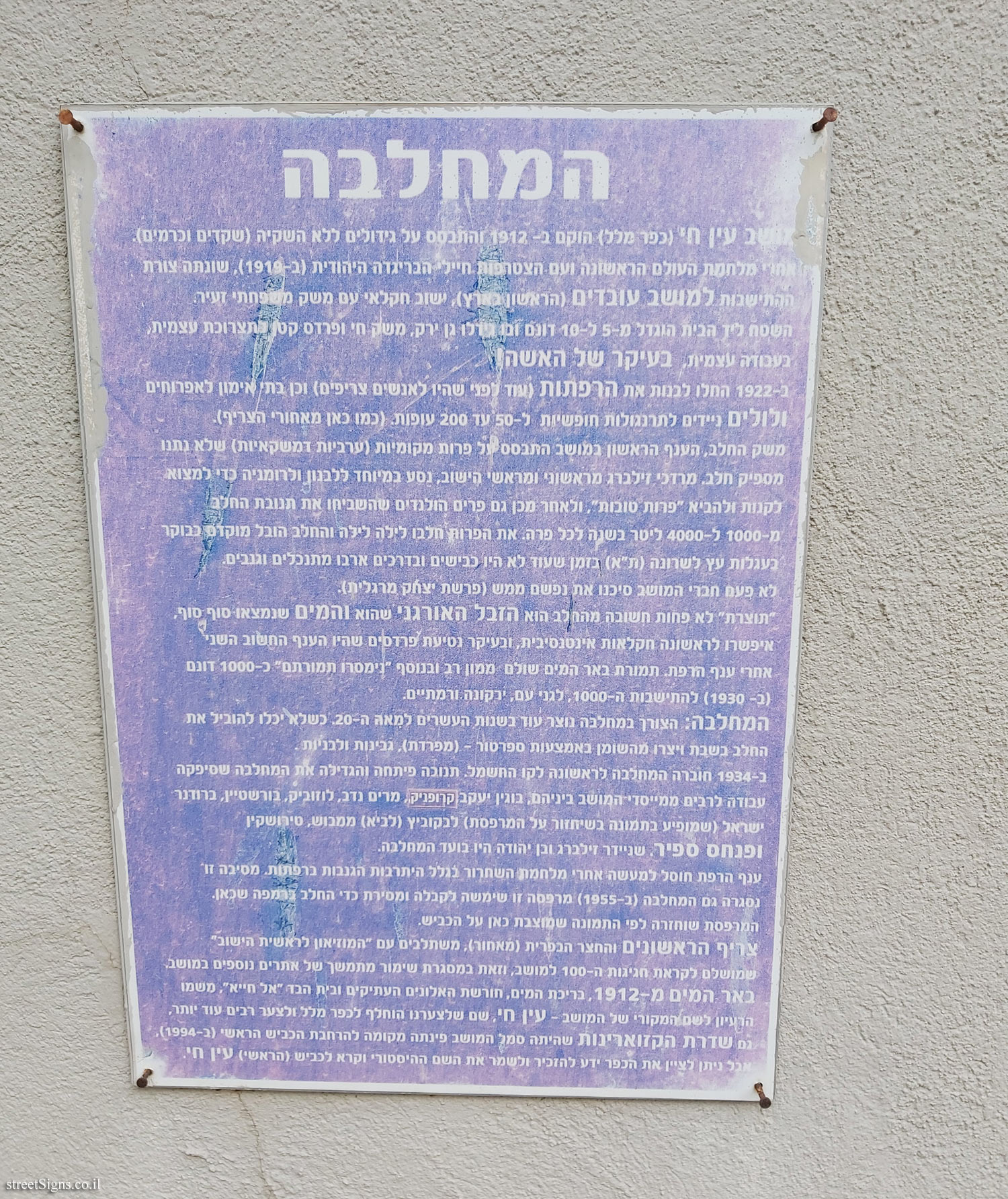
Ein Hai’s first water well (Kfar Malal) The first water well in Ein Hai was excavated in 1912, when laborers began working on farmland instead. The well was excavated to a depth of 62 meters, and in the early years raised the water with a rope and buckets. In 1914, a steam engine was installed, and the engine worked two days a week.
The amount of water in the well was very low and required the settlers to bring water in barrels (from Kfar Saba, Yarkon River and Raanana) that were transported in wooden wagons and on mules. The wagons carried the water in a sandy way, which in winter became a mud. This side road is today the main road (Road # 4).
Session life revolved around the well and water. Above the well, the first canopy was built and then a shack used for living quarters, as well as a dining room and kitchen that were shared by all workers. In 1919, a permanent core was located in the tents next to the well and later the first houses were erected in place of the tents. The water well was refurbished, the steam engine replaced with a diesel engine (restored here) but the amount of water the well provided was very low due to miscellaneous considerations in the well location.
In the 1920s, residents planted orchards and additional water wells were needed to develop the orchard industry. The settler institutions, the Keren Hayesod and the Keren Kayemet gave funds for the construction of the wells for part of the lands of the Kfar Malal taken for the establishment of the Givat Chen, Yarkona, Ganei Am, Ramot Hashavim and parts of Ramataiim.


 Click for all signs belonging to Heritage Sites in Israel
 Click for the map of all signs belonging to Heritage Sites in Israel
  Click for the route that starts with this sign and goes through the signs belonging to Heritage Sites in Israel
 Click for more details on Heritage Sites in Israel
 The closest sign from this series (329 Meter): Kfar Malal - Heritage Sites in Israel - Museum "Ein Hai" - Kfar Malal
 667 Meter
 1.55 Km
 1.68 Km
 1.81 Km
 1.81 Km