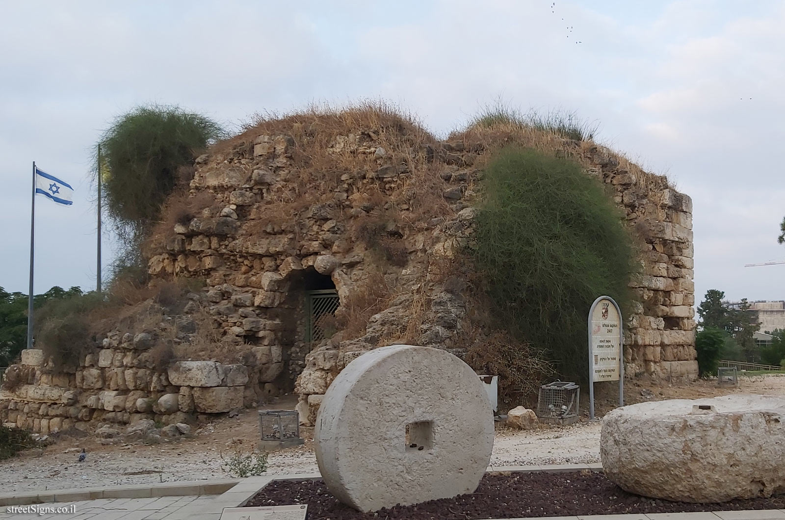
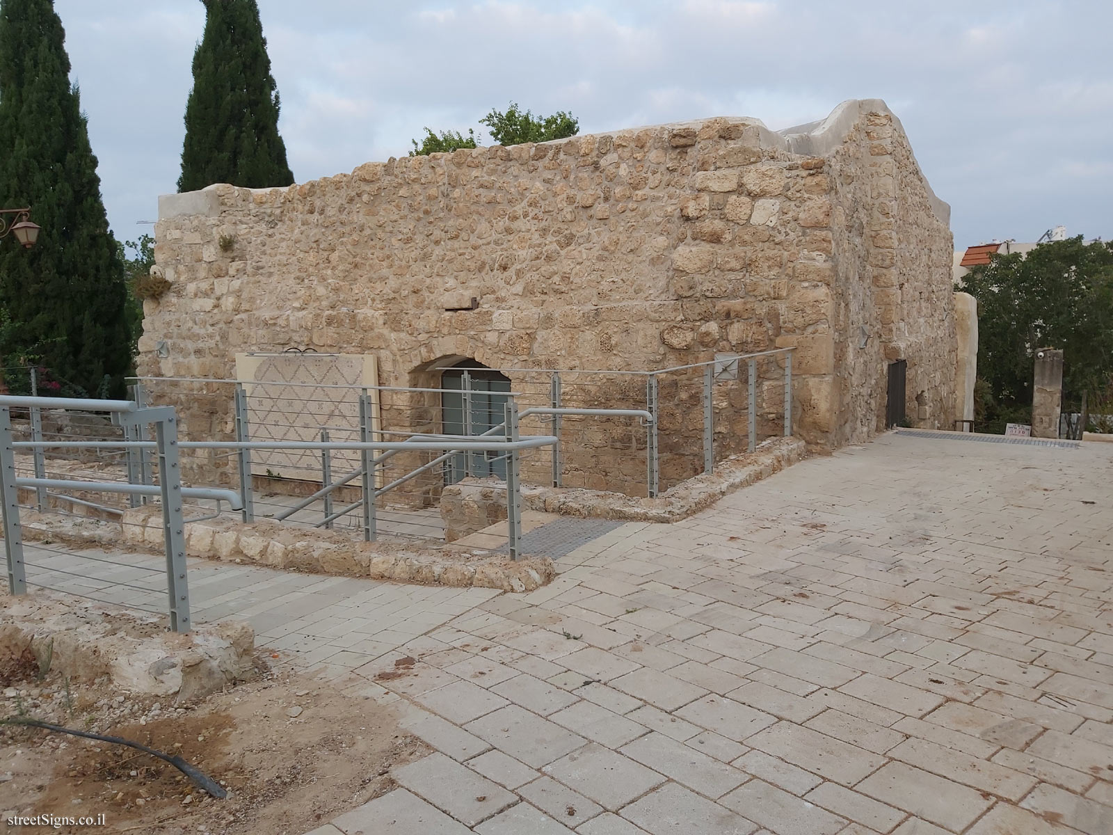
The fort was photographed that day:
The tower at the top of the hill
 Click for a larger image
 The second tower
 Click for a larger image
 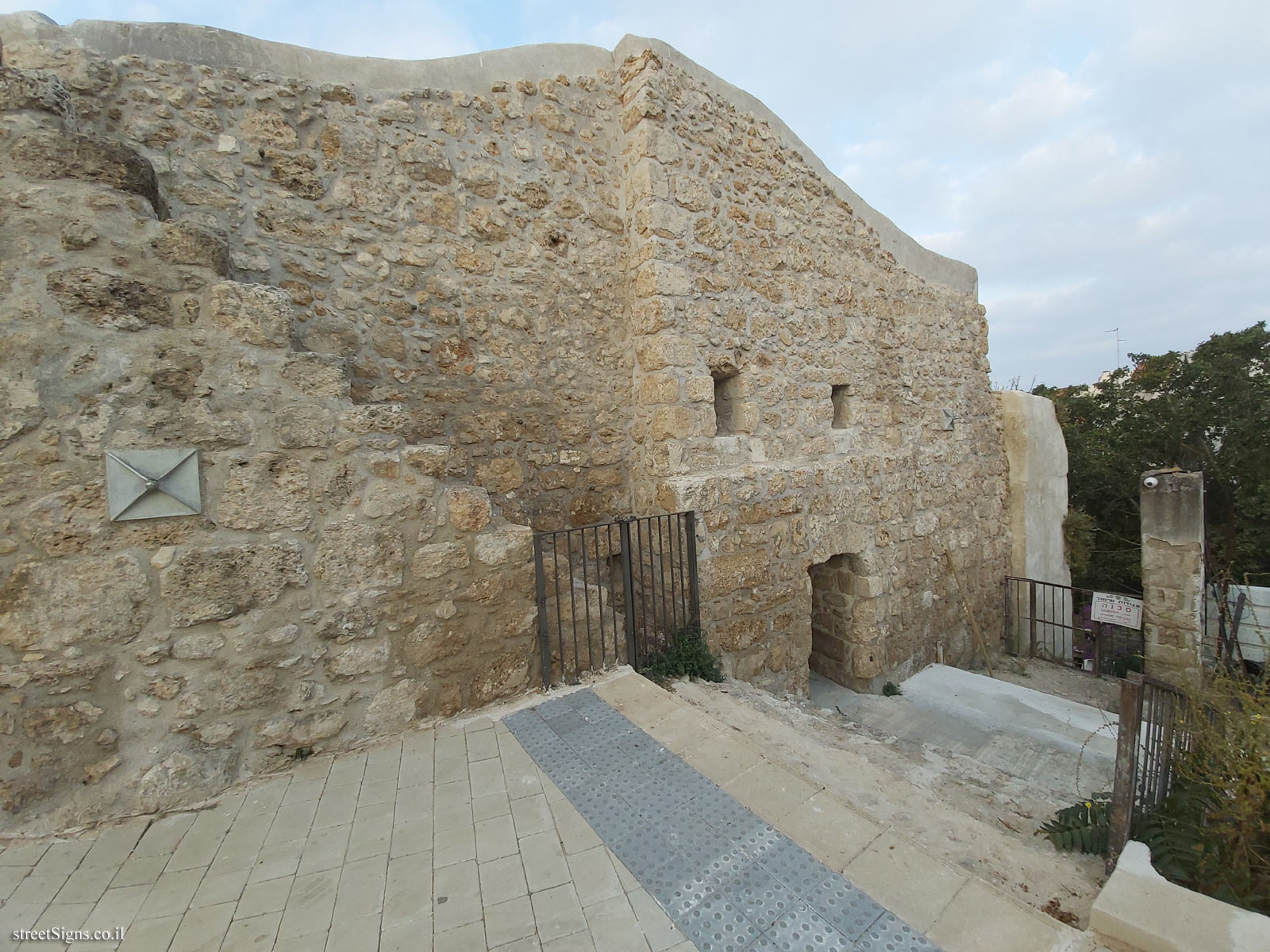 Click for a larger image
 There is also an archeological garden
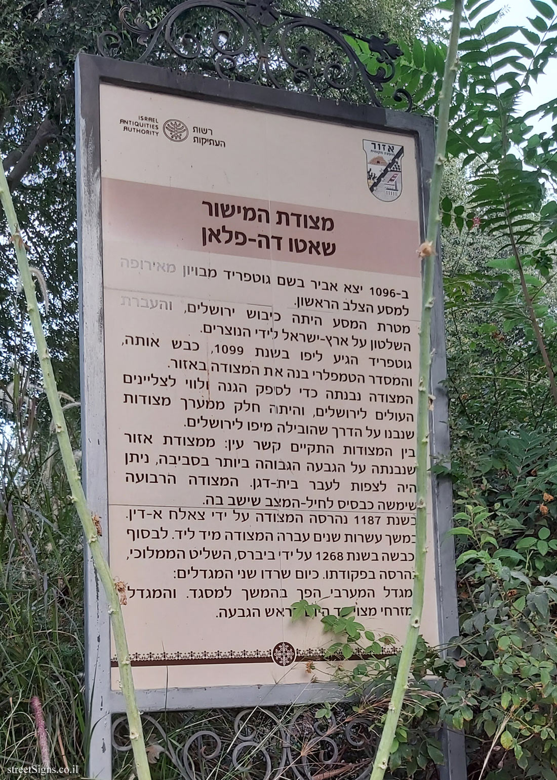
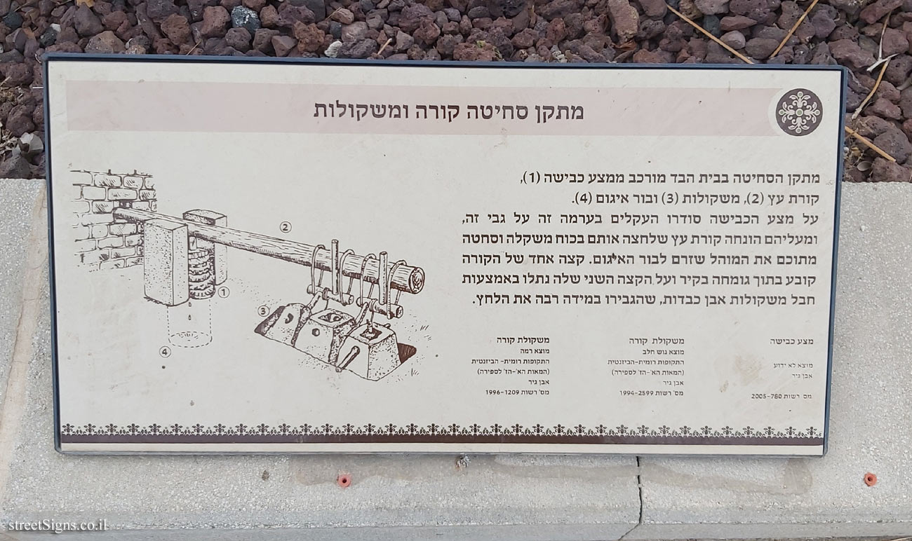
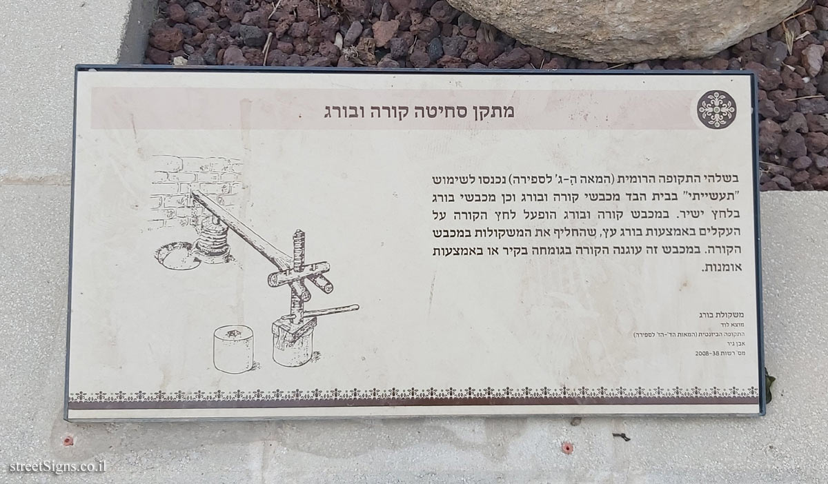
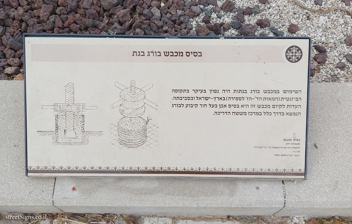
Translation of the text on the sign:
Symbol of the Azor local council
Logo of the Israel Antiquities Authority
The Citadel of the Plain
Chateau de Plan In 1096 a knight named Gottfried of Bowen set out from Europe for the First Crusade.
The purpose of the campaign was the conquest of Jerusalem, and the transfer of power over Israel to the Christians.
Gottfried came to Jaffa in 1099, conquered it, and the Templar Order built the fortress in Azor.
The citadel was built to provide protection and guidance for pilgrims immigrating to Jerusalem, and was part of an array of citadels built on the road that led from Jaffa to Jerusalem.
There was eye contact between the fortresses: from the Azor fortress built on the highest hill in the area, one could look towards Beit Dagan. The square fortress served as a base for the garrison that sat in it.
In 1187 the fortress was destroyed by Saladin.
For decades the fort passed from hand to hand. It was finally conquered in 1268 by Beavers, the Mamluk ruler, and destroyed by order. Today, the two towers have survived:
The western tower later became a mosque. And the eastern tower is to this day at the top of the hill.
Learn about: