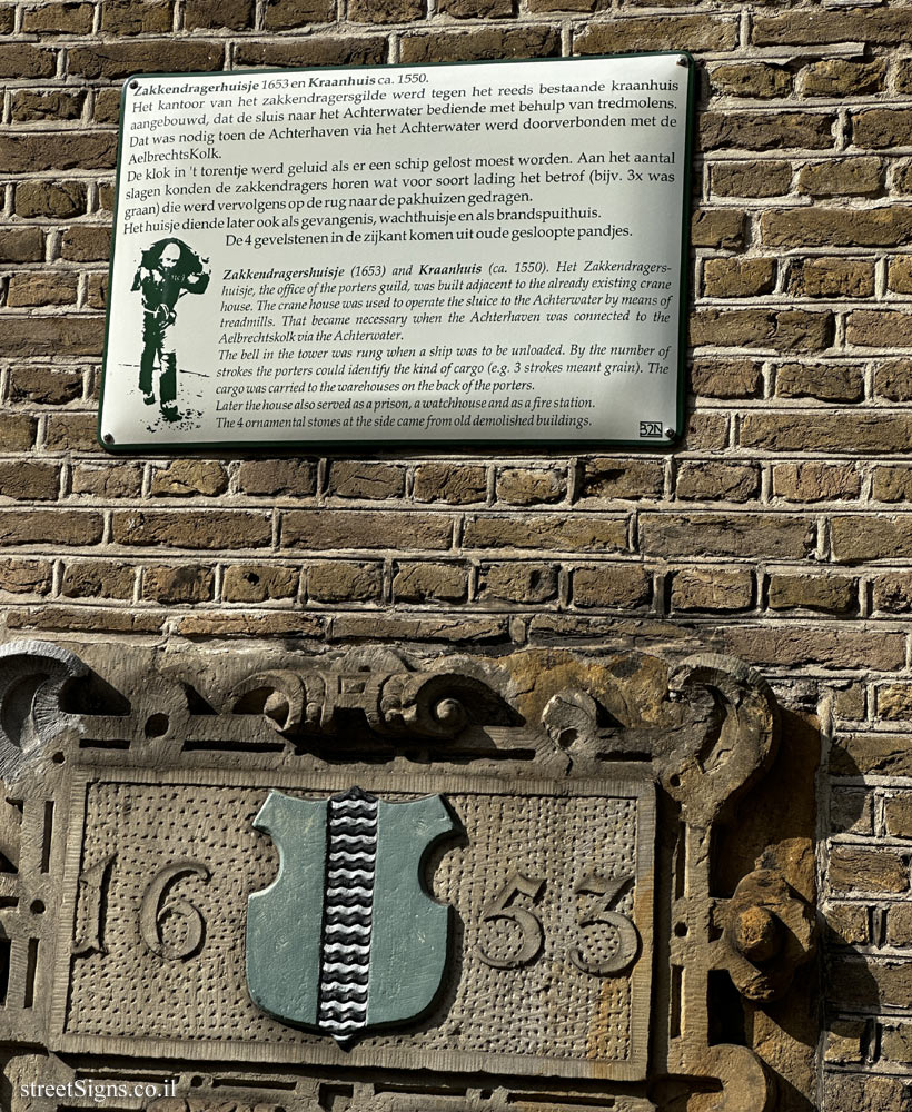
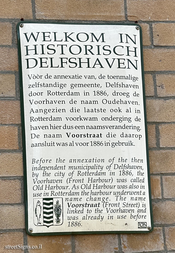
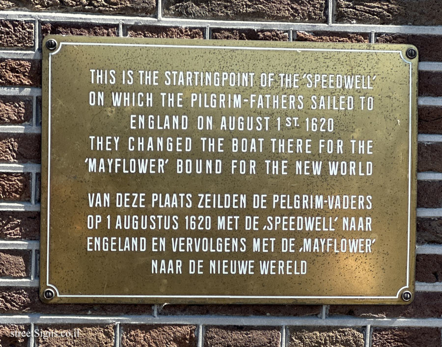
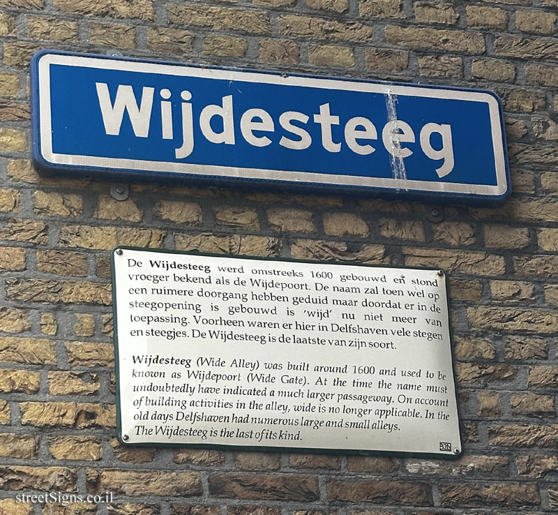
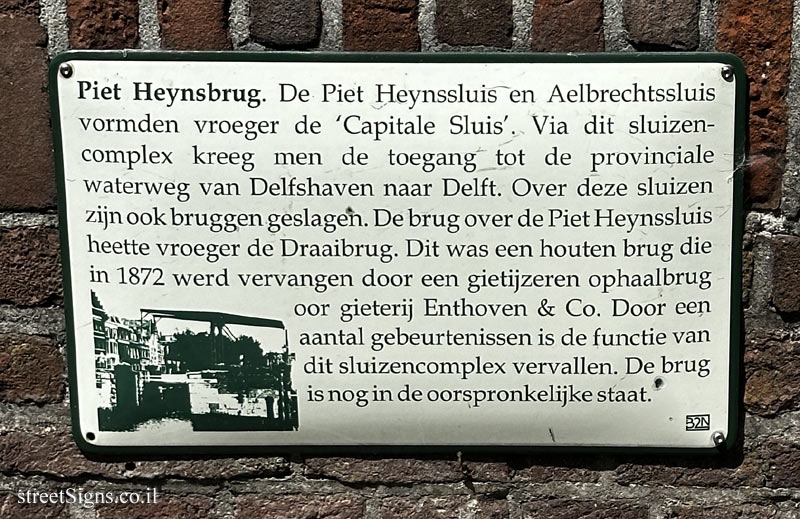
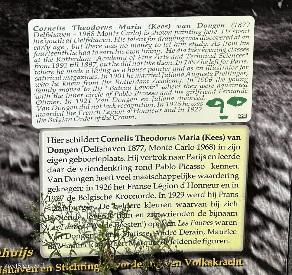
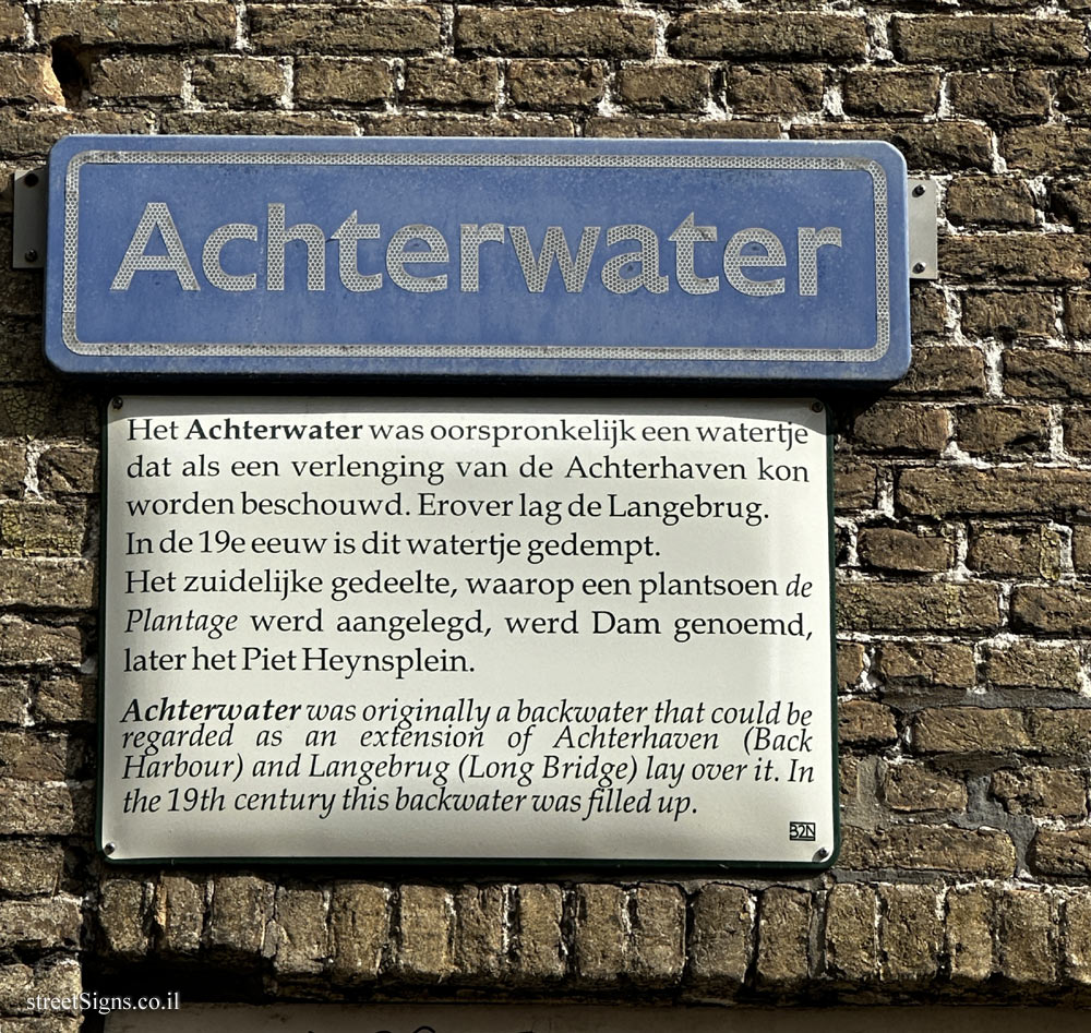
The ultimate street signs, historical sites and house numbers


 Click for sign's details (perhaps their color has faded somewhat), accompanied by explanations about the name of the street and its history.
 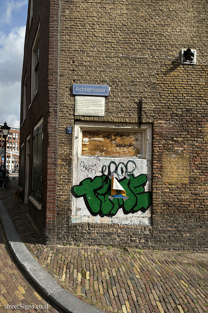 Click for a larger image